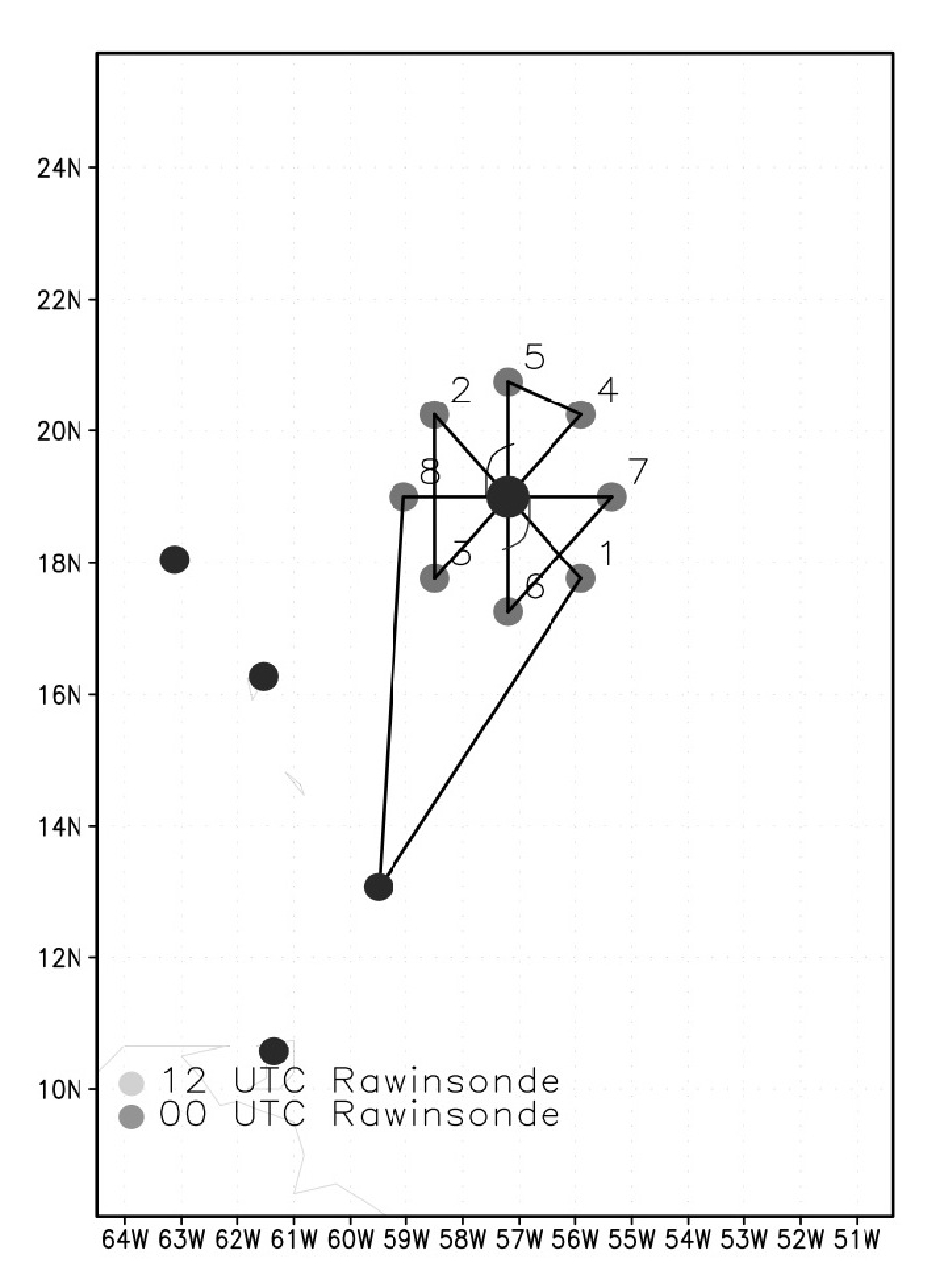
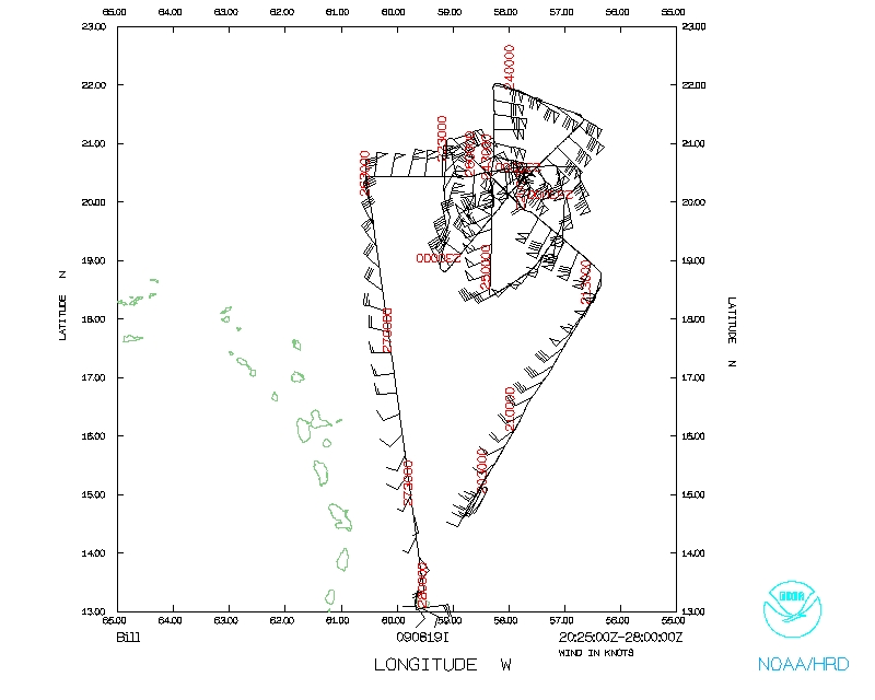
 Figure 1: Planned flight track for NOAA 43 mission 20090819I2 is shown. |
| Aircraft Commander | Barry Choy |
| Co-pilot | Mark Nelson |
| Co-pilot | Cathy Martin |
| Flight Engineer | Paul Darby |
| Flight Engineer | Joe Klippel |
| Navigator | Tim Gallagher |
| Navigator | Chris Sloan |
| Flight Director | Jack Parrish |
| Flight Director | Richard Henning |
| Lead El Tech | Dana Naeher |
| El Tech | Joe Bosko |
| Lead Project Scientist | Joe Cione |
| Dropsonde Scientist | Bachir Annane |
| Radar Scientist | John Gamache |
Mission Plan :
|
Figure 1: Planned flight track for NOAA 43 mission 20090819I2 is shown. |
Prior to the flight, the system of interest was classified by NHC as a Category 4 hurricane with maximum surface winds ~115kts. And MSLP 949mb. At takeoff (2000 UTC), Hurricane Bill's center of circulation was ~19.5N 57.3W. The planned mission of interest was a 4-penetration butterfly pattern that incorporated l05mi legs. The goal was to maximize area coverage completely around the core of the storm. Similar to previous missions in Bill, NOAA 49 was concurrently sampling he large surrounding environment around the hurricane . The flight track geometry for both NOAA 49 and NOAA 43 is illustrated in Figure 1. Unlike the previous day NOAA 43 mission no eyewall/eye mixing module was to be conducted. Total flight time was approximately 8h. Follow-on missions at 12-hour intervals were planned with N43 and N49.
Mission Summary :
| Take off | Landing
| MacDill AFB, FL | 19:95 UTC
| MacDill AFB, FL | ??:?? UTC
| | ||
Takeoff time was 1955Z. Our ferry altitude was 12kft. Forty minutes into the ferry a UPS located at station 3 began to smoke. After extinguishing the problem and subsequent brief delay, the flight crew determined that we should be able to continue the mission. More details on this can be found under the 'problems' section of this summary. As Figure 1 illustrates, our IP required a NE heading in order to enter the storm from the SE. The drop pattern for this 23 GPS sonde, 4-penetation mission was as follows: Drop at each 105nmi endpoint , then again at the 75 mile mid-point, and again at the estimated radius of maximum wind. Once through the eye the drop sequence was reversed (i.e. eyewall, mid point, endpoint). On legs 1-2 and 7-8 we also conducted eye/center fix drops.
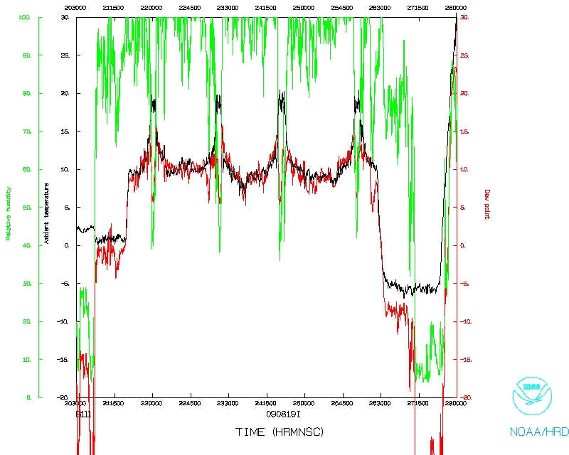
Similar to the 20090818I1 mission conducted 24 hours earlier, both GPS surface wind observations SFMR measurements indicated that maximum surface winds were located in the NE quadrant of the storm. SFMR (GPS) max winds were 110kts (120kt at 8m). MSLP was ~948mb on leg 1-2 early in the flight and slightly fell to ~945 just before departure of the storm ~02Z 20 August. Throughout the storm there was evidence of dry air getting into the core circulation. . This is consistent with the water vapor imagery at the time that showed significant dry air to the north and west (Figure 2). From a reflectivity standpoint, the eyewall was 'open' on the southwest and west side of the circulation. It was evident some of this dry air was making its way into the core of the storm and having a direct impact on the subsequent precipitation pattern observed on LF radar throughout the mission. This pattern, depicting strong precipitation (40-45dbz max) on the eastern and northern side of the storm also showed up well on a ~ concurrent SSMI pass (Figure 3). It is interesting to note that IR imagery at this time (Figure 4) is very misleading in that the coldest cloud tops on the western side would -presumably- be associated with deep convection/ precipitation on that side of the storm. However, as SSMI and LF radar observations clearly attest, that assumption would be 100% incorrect in this case.
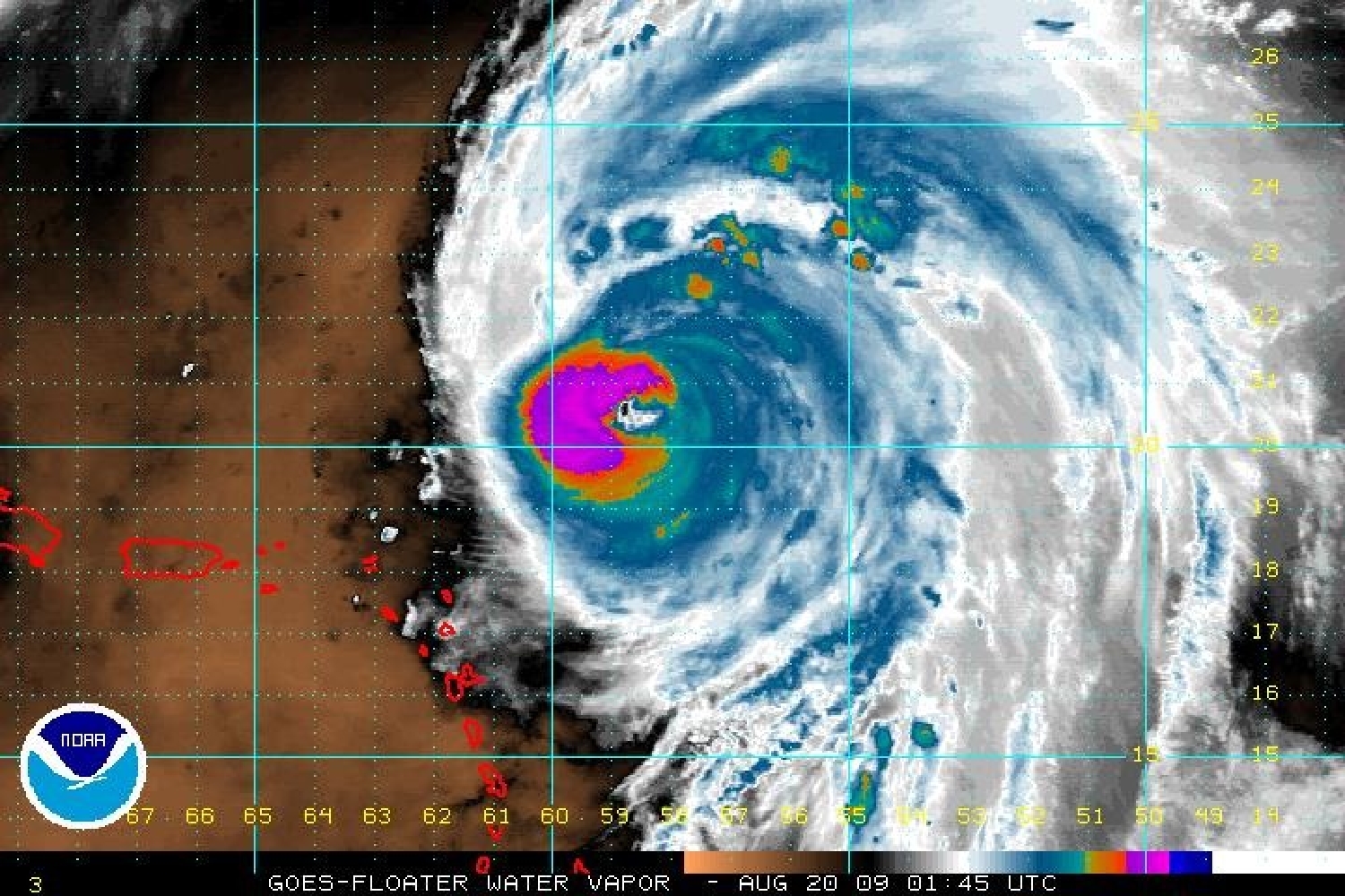 Figure 2: GOES Water Vapor imagery of Hurricane Bill valid 0145Z 20 August. |
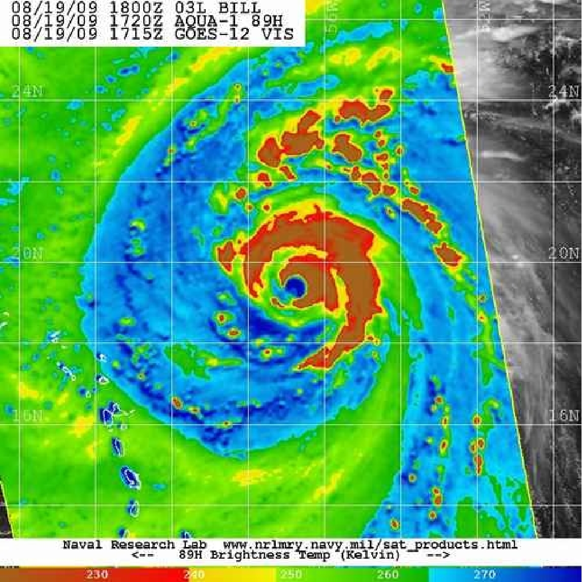 Figure 3: Microwave pass 18Z 19 August showing precipitation on N and E side of the storm. |
Besides this interesting development, there were other observations of note during this flight. To that end, please see Appendix 1 which is a partial record of the xchat session between NOAA 43, NOAA 49 mission scientists as well as real-time comments from other NOAA scientists in Barbados and the US. As LPS, I did note that the (precipitation free) SW eyewall was radically different than the adjacent eyewall region found in the (strongest) NE quadrant. While significant kinematic differences existed (maximum surface winds in the SW eyewall ~80kts vs 120kt found in the NE) even more dramatic contrasts could be found with the thermodynamic structure illustrated associated with each of these eyewall regions In the SW, we found RH conditions relatively dry (85%) near the surface. This wasn't overly surprising given the fact that it was precipitation free. However, saturation was never achieved anywhere in the sounding (max RH ~90% at 900mb). Even more noteworthy was that from 900 mb all the way up to 10kft flight level, RH linearly dropped off to a value ~60% RH. It must be reiterated that this was a category 4 hurricane eyewall profile. In contrast the NE drop showed RH near 95% at the surface and saturation above that all the way up top 10Kft, both of which are typical and to be expected. Each drop was roughly separated by 50nmi. Incredible contrast over a very small distance for a mature category 4 storm. A tale of 2 hurricanes. It will be interesting to see how long Bill maintains this intensity with this highly variable inner core thermodynamic structure.
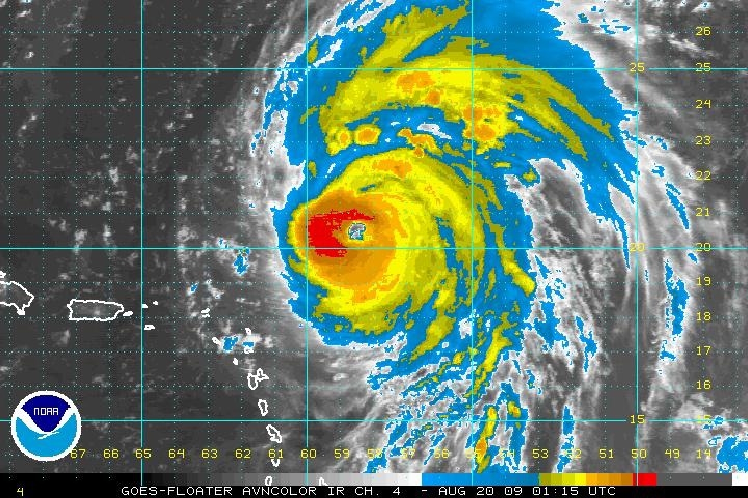 Figure 4: GOES IR image valid 0115Z 20 August. While NOAA 43 LF radar showed no eyewall convection west of the circulation center, the coldest cloud tops were observed on the western side of Hurricane Bill throughout the mission. |
Problems :
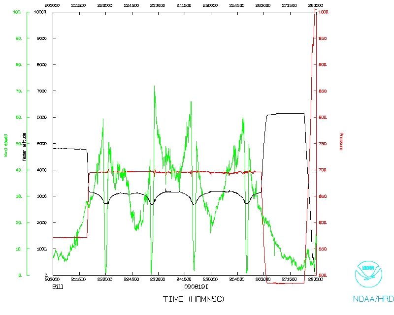
The radar, flight-level, SFMR, and dropsonde systems worked well for most part of the mission. However, unlike previous flights the LF radar's performance became less consistent. J. Gamache estimated that the radar system was down for ~30% of the flight. This situation would have to be monitored on future flights. The UPS failure mentioned earlier was rectified quickly once the visible smoke was detected by J Gamache. Initially we turned back to Barbados before the source of the smoke was positively identified by the flight crew. Once identified the crew determined it was safe to proceed with the mission. All 23 dropsondes reported data throughout the drop and reached the surface. Both real time Doppler and Superob analyses were conducted and successfully sent off the plane in real time.
Joseph Cione
08/22/09
Error log | Fast data | NetCDF | 1 second data
 Flight track |
 Temperature and Moisture |
 Wind and Atlitude |
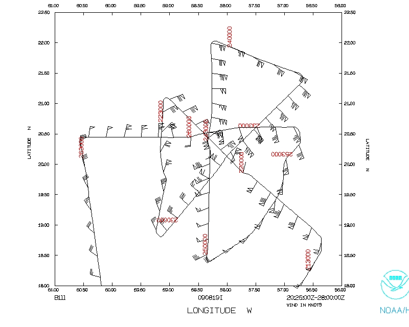 Flight track |
Page last updated Oct. 06, 2009
[mblack_hrd] and IR from 2245 show big weakness there- I thought satellites told the whole story :)
[mblack_hrd] yes, it sure was warm there the other day
[cione] 105kts NE...by far strongest quad...
[mblack_hrd] here on the g-IV i am near the avaps rack to stay warm
[cione] backwards C shaped eyewall painted by LF
[cione] 80-90 kts in other 3 quads...
[JGamache] NE Sonde in eyewall shows 118 kts from 085 at surface, and above 140 above.
[mblack_hrd] see- you guys validated the obs from the satellites earlier today
[JGamache] SW "eyewall" 50% RH at 700 mb from sonde
[cione] wow...
[mblack_hrd] water vapor also shows weakest quad is NE
* marks_hrd (~markshrd@chatting.up.a.storm) has joined #hrd
[cione] 50-60% RH going to sat at 900mb on SW "eyewall"
[cione] compared with 100% sat from 10kft to sfc on NE
[mblack_hrd] IR and WV heaviest convection and moist in SW quad
[cione] explains how we had no reflectivity echos on SW yet somehow still had stadium (clouds) all around
[cione] this thing is BATTLING very dry cond just above 900 mb....the active convection on east side though suggests dry air isnt on that side...
[cione] my q is how long can HALF a hurricane exist survive like this? v interesting
[mblack_hrd] strong low-level updrafts form on E to NE side - advect around as they rise- -dry air enhancing downdrafts on west side - lots of debris but outflow channels up high carry it away to the north
[mblack_hrd] coldest cloud tops on SW - thick area of -80 - open ne in ir and W vapor
[mblack_hrd] checking ssmi now
[cione] complete opposite of what we are seeing in reflectivity (ie max in NE zero in SW/w)...think u have it right mike about forming in e/ne and wrapping around
[mblack_hrd] the extremely  dry air can't get in from the west- all outflow at all levels there
[mblack_hrd] only way in is in a channel from the south - not obvious though
[mblack_hrd] strong storms can fight the shear for awhile- convection can be enhanced  if shear is not too strong- enough to maintain or even intensify
[cione] btw  120kts Vmax in ne from drop....bit more than that 105/110 sfmr we saw...
[mblack_hrd] SSMI at 2111 confirms what you see on radar- convection on E and NE - open to SW and no other convection at all west and sw of eyewall
[mblack_hrd] only dry slot that may entrain the dry air is 150 miles to SE on other side of principle band
[cione] lesson learned for me...cold cloud tops in IR imagery dont mean convection there....in fact likely 1/2 storm away
[cione] of course i realized SOME rotation but not 180 deg like we see here
[mblack_hrd] not too uncommon- don't know how many people realize it though
[cione] with NOTHING below those cold cloud tops...again..we had 50-60% rh on that sw/w side at 10K
[cione] bet THATS more uncommon
[JGamache] 2nd analysis started
[mblack_hrd] dry air on west may enhance the downdrafts there and may erode some of the convection on outer portion of eyewall  there
[mblack_hrd] this could enhance the convection downwind (east and NE side_ -like a dry slot in squall line
[JGamache] beginning to compute superobs
[mblack_hrd] which pass?
[JGamache] 2nd
[JGamache] In the beginning of our 3rd pass.
[mblack_hrd] we'll be landing in about an hour- plenty of time for giv crew rest for 1730 tomorrow
* mblack_hrd is now known as cant_spel
* cant_spel is now known as kant_spel
[cione] guys just did north eyewall...45dbz or so....sfmr saw 110kts or so....get this though..extrapolated MSLP IN eyewall was 938...meso convectively driven?  not sure...doing a fix now and we are back to 943 or so
[kant_spel] could be a meso
[cione] fix roughly 945 extrap...20 16' 58 16'
[cione] we will do a real center fix on pass 4 e-]west..so that one should be taken with a grain of iodized salt
[JGamache] 2nd set of superobs is available in directory, Yonghui.
[Yonghui] I got it. Thanks.
[kant_spel] Bill not weakening yet - may reach max intensity overnight or early am
* kant_spel is now known as mblack_giv
[cione] on south side...no convection whatsoever
[mblack_giv] coldest cloud tops and thickest eyewall on ir now in NW quad
[mblack_giv] very cold and almost as thick on S side, though
[cione] some craziness now...looks like..tuff to say definitively...but looks like we are trying to form a new smaller eyewall..to reclose off the circulation...happened as we were passing thru..the e-w leg should show this much more/fully? evolved  by then...another first for me..crazy flight
[mblack_giv] yes, that can happen with an open eyewall - it can close off at a smaller radius
[cione] we had vmax 'within the eye as we were outbound...jack and rich didnt drop since it didnt make sense that it was indeed the vmax on s side..but it was...now we are seeing faint reflectivity of that smaller nascent eyewall trying to form
[mblack_giv] this can be transient or can form into the new eyewall and close it off
[mblack_giv] even without clouds, the dynamical eyewall can be at a similar radius as the convective side- sometimes in clear air
[cione] strong cells forming as i type in SW....a little far radially to be sw eyewall? but could propagate around and radially in...will watch closely...
[mblack_giv] I have seen stronger winds at the surface on the open side of an eyewall than the convective side
[mblack_giv] the sea state can be pretty amazing when you view the wind max of a major hurricane in clear air
[cione] yes mike u r right...looks like a convective 1/2 eyewall WITH a smaller dynamic eyewall thats much smaller 15-20 mi dia vs 30 mi (convective)
[mblack_giv] the inertial stability causes the are to stay at a similar radius while the downward moving air on the weak side brings the higher momentum air that was partially generated by the convection upwind
[mblack_giv] I'll be putting away my laptop soon but will email or put on ftp the sat images from tonight
[cione] we are getting far from the core now but if my eyes are tricking me id say that the smaller dynamically driven eyewall is winning the battle..we should see a smaller 15-20nmi eye when we pass next vs the 30 mi eye we had been seeing...not sure how convectively active it will be in each/all quads but we will find out in about an hr or so...
[JGamache] I notice Pete has been signed on all night, but I haven't seen anything from him.
[mblack_giv] when you come in from the east you will cross a couple of bands and maybe get a big updraft or two in the e wall
[mblack_giv] the west side will have thick cirrus above - look at TA radar - then you will be in almost all dry air at the end of the leg or just beyond (look at LF)
[mblack_giv] west side will be mainly downdrafts
[mblack_giv] shutting down now- see you am or email tonight - good luck rest of flight
[JGamache] Goodnight MIke.  Enjoy the sleep.
[mblack_giv] Yes, in bed by 11 , nice - get some rest too
* mblack_giv has quit (Quit: Leaving)
* JasonD (~fpm@chatting.up.a.storm) has joined #hrd
[JasonD] hey joe...how goes it?
[cione] very interesting..can u scroll up and see recent conversations?
[JasonD] i saw a few of your commented before the mac froze up, so i missed a bunch.  sounded cool though
[cione] yeah backwards c reflectivity with coldest IR tops 180 degrees rotated...then we saw formation of a smaller eyewall as we made n-s pass...
[cione] also had a temporary 5-6 mb drop as we went thru eyewall..dwon to 938 extrap..meso feature?  this upcoming e-w pass should be v interesting
[JasonD] cool.  saw you mentioning some of those thermo profiles too...I'd like to see some of those later fro sure
[cione] yeah the BEST comparison...most wow factor..would be to have our SW and NE passes side by side...crazinesss...one is sat up to 10K and the other has 90ish%brh below 90mb 85 sfc?  but above it goes linearly from 90% rh u to 60% at 10kft...at the time we had zero convec on west side...yet mike telling me -80 cloud tops on west/sw side..awesome
[marks_hrd] Shear let up?
[marks_hrd] Or is it changing direction and will pick up again
[JasonD] nice...was the funky thermo confined to the western  semicircle?
[marks_hrd] Pete has been hammering on James for not trusting SFMR in advisories
[JasonD] frank...i'm setting up g-iv legs to check out radial shear gradients in SW & NW.  take off 8z
[cione] not sure on the shear situation....looked to be out of SW from imagery i saw...
[marks_hrd] Good because CIMSS site not representative
[marks_hrd] cione: Beats pulling out hair with aerosonde
[marks_hrd] Battery on iPhone getting critically low
[cione] on the N/NE (convective side) looked MUCH more like normal mature cane...near saturation from 10ktft to  sfc
[cione] what hair?
[cione] ;-)
[marks_hrd] Sounds like Bonnie 1998
[marks_hrd] JGamache: I am signing off. Be up with Shirley in AM. Long day.
[cione] jason: on south east side sort of a mix in the thermo..so with that seems like dry air modifying as it wraps around and mixes with DEEP moist inflow channel set up to the south...
[cione] ps how long can a thermodynamically schizophrenic storm like this maintain?
[marks_hrd] Long time likely
[JGamache] Ok Frank.  Just starting computation of superobs on 3rd leg.  Goodnight.
Return to Mission page.