 |
 |
| Aircraft Commander | Scott Price |
| Co-pilot | Nate Kahn |
| Co-pilot | Adam Abitbol |
| Flight Engineer | Paul Darby |
| Flight Engineer | Chris Lalonde |
| Navigator | Todd Richards |
| Flight Director | Mike Holmes |
| Flight Director | Carpenter |
| System Engineer | Hartberger |
| Data Technician | Mike Mascaro |
| Data Technician | Warnecke |
| LPS | Rob Rogers | HRD |
| Dropsonde | Kaythryn Sellwood | HRD |
| Radar | Paul Reasor | HRD |
| Guest | Patricia Mazzei | |
| Guest | Chang Lee |
| Radar | Nancy Griffin | HRD |
Mission Plan :
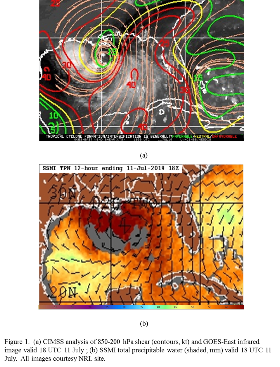
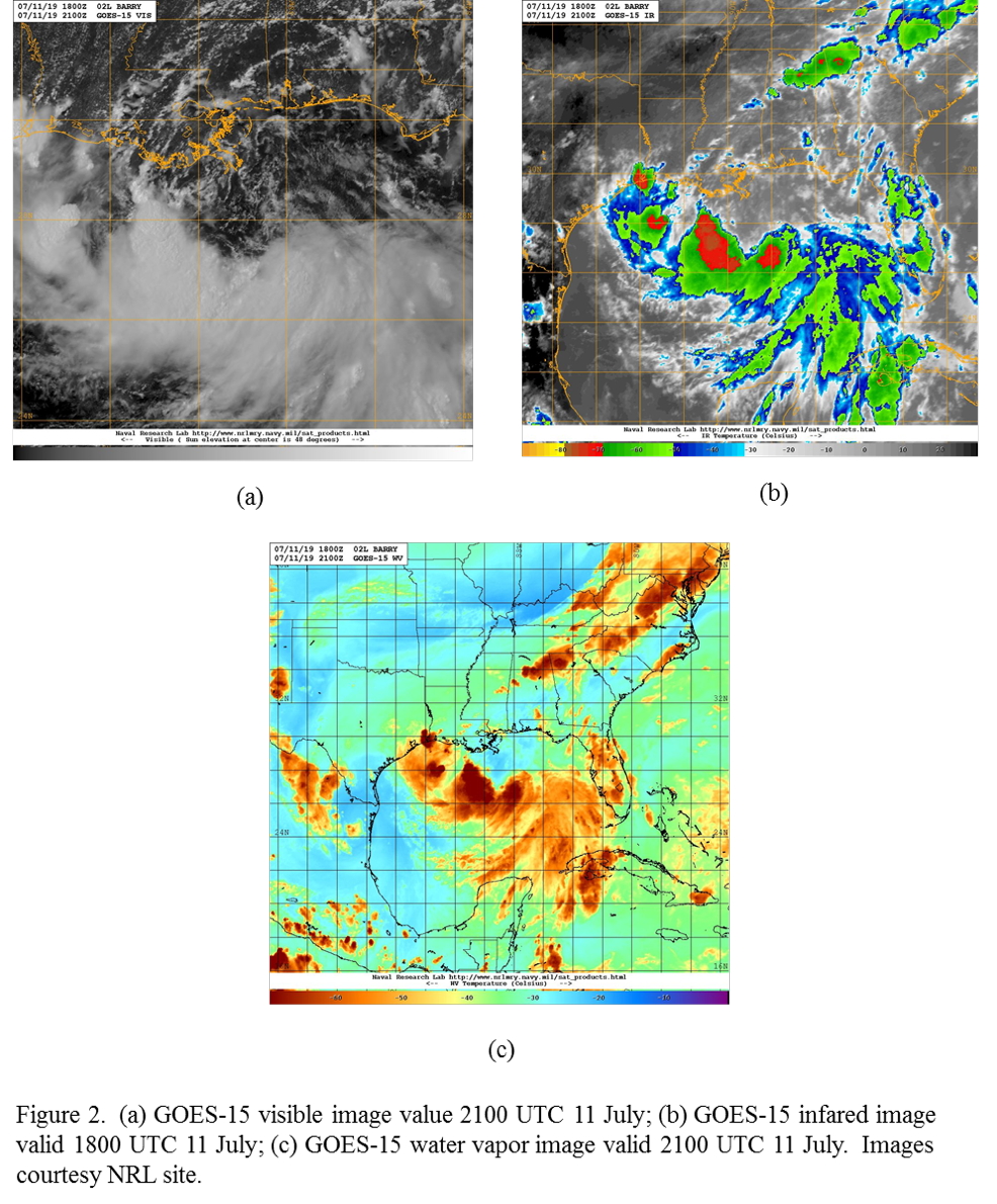
NOAA 42RF (N42) will conduct an EMC-tasked TDR mission into TS Barry. Barry remains a broad circulation in the northern Gulf of Mexico south of the Mississippi/Alabama border. It is still experiencing a complex shear environment characterized by strong northerly shear in the eastern portion of the circulation and weak shear in the western portion and closer to the circulation center than 24 h previously (Fig. 1). The environment remains moist in the lower troposphere, with some indication of dryer air well to the west and southwest of the circulation center. Convection and cold cloud tops are confined to a west-east line south of the low-level circulation (Fig. 2). Multiple low-level swirls in the visible imagery are rotating out from regions of deep convection and moving northward in the background circulation. Dry mid- and upper-level air pervades in the northern Gulf.
|
|
|
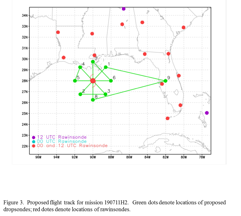
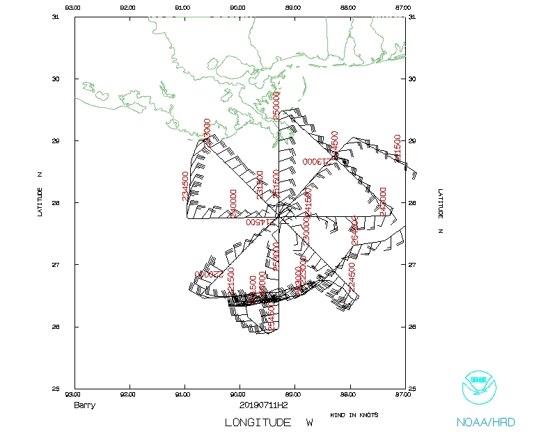
The plan calls for flying a rotated Figure-4 pattern (Fig. 3). The initial point is on the northeast side, and the final point is on the south. Leg lengths are 105 nm. The plan calls for dropping sondes at all end point, midpoints, and the center, with the potential for dropping two sondes on the northeast (upshear) downwind leg. Fly at 20,000 ft for as much of the pattern as possible, but definitely on the north side of the storm.
 |
|
Prepared by the Hurricane Research Division July 10, 2019 Aircraft: N42RF Proposed takeoff: 11/0800Z
DROP LOCATION TABLE
| #
| LAT
| LON
| RAD/AZM
| Time
|
| deg min
| deg min
| n mi/deg
| hr:min
| 1S | 29 15 | 88 36 | 105/045 | 1:07
| 2S | 26 46 | 91 23 | 105/225 | 2:00
| 3S | 26 46 | 88 37 | 105/135 | 2:37
| 4S | 29 15 | 91 24 | 105/315 | 3:30
| 5S | 28 00 | 91 59 | 105/270 | 3:51
| 6S | 28 00 | 88 01 | 105/090 | 4:44
| 7S | 29 45 | 90 00 | 105/000 | 5:22
| 8S | 26 15 | 90 00 | 105/180 | 6:15
| | ||||||||||||||
Mission Summary :
| Take off | Landing
| Linder-Lakeland Airport, FL
| 20:12 UTC
| Linder-Lakeland Airport, FL
| 03:49 UTC
| | ||
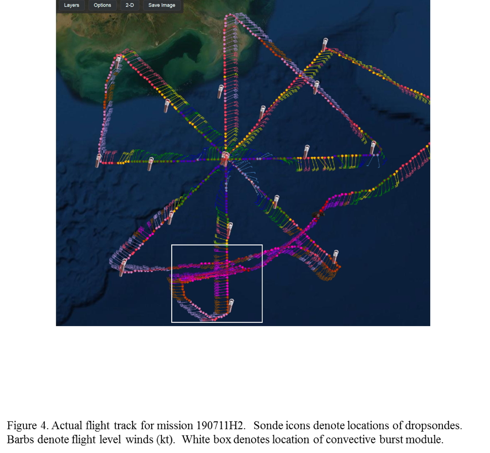 |
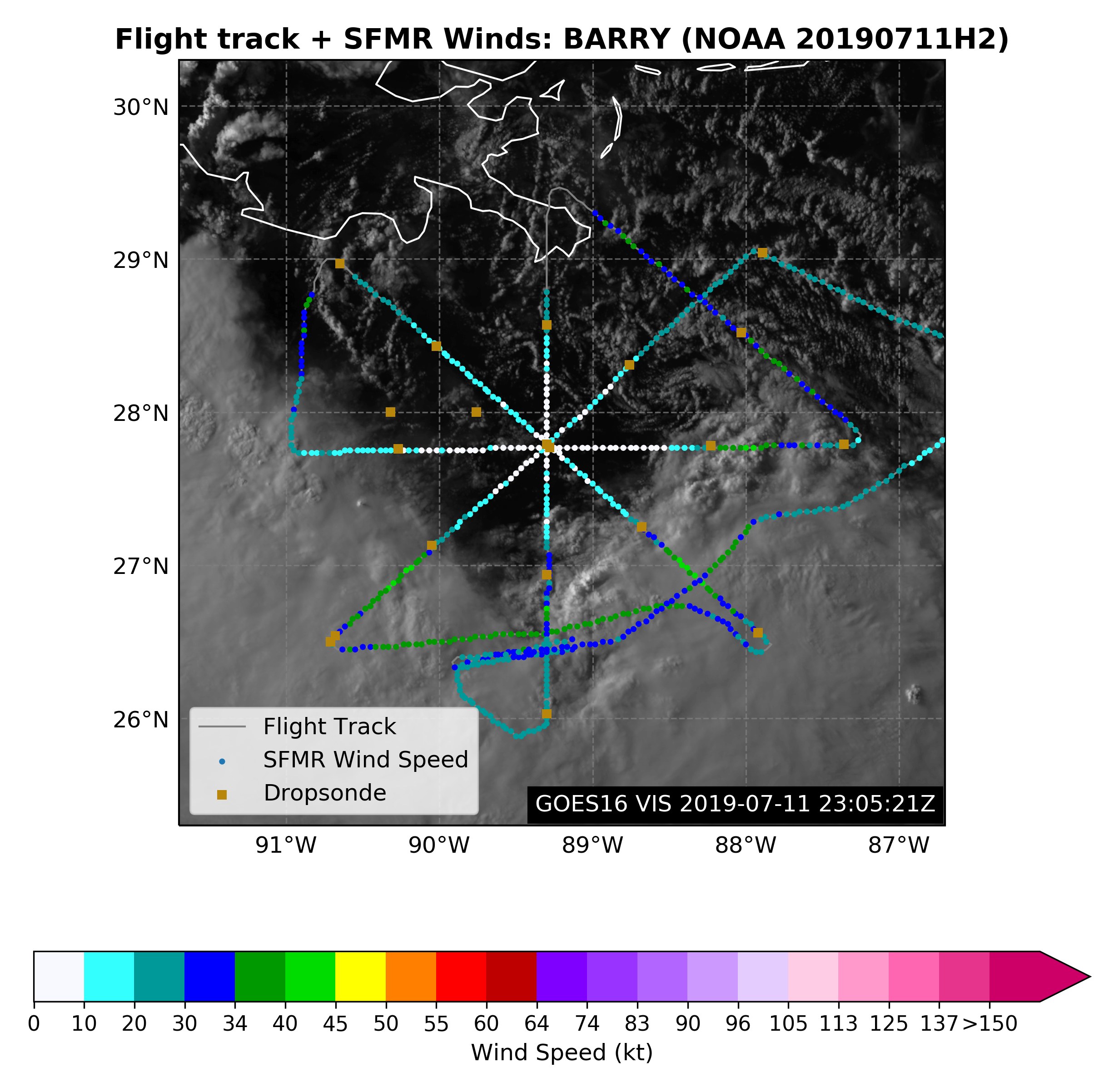
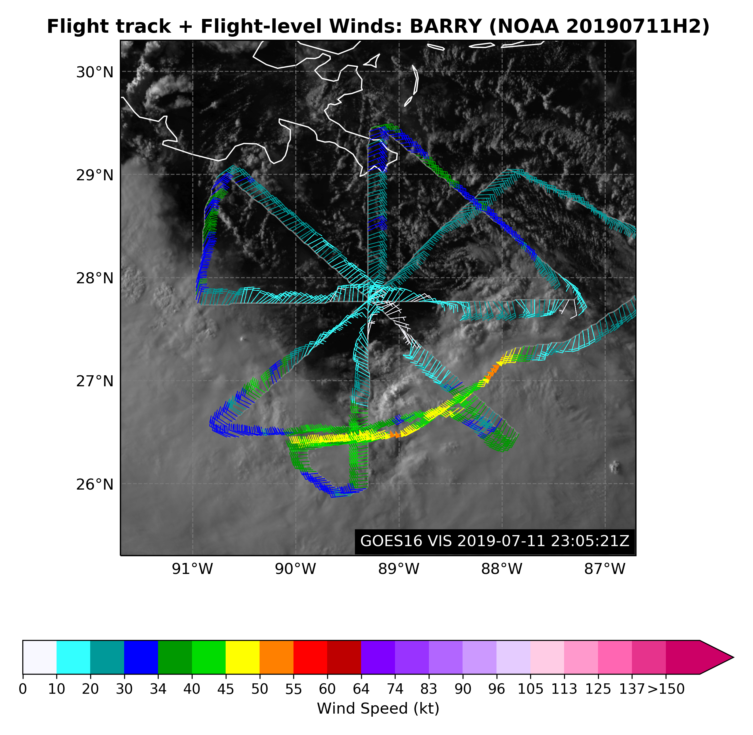
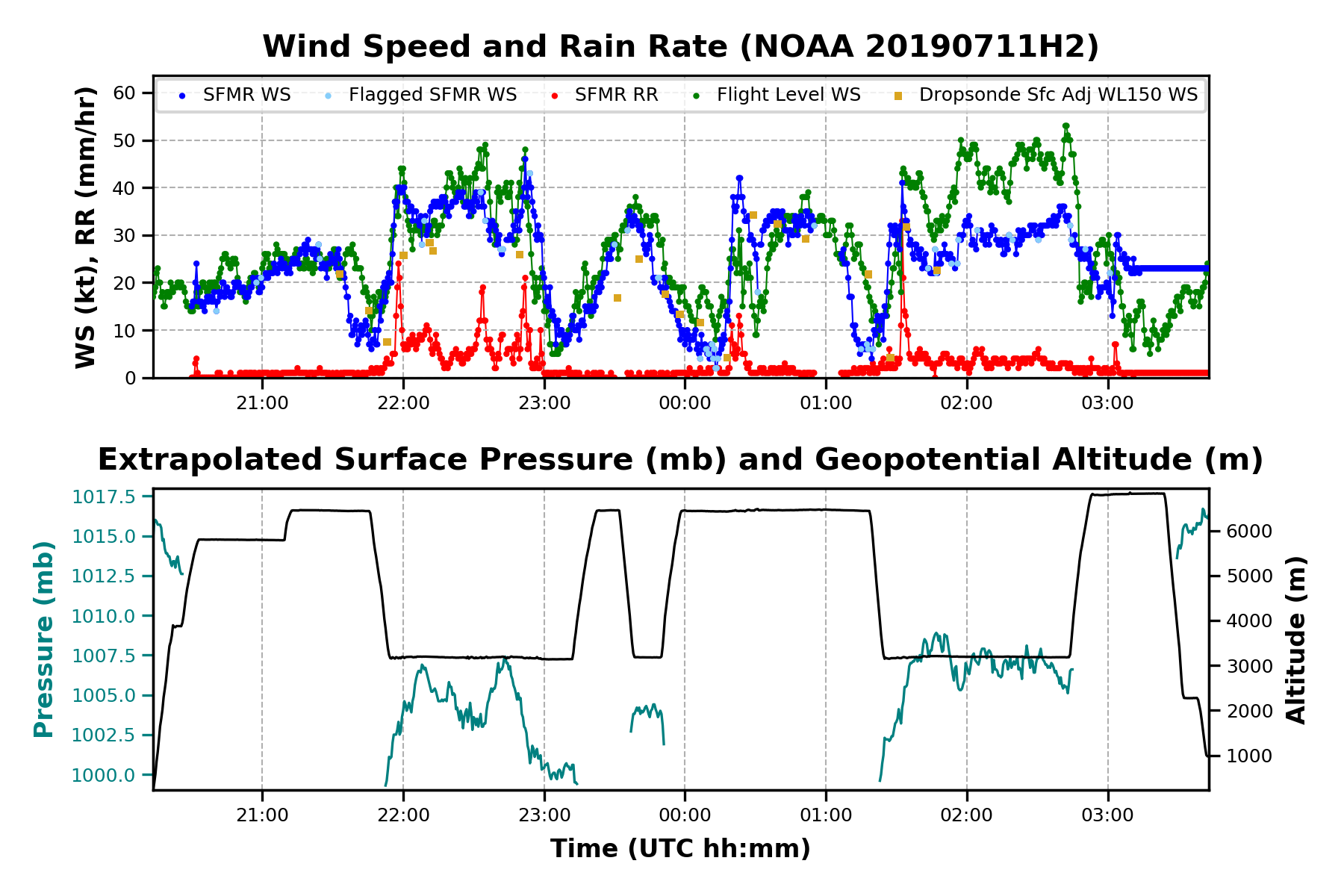
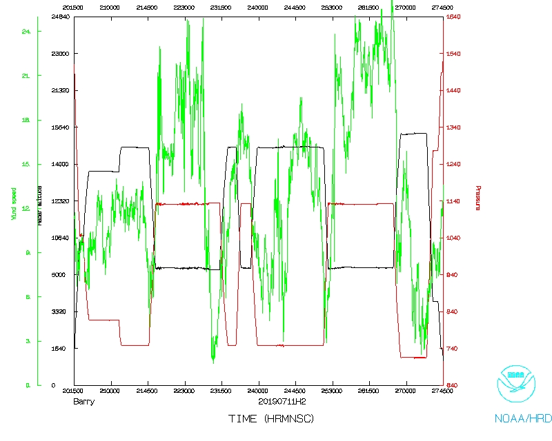
The mission was flown almost exactly as planned (Fig. 4). The aircraft took off at 2013 UTC and flew at high altitude for the majority of the survey pattern, only deviating on the downwind legs on the northwestern and southern portions of the pattern. The radials were very straight as well, which aids the Doppler radar analyses. There were center drops on the first, third, and fourth passes, with the central pressure holding steady at 1002 hPa. Drops at all end and midpoints were released, except for on the north and northwest sides because of proximity to land. Two extra drops were released on the northeast downwind leg.
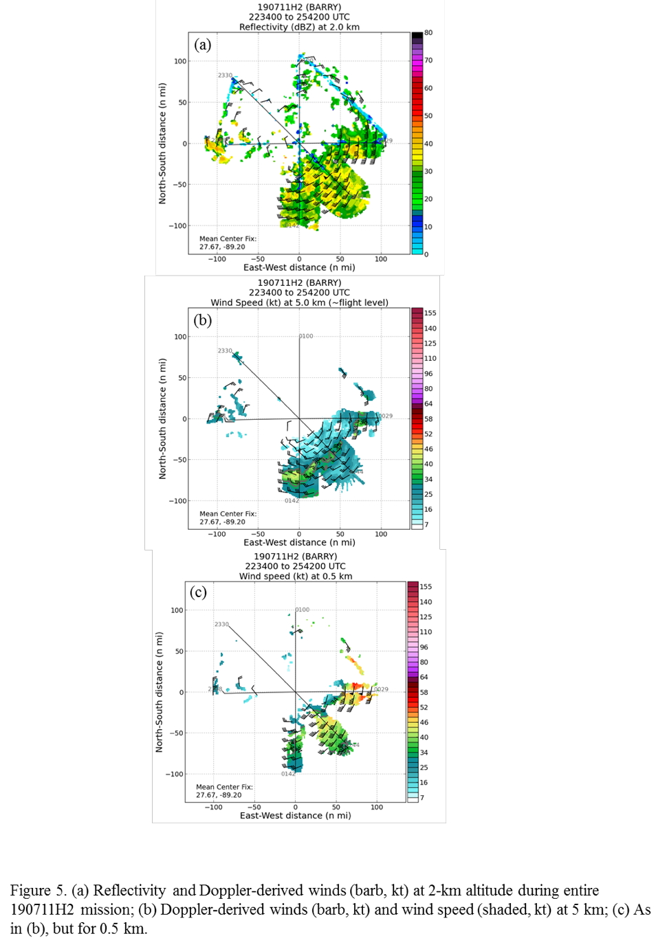
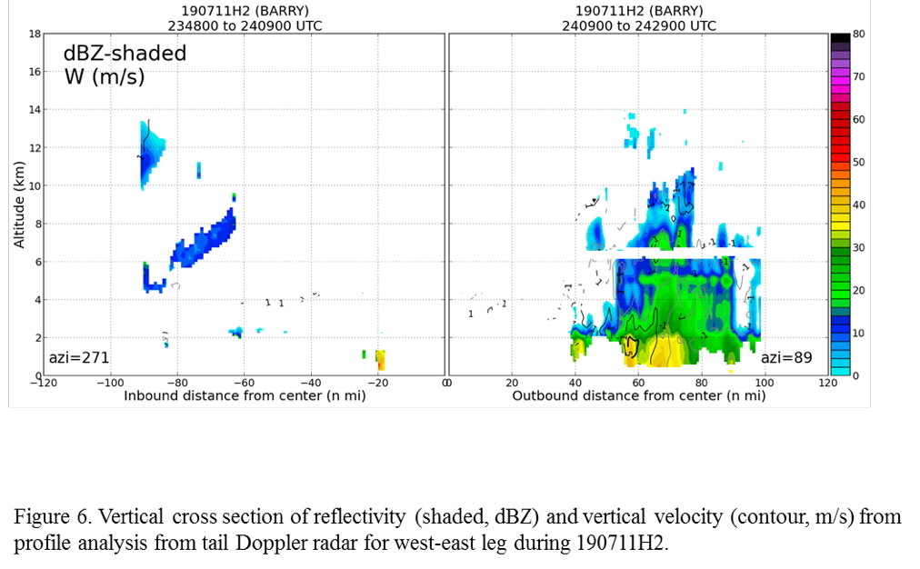
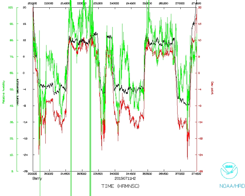
Dropsondes on the north side did not show a clear region of dry air, which contrasted with the appearance on satellite imagery (cf. Fig. 2c), nor did they show strong shear, at least up to ~450 hPa. The only clear inhibitor of convection on the north side appeared to by high-level shear and/or stability. While there were multiple swirls evident in the low levels during the mission, toward the end of the flight there did appear to be more convection and stratiform precipitation on the south and southeast sides, with this precipitation appearing to get nearer to a possible dominant circulation. This evolution is marginally reflected in the real-time radar analyses (Fig. 5), though this analysis represents the wind structure essentially “smoothed” over the entire time of the survey pattern, and hence does not incorporate evolution over smaller time scales. A west-east vertical cross section of reflectivity and vertical velocity (Fig. 6) shows a peak in reflectivity on the east side of the storm, with echo tops reaching 10 km about 60 km from the center of the profile, possibly indicative of moderate convection.
 |
 |
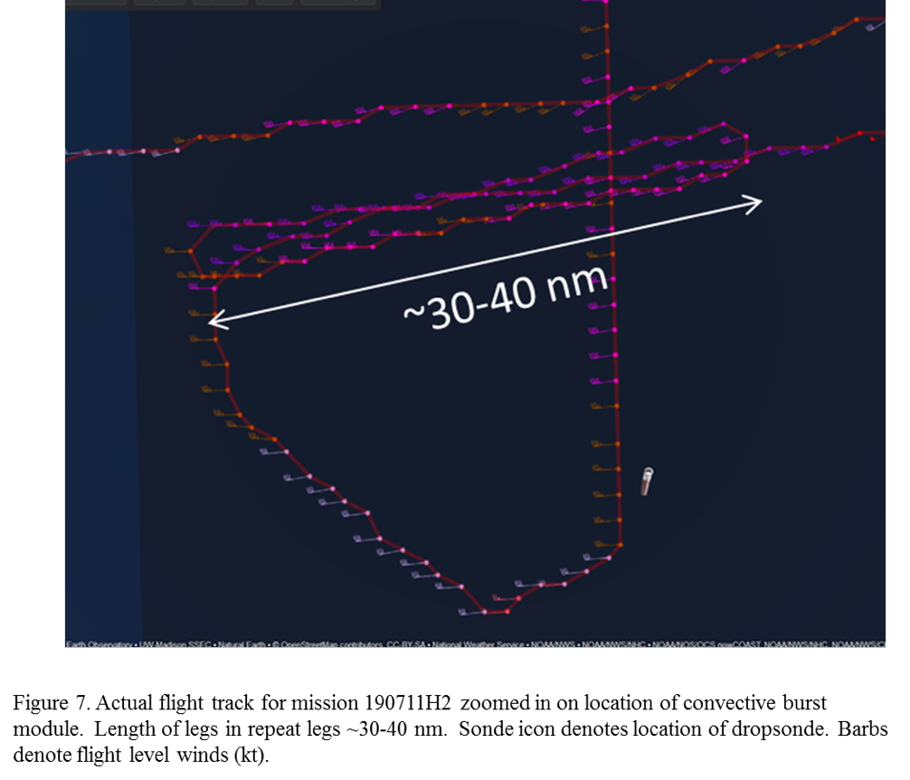
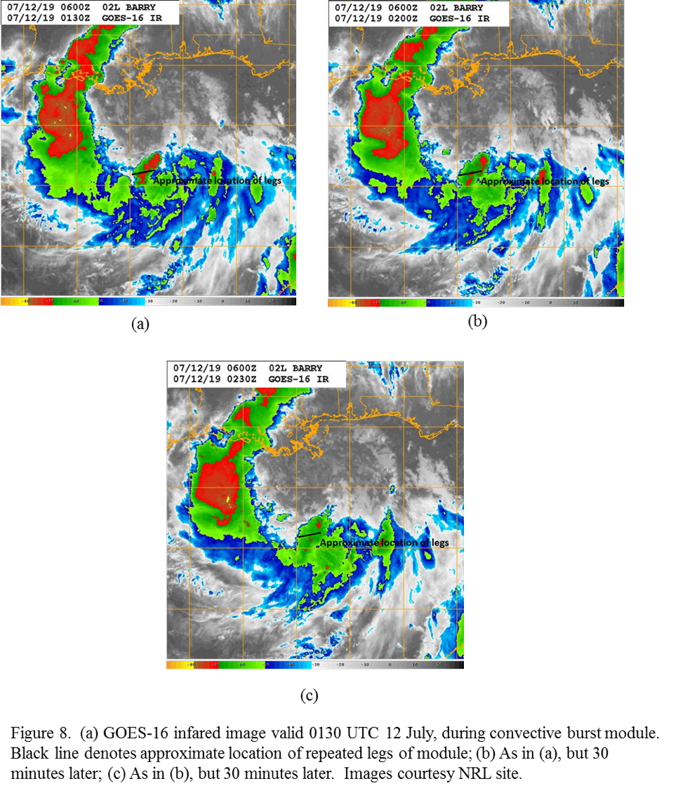
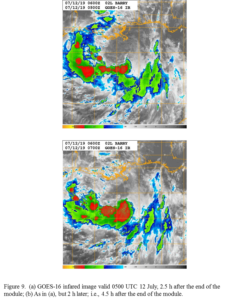
Upon completion of the survey pattern, a convective burst module was flown on the south side of the pattern. This module had three race tracks repeating in space, each of them ~30-40 nm in length (Fig. 5). The module targeted a region of cold cloud tops on the south side of the circulation near the center, as noted during the survey pattern (Fig. 6). The racetrack pattern was flown ~10 nm offset from the precipitation. The sampling occurred over about a 34-minute span, from 0156-0230 UTC. Unfortunately, as the infrared imagery indicates, the system flown during the module was experiencing decaying convection and warming cloud tops. However, over the next 2-4 h after completion of the module, a broad cold cloud shield developed (Fig. 7), suggesting that the local environment had again become favorable for the development of deep convection.
The aircraft landed at Lakeland at 0348 UTC.
 |
Mission Evaluation :
The mission was a success. The pattern that was flown was excellent, and the convective burst module, when combined with a similar module flown during the subsequent mission 12 h later, may yield important information on the kinematic and precipitation structure and evolution in a region near and downshear of the low-level center.
A total of 22 GPS dropsondes (20 good) were released.
 |
 |
Problems :
There was a problem with the Doppler radar during the first northeast-southwest pass, with the raw files from the master antenna not being transferred to the radar workstation. This data may be recoverable, though. 20 of 22 sondes worked.
Rob Rogers
Oct. 31, 2019

Track with SFMR winds |

Flight track with winds |
Track with SFMR winds (Inner core) |
Flight track with winds (Inner core) |
Timeseries wind, SFMR wind, rain rate, altitude and pressure plots |
|
 Flight track |
 Temperature and Moisture |
 Wind and Atlitude |
Flight Director's log |
Flight Director's manifest |
NetCDF data |
1 second data |
SFMR data |
serial data
LPS log |
Radar log |
Drop log
Page last updated March 20, 2020
Return to Mission page.