 |
 |
 |
| Aircraft Commander | Scott Price |
| Co-pilot | Nate Kahn |
| Co-pilot | Adam Abitbol |
| Flight Engineer | Paul Darby |
| Flight Engineer | Lalonde |
| Navigator | Todd Richards |
| Flight Director | Mike Holmes |
| Flight Director | Carpenter |
| System Engineer | Hartberger |
| Data Technician | Mike Mascaro |
| Data Technician | Warnecke |
| LPS | Rob Rogers | HRD |
| Dropsonde | Kaythryn Sellwood | HRD |
| Radar | Paul Reasor | HRD |
| Observer | Addison Alford | UOklahoma |
| Observer | Kelly Nuñez Ocasio | PSU |
| Radar | Nancy Griffin | HRD |
Mission Plan :
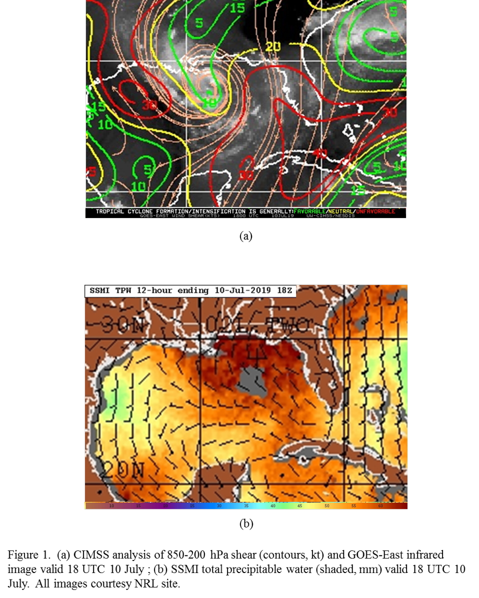
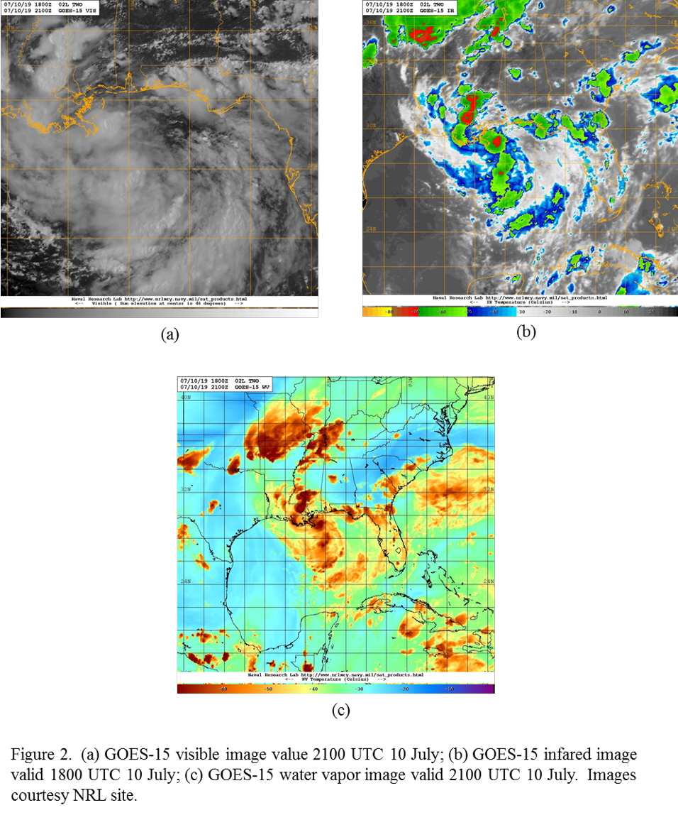
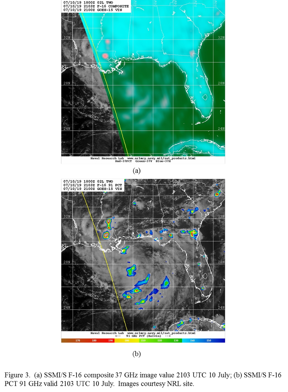
NOAA 42RF (N42) will conduct an EMC-tasked TDR mission into AL02, in the northeastern Gulf of Mexico. AL02 is still a broad circulation encountering moderate northeasterly shear. AL02 is located in a region of a pronounced shear gradient, with 30 kt of northerly shear in the eastern Gulf and a small area of < 10 kt of shear south of Louisiana (Fig. 1). The low-level environment is moist over the entire central and eastern Gulf of Mexico, and analysis fields show a sharp shear axis in the extreme eastern portion of the Gulf. There are scattered, limited areas of cold cloud tops and convection primarily in the western portion of the circulation (Fig. 2). The thermodynamic environment is complex, with dry mid- and upper-level air over the southeastern United States. (cf. Fig. 2c). Microwave imagery (Fig. 3) also reflects the presence of rain and ice scattering in the central Gulf, where the shear is lower. Models forecast slow intensification initially, and then a more significant intensification near landfall in ~48-72 h.
|
|
|
|
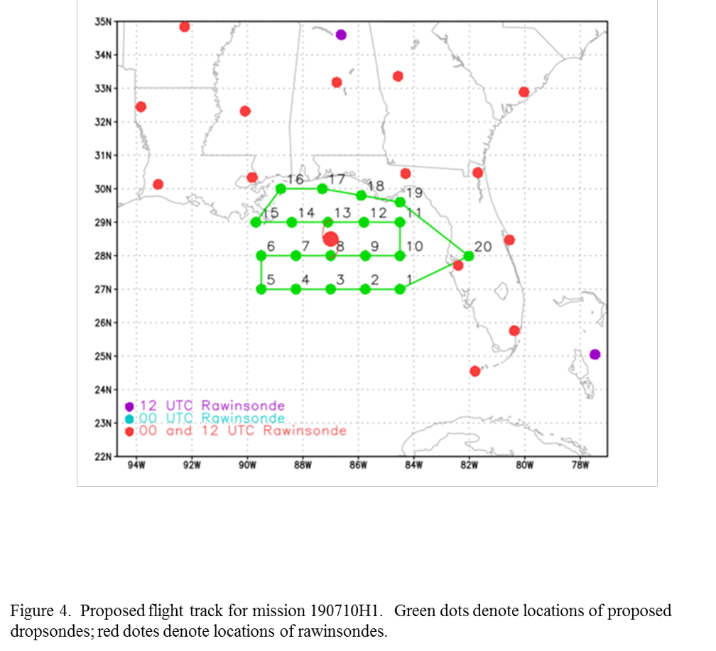
The plan calls for flying a lawnmower pattern, with each leg of the pattern spanning six degrees from east to west and covering four degrees north to south (Fig. 4). The initial point is set for the northeast side. Drop sondes at one-degree spacing, with combination AXBT/sonds at five points on the southwest side. Fly at 20,000 ft altitude or as high as possible, which is especially important on the north (upshear) portion of the pattern. The aircraft would only descend below the melting level if necessary.
 |
 |
| ||||||||||||||||||||||||||||||||||||||||||||||||||||||||||||||||||||||||||||||||||||||||||||||||||||
Mission Summary :
| Take off | Landing
| Linder-Lakeland Airport, FL
| 20:03 UTC
| Linder-Lakeland Airport, FL
| 01:47 UTC
| | ||
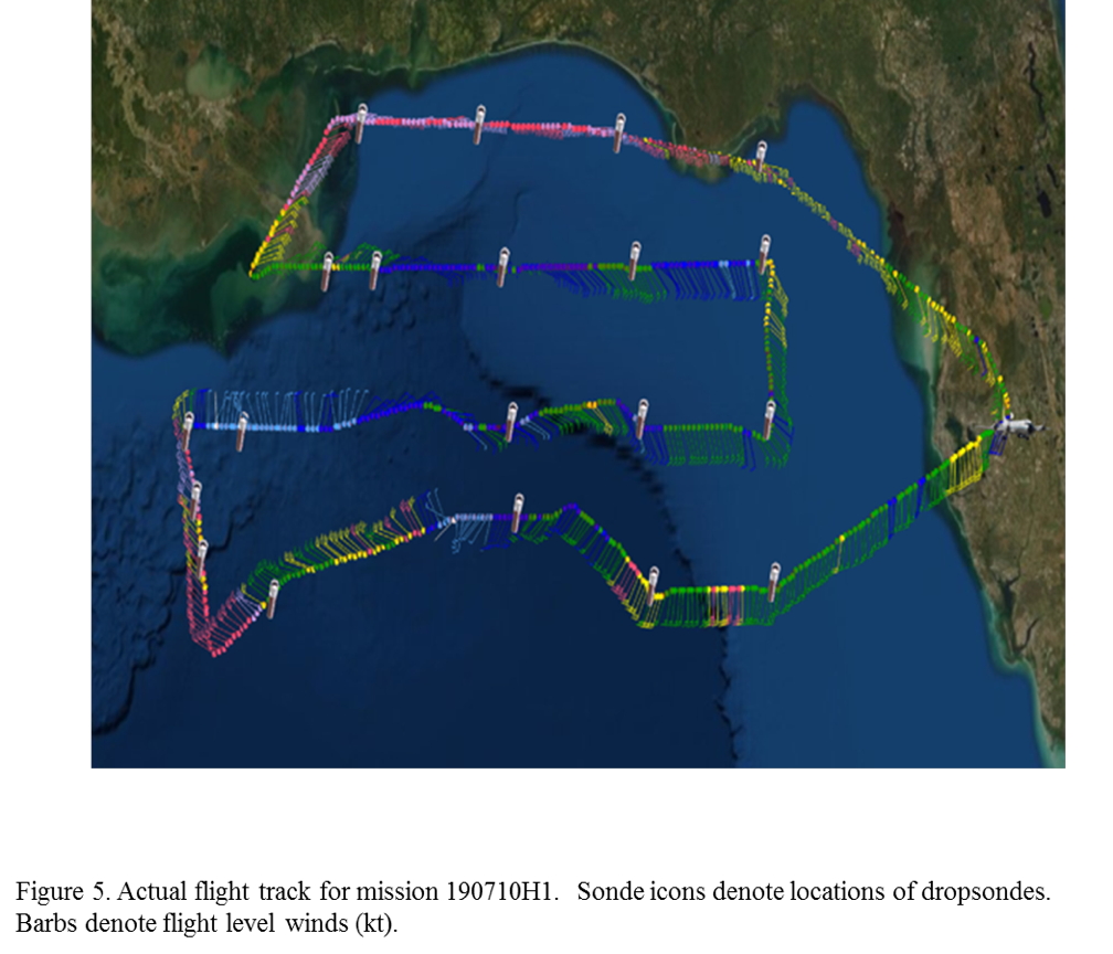
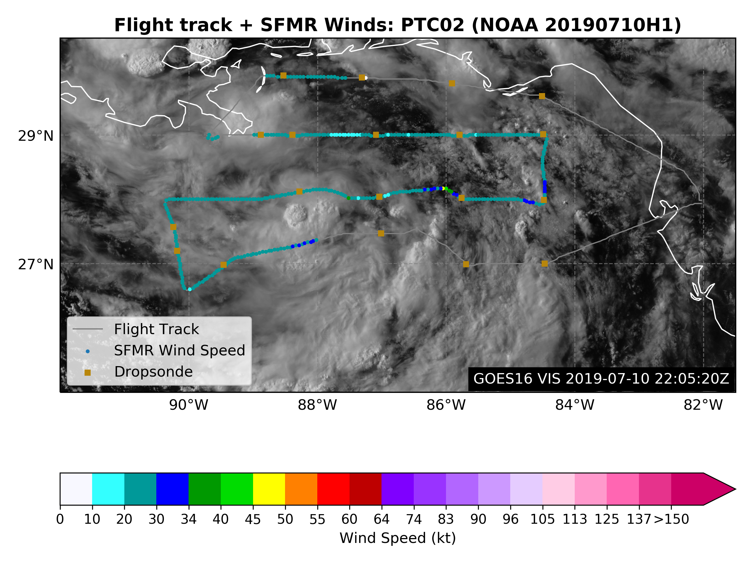
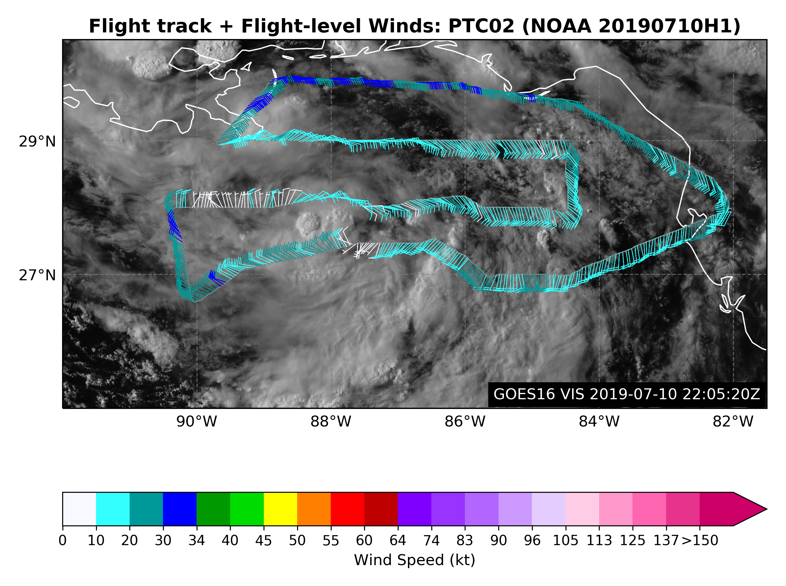
The mission was flown mostly as planned (Fig. 5). The aircraft took off at 2002 UTC from Lakeland. It was able to stay at 20,000 ft altitude, and sometimes reached 22,000 ft, for most of the pattern up until halfway through the last west-east leg. The previous east-west leg was truncated to set up for an underpass with the AEOLUS satellite. From there the aircraft flew toward the south-southeast, dropping two extra sondes. On the final west-east leg the pattern extended about 30 nm to the north of the planned line to try to sample a mesoscale convective system that was occurring to the north of the line. The aircraft has to stay on that line for a longer distance because of cells ahead of the plan, and then the plane returned back to the original line.
 |
The aircraft landed at Lakeland at 0147 UTC.
Evaluation :
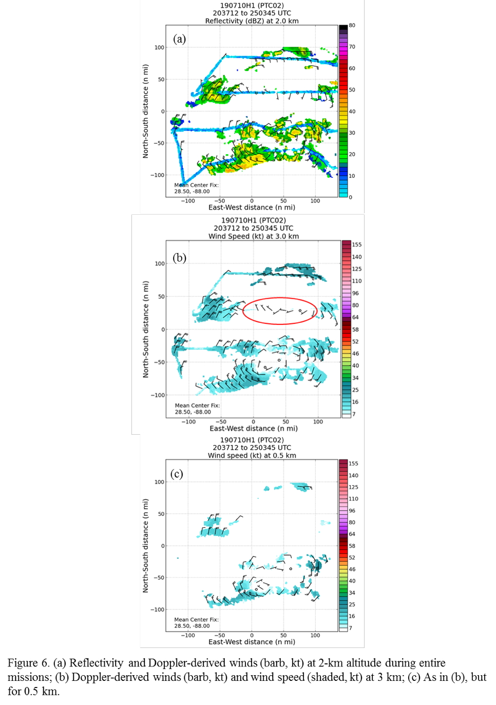
The mission was mostly a success. The radar had noise along the flight track (cf. Fig. 6b, c). The source of that noise is uncertain. NHC was not confident in the SFMR because of the altitude of the aircraft; as a result, HDOB transmission was turned off. It was helpful, however, for the sondes to fly that high.
A total of 24 GPS dropsondes (22 good) and 5 AXBTs (2 were good) were released.
Problems :
Problems were encountered with the Doppler radar noise along the flight track, and the 2 sonde and 3 AXBT failures.
Rob Rogers
Oct. 31, 2019
Track with SFMR winds |
Flight track with winds |

Track with SFMR winds (Inner core) |
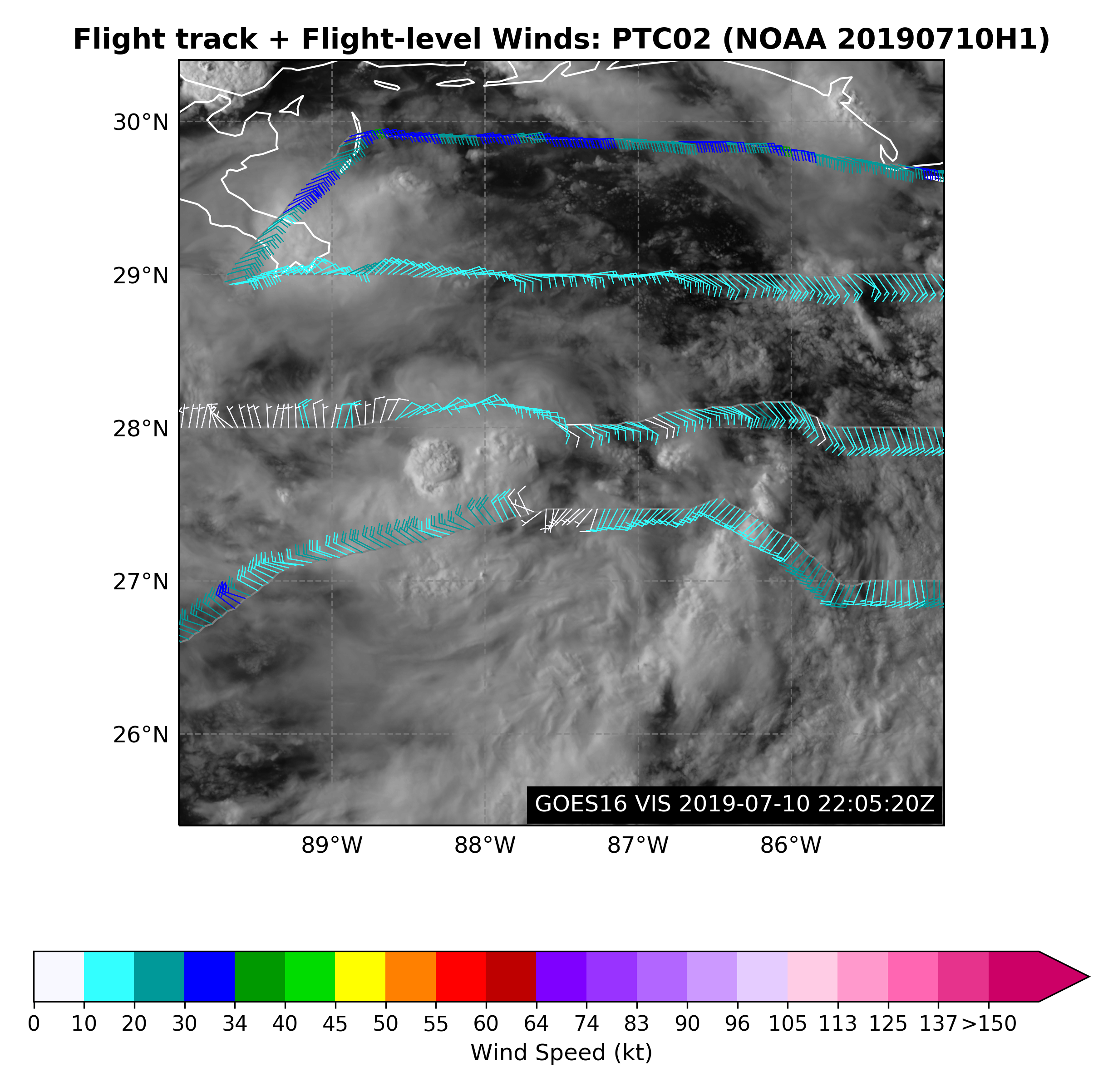
Flight track with winds (Inner core) |

Timeseries wind, SFMR wind, rain rate, altitude and pressure plots |
|
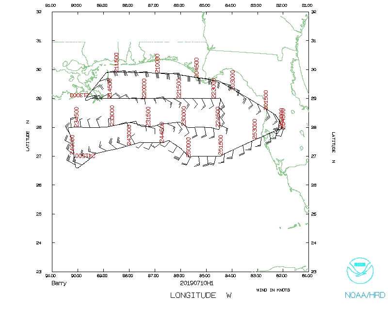 Flight track |
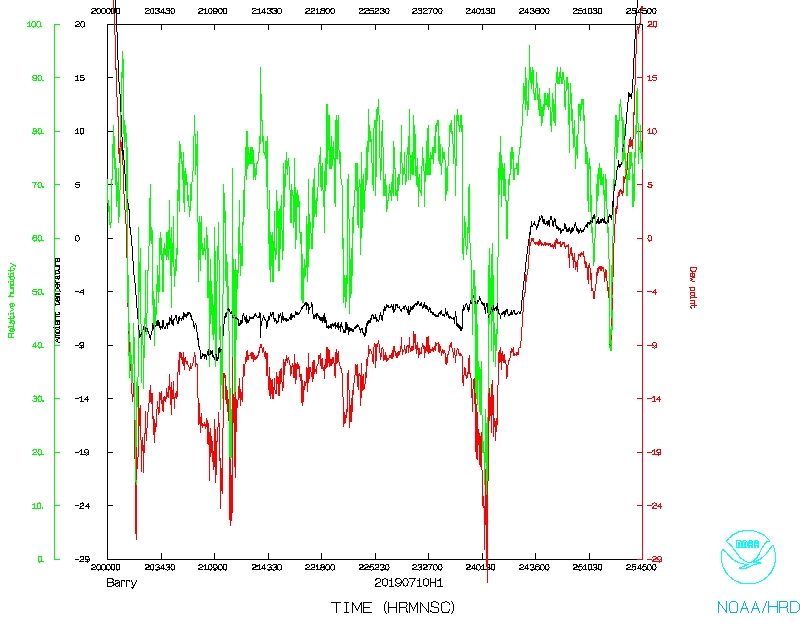 Temperature and Moisture |
 Wind and Atlitude |
Flight Director's log |
Flight Director's manifest |
Drop Log |
AXBT log |
NetCDF data |
LPS log |
Radar log |
Drop log |
AXBT log |
1 second data |
SFMR data