Figure 1.
| Aircraft Commander | Justin Kibbey |
| Co-pilot | Chris Kerns |
| Co-pilot | Adam Abitbol |
| Navigator | Pete Siegel |
| Flight Engineer | Joe Klippel |
| Flight Engineer | Paul Darby |
| Flight Director | Barry Damiano |
| System Engineer | Charles Lynch |
| System Engineer | Jorge Delgado |
| Data Technician | Joe Bosko |
| Data Technician | Todd Richards |
| Observer | Tanner Sims |
| LPS | Lisa Bucci (HRD) |
| Dropsondes/AXBT | Hua Chen (HRD) |
| Radar | Rob Rogers (HRD) |
| Radar | Robert Nystrom (U.Illinois U-C) |
Mission Plan :
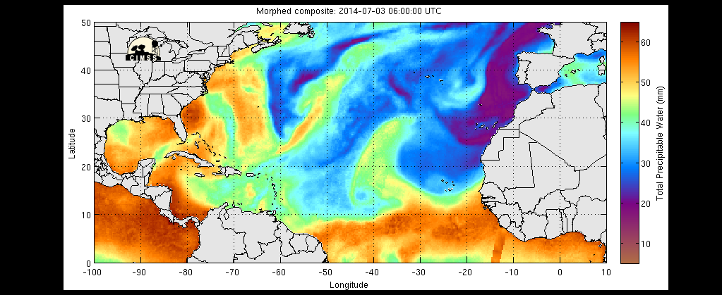
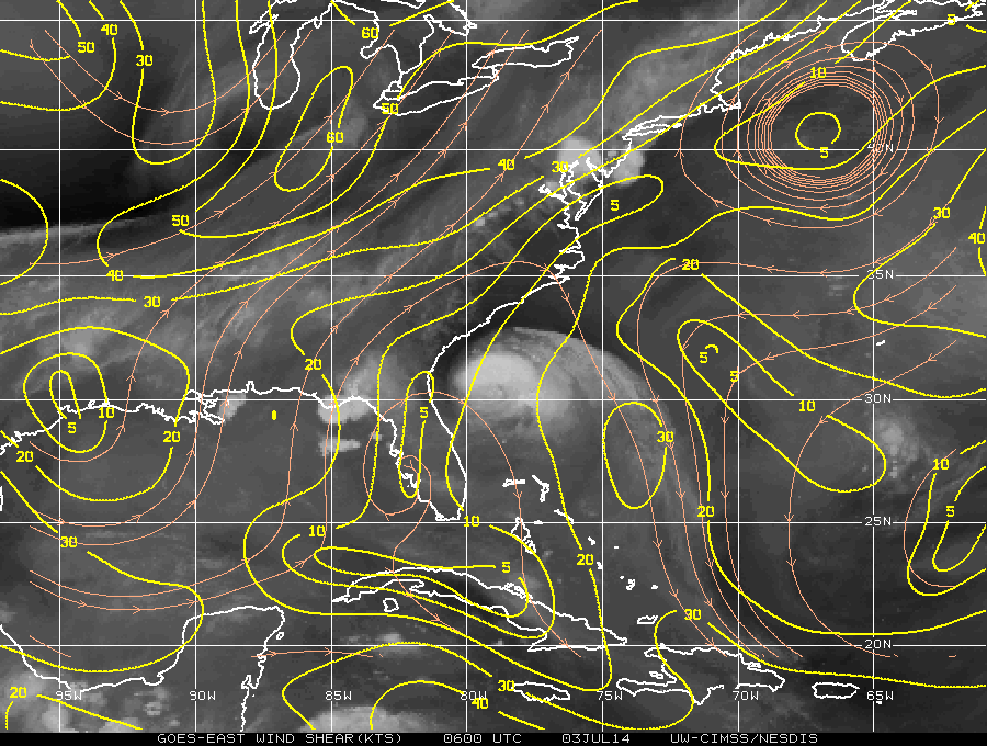
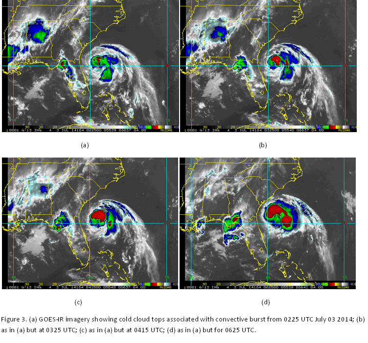
The mission is to conduct a TDR pattern in Tropical Storm Arthur, which is travelling northward off the coast of Georgia. Arthur is still experiencing north-northwesterly shear (Fig. 1). Shear is weaker on the far western side (5-10 kts), but the majority of the storm is experiencing 10-20 knots of shear. The near storm environment continues to be generally moist with total precipitable water greater than 55 mm (Fig. 2). A drier region of ~40 mm is located northeast of the storm off the coast of North Carolina. There are concerns of a turbulent flight given the recent convective burst seen in GOES IR imagery (Fig. 3) and because of information relayed from the prevision mission.
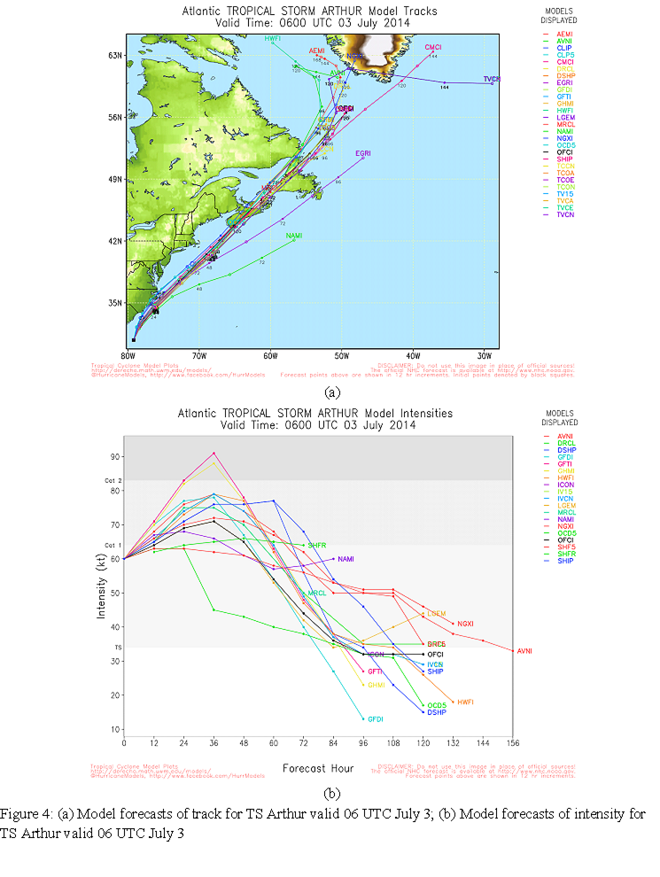
Model track guidance (Fig. 4) consistently indicates Arthur will make landfall in the Outer Banks of North Carolina in about 24 hours. Models then bring Arthur east of New England with a second landfall in Nova Scotia. Most models predict Arthur will become a Category 1 hurricane in 12 hours with only two version of the GFDL bringing it to a peak intensity of ~90 knots (Category 2).
The plan calls for a TDR pattern with an initial point on the west side of the storm (Fig. 5). A figure-4 pattern will be flown and completed to the south of the storm. From there, the plane will complete an octagonal circumnavigation of the center at about 35 nm (1.5 RMW). The circumnavigation will also be completed to the south before flying downwind to the southeast quadrant of the storm to complete a figure-4 pattern. The completion of the figure-4 pattern will place the plane northeast of the storm where it will turn around, make one more cross section and then return to MacDill Air Force Base.
Mission Summary :
| Take off | Landing
| MacDill AFB, FL | 06:27 UTC
| MacDill AFB, FL | 14:06 UTC
| | ||
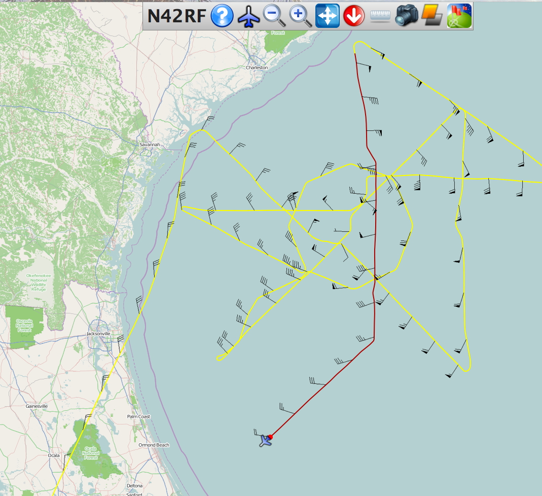
The pattern was changed (Fig. 6), moving the IP to the northwest side of the storm. A figure-4 pattern was flown and completed in the southwest quadrant. From there, an octagonal circumnavigation of the center at about 35 nm (1.5 RMW) was completed followed by a final figure-4 pattern. The completion of the figure-4 pattern placed the plane south of the storm where it returned to MacDill Air Force Base. Take-off was at 0627 UTC- slightly later than planned because of holiday leave for the fueling crew.
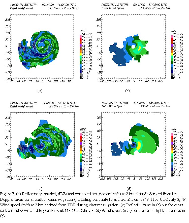

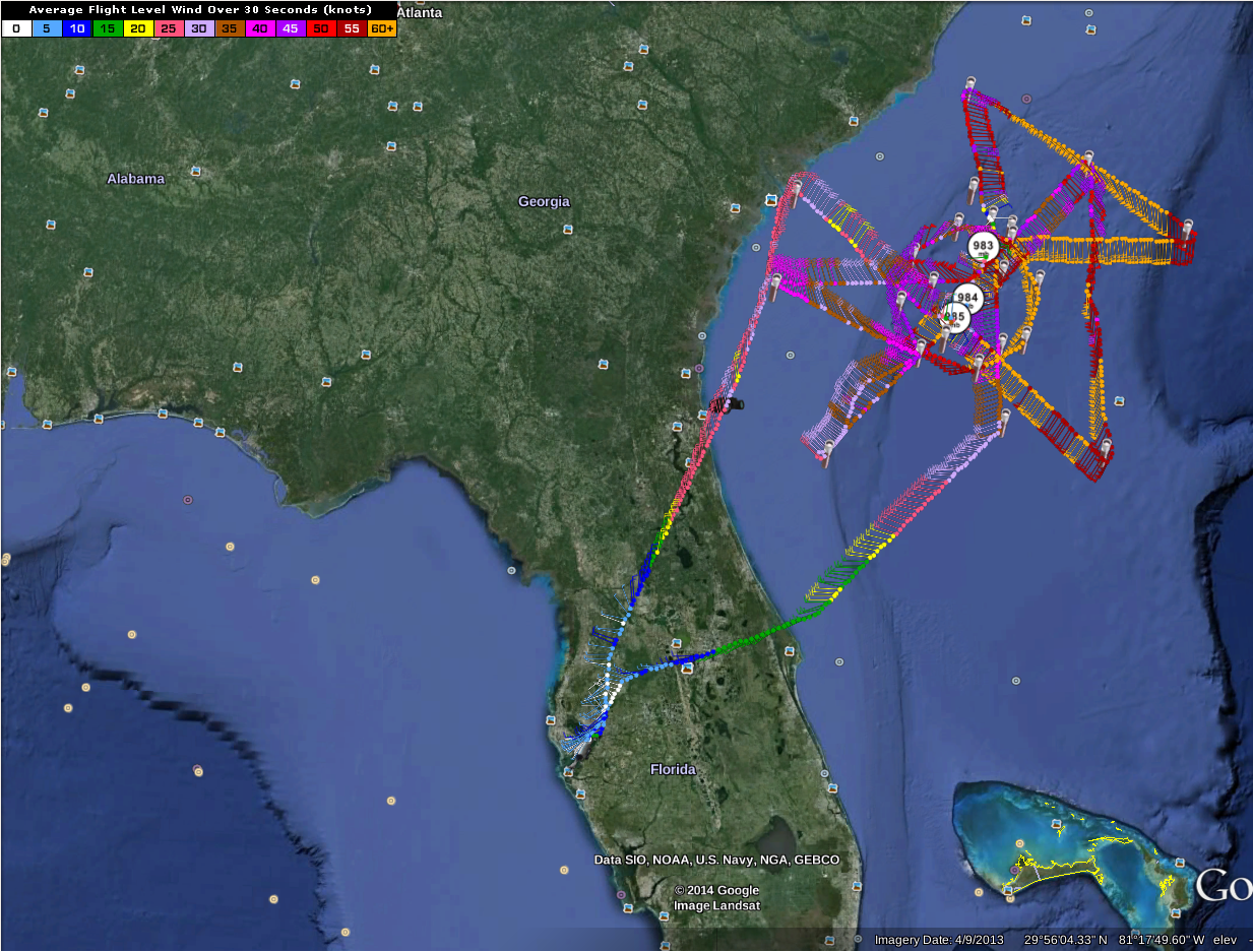
NHC upgraded Arthur from a tropical storm to a hurricane upon completion of the initial cross section and downwind leg. Strongest flight level winds during the mission were about 85 knots found on the east side. Arthur was more organized during this flight with a nearly complete eyewall and spiral bands with some embedded deep convection by the end of the flight. The circumnavigation portion of the pattern placed the plane between convection associated with the eyewall and the primary spiral band. The entire circumnavigation took 45 minutes and provided reasonable symmetric coverage of Arthur compared to an 80 minute cross section and downwind leg (Fig. 7). Radar composites show that Arthur was vertically aligned (Fig. 8), with radar echo tops extending up to 12-15 km. The strongest surface winds found by the SFMR were on the east side of Arthur and were measured at 42 m/s or 81 knots placing it close to Category 2 intensity.
The aircraft completed its mission and landed at MacDill at 1408 UTC. At total of 27 GPS sondes were dropped.
Mission Evaluation:
Though the pattern was altered, removing one cross section, it was flown successfully. Five radar analyses were completed and transmitted and there were no problems with dropsondes during this flight.
Problems :
Take off was delayed because the fueling crew was given holiday leave. While there were concerns that data would not be ingested in the 0600Z run of HWRF due to the late take off, everything was performed as planned. One dropsonde was missed at the RMW on the initial cross section.
Lisa Bucci
July 11, 2014
 Flight track |
 Temperature and Moisture |
 Wind and Atlitude |
Flight Director's log | NetCDF data | One second data | serial data