GPS dropsonde (HSA) data format
| Storm/ Date | Aircraft (Duration) | Altitude | Experiment/ Pattern | Comments (expendables) |
| Bret | ||||
| 20 August | N43RF (9.2 h) mission summary GPS dropsondes AXBT data One minute listing WC-130 |
14 kft
1500 ft |
Modified Extended Cyclone Dynamics (XCDX)/Air-sea Interaction Expeiment.
75 nm radius rotating Fig. 4 in core, followed by E-W leg along 24° N dropping AXBTs. AFRES recon. |
|
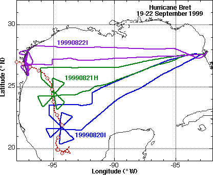
On 20 August we planned a second modified (XCDX) mission for N42RF on Saturday (21 August) to continue monitoring intensification while the G-IV (N49RF) did a synoptic surveillance mission. Also started making plans for possible landfall missions, moving more AXBTs and people to AOC on Saturday. As part of the preparations we contacted the landfall teams from Texas Tech University (TTU), University of Oklahoma, University of Alabama Huntsville, and Clemson University to see if th ey wanted to position there portable towers, profiler, or Doppler on Wheels in TX ahead of Bret. Only the two towers from TTU were available. Saturday morning (21 August) the cold core low had moved over TX and Hurricane Bret was tracking N along 95° W. N49RF and N42RF missions were scheduled to depart AOC at 1730 UTC. The combination of a N49RF surveillance and the N42RF inner core flight should provide a great data set of rapid intensification.
| Storm/ Date | Aircraft (Duration) | Altitude | Experiment/ Pattern | Comments (expendables) |
| Bret | ||||
| 21 August | N49RF (9 h) GPS dropsondes N42RF (9.2 h) mission summary
WC-130 |
45 kft
14 kft 5000 ft |
Modified Extended Cyclone Dynamics (XCDX)/Air-sea Interaction Expeiment.
75 nm radius rotating Fig. 4 in core, with E-W leg along 26° N to drop AXBTs across storm track, warm ring sampled in July, and near west- and mid-Gulf buoys. AFRES recon. |
|
On 21 August we planned for landfall missions the next day, tentatively near Brownsville TX. Two flights were schedued: (1) N43RF for 1730 UTC Sunday (22 August) to cover the earliest possible landfall; and (2) N42RF for 0200 UTC Monday (23 August) to cover the latest possible landfall. We assisted the TTU crews pick sites near Brownsville and Corpus Christi, TX; one tower near Corpus Christi WSR-88D and the other at Kingsville Auxiliary Naval Air Station, about 40 km SW of Corpu s Christi (with help from CARCAH and the FEMA liaison team at NHC). Sunday morning (22 August) it was apparent landfall would happen between Brownsville and Corpus Christi around 0000 UTC 23 August. We canceled the N42RF flight. N43RF took off at 1730 UTC and arrived at the storm around 2015 UTC while the center was 10 nm off Padre Island. The combination of the Doppler radar, GP-sondes, and SRA storm surge is going to make an excellent landfall data set.
| Storm/ Date | Aircraft (Duration) | Altitude | Experiment/ Pattern | Comments (expendables) |
| Bret | ||||
| 22 August | N43RF (9.2 h) mission summary
GPS dropsondes AXBT data One minute listing WC-130 |
14 kft
5000 ft |
Windfields at Landfall Expeiment.
75 km leg Figure-4 through center at 12 kft, penetrating 10-15 km over land. S-N run was along barrier island to map storm surge AFRES recon. |
|
Overall, the Bret flights were a great success. We captured an excellent data set in a rapidly intensifying TC over 3 days which should provide excellent documentation of the intensity changes in the inner core, as well as some good data on the envir onment around the storm on 21 August. The landfall experiment provided a further increase to our knowledge about the wind field evolution near landfall. Bret was the most intense storm we have sampled in our 5 years of doing the landfall experiments. The strengths of this landfall data set will be the excellent WSR-88D coverage (possibly providing some dual-Doppler observations), the GPS-sondes in the onshore and offshore flow within the eyewall, and the SRA surge observations along Padre Island. The TTU towers should provide some observations of the wind field evolution after landfall.
©1999 NOAA/AOML Hurricane Research Division For information about NOAA Hurricane Field Program marks@aoml.noaa.gov Updated Monday, 22 November 1999