
As a hurricane approaches landfall, citizens are hoping that they are adequately prepared for the potential damage from strong winds and rising oceans. NOAA’s job is to forecast the storm location and strength, or intensity, to help communities make the best informed decisions. For many scientists, predicting intensity is a challenge at the forefront of hurricane research, and in recent years advancements in observations and modeling have improved NOAA’s forecasts of intensity by 20%. We are now at the point where scientists can observe and predict with very fine detail what is happening in the inner core of the storm.
Accurately modeling hurricanes involves understanding and reproducing very complex processes that directly influence storm evolution. Many variables influence hurricane development; from the energy they draw from the oceans below and their interactions with the surrounding environment to the dynamic inner core. By building on years of observational expertise and cutting-edge approaches to data integration and model development, hurricane scientists look to further improve the nation’s ability to prepare for and respond to these natural disasters.
This summer, the hurricane researchers at NOAA’s Atlantic Oceanographic and Meteorological Laboratory will continue their Intensity Forecasting Experiment (IFEX) with three main goals:
- Collect observations that span the hurricane life cycle in a variety of environments.
- Develop and refine measurement technologies that provide improved real-time monitoring of hurricane intensity, structure, and environment.
- Improve understanding of the physical processes important in intensity change for a hurricane at all stages of its life cycle.
All three IFEX goals work hand in hand, and NOAA scientists are working toward developing better forecast tools for the hurricane season. With Hurricane Hunteraircraft flight-ready in July, scientists will be positioned to perform a wide array of experiments both up in the sky and here in the lab.
One of the highest forecasting priorities is rapid intensity change, a complex prediction problem that results in storms ramping up wind speeds very quickly. Forecasters want to accurately predict storms like Hurricane Patricia (2015) which dramatically increased wind speed by 120 mph in one day.
With experiments such as the Rapid Intensification Experiment (RAPX), NOAA will use the NOAA P-3 and G-IV aircraft to measure changes in the temperature, moisture, winds, and pressure of the atmosphere and energy content of the ocean. These observations will be taken within the inner core of a hurricane and its surrounding environment. Scientists will use these data to test hypotheses regarding spatial scales associated with rapid intensification and the potential for improving predictions.

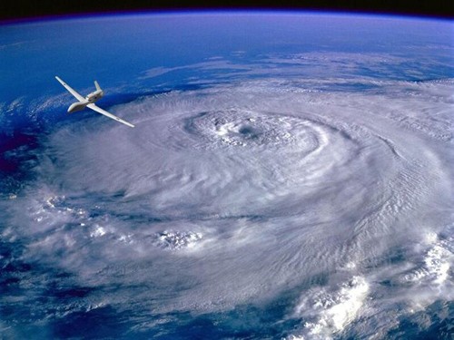
Other experiments this season are the Small Unmanned Aerial Vehicle Experiment (SUAVE), the P-3 aircraft 3-D Doppler Winds Experiment, and the Doppler Wind Lidar Experiment. SUAVE will use the Coyote to collect high resolution observations of hurricane temperature, moisture, and winds at low altitudes to improve understanding and model performance. The experiment will assess the strength and location of the storm’s strongest winds, the extent of maximum winds, as well as the storm’s minimum sea level pressure.
With the Three-Dimensional Doppler Winds Experiment, scientists will produce three-dimensional images of a hurricane’s wind structure using Doppler radar on the aircraft. These data will be transmitted in real-time to be used in the latest Hurricane Weather Research Forecast (HWRF) model, helping improve HWRF intensity forecasts and refining and improving our understanding of hurricane processes.

While the Doppler radar can measure winds in regions of rain, it is blind in regions where there is no rain. The Doppler Wind Lidar, flying on the P-3 aircraft this year, uses laser technology to measure the wind field above and below the aircraft in rain-free regions. This will complement measurements from the radar and provide a more complete picture of the wind field in the hurricane.
Data assimilation experts will incorporate these and other new observations from platforms such as land-based Doppler radar and polar-orbiting satellites into an experimental version of the HWRF model in near real-time. AOML will test new state-of-the-art techniques to incorporate the data, with a new algorithm and quality-control mechanisms run on high-performance computers that will allow for better and faster incorporation of the data.
There are a total of 21 experiments proposed for this hurricane season, each using a different approach to address our gaps in knowledge and understanding of hurricanes; from assessing the odds for development off the coast of Africa to calculating the impact of ocean temperature and wind shear to the potential wind speed and landfall near our coastal communities.
With over 60 years of experience studying hurricanes, working side-by-side with a team of modelers and experts who feed these new insights and observations into high resolution models, AOML is uniquely positioned to leverage these combined assets to improve hurricane forecasts.
For the latest forecast on any current storms, visit: www.nhc.noaa.gov.
To see data and images collected from the 2016 storms, visit: AOML’s Hurricane Research Division
To see the latest “Tweets From The Eye” from our hurricane scientists, follow: www.twitter.com/HRD_AOML_NOAA
Originally Published by Nicholas Komisarjevsky, 2016