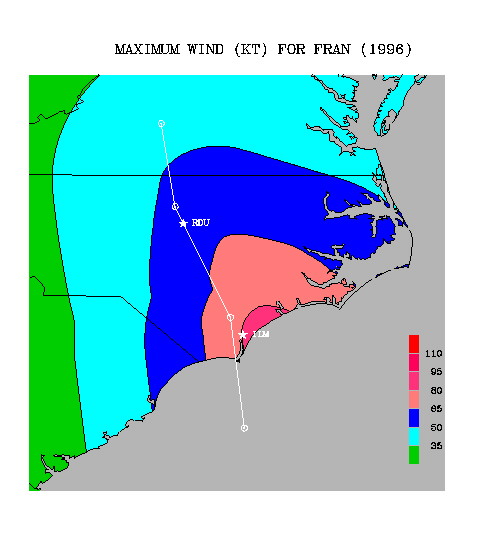
Maximum sustained surface wind forecast for Hurricane Fran (1996) by the Inland Wind Decay Model. Information about Fran's structure and movement at landfall necessary to run the IWDM was obtained from the last NHC advisory and HRD surface wind analysis available prior to Fran's landfall. Fran's observed track from 21 UTC 5 September to 15 UTC 6 September is depicted by the solid white line. The open circles denote Fran's locations at 6 hr increments from just prior to landfall until the last advisory time period when Fran was still of tropical storm strength. Two North Carolina cities that experienced significant wind damage due to Fran, Wilmington (ILM) and Raleigh (RDU), also appear.