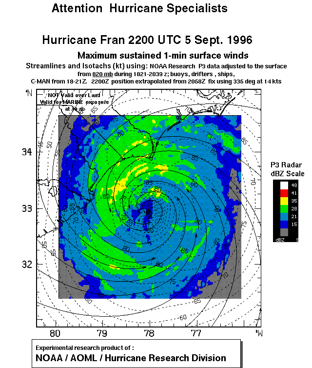
This surface wind field for Hurricane Fran at 2200 UTC 5 September 1996 was available at the National Hurricane Center (NHC) in real time. The winds, depicted as streamlines and isotachs (the contour interval is 5 kt), were superimposed on a radar reflectivity (in dBz as indicated on the scale to the right) image transmitted to NHC by a NOAA P3 aircraft during HRD's research mission into Fran as it made landfall.