Quantifying Sea-Air CO2 Fluxes Using Surface Water CO2 Measurements from Ships of Opportunity
Rik Wanninkhof and Denis Pierrot
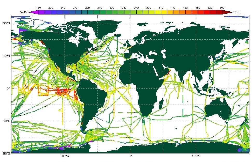 The global ocean takes up approximately one quarter of the anthropogenic CO2 released each year but the patterns of uptake and release of CO2 by the ocean vary in time and space. To quantify the fluxes on seasonal and regional scales, NOAA operates the largest automated measurement campaign of surface water CO2 from ships of opportunity in the world (SOOP-CO2). The data have been used to create the iconic global ocean sea-air flux maps under the leadership of Dr. Taro Takahashi of Columbia University's Lamont-Doherty Earth Observatory. The objectives of this sustained effort are:
The data from our group and four other groups sponsored by NOAA's Climate Observation Division of the Climate Program Office is provided to the lab of Dr. Takahashi for incorporation in his global dataset. Furthermore, we provide our data to the Surface Ocean Carbon Atlas (www.socat.info), a group endorsed by the International Carbon Coordination project (www.ioccp.org), and work with this effort to provide expert input on instrumentation and data acquisition. We have also helped to design and develop a state-of-the art automated surface water CO2 instrument produced by General Oceanics, Inc. which is used worldwide. |
pCO2 Underway Data (SOOP) |
|
Ongoing Collection by Ship: |
|
Completed Collections by Ship: |
|
Completed Collections by Cruise: |