« GCC Home
R/V Brown Data:
Year
1997
1998
1999
2000
2001
2002
2003
2004
2005
2006
2007
2008
2009
2010
2011
2012
2013
2014
» Introduction
» CruiseTracks
» Realtime Display
» Cruise Inventory
» Annual Files
» Contact
» Internal QC Plots
» Ron Brown Homepage
» Ron Brown Schedule Page
Ongoing R/V Brown Data » 2010 Data
Master Readme File
Click cruise track to view full size.
RB-10-01
CLIVAR A13.5 Leg 2 2010
03/07/2010-04/17/2010
»
CSV Data File
»
Readme File
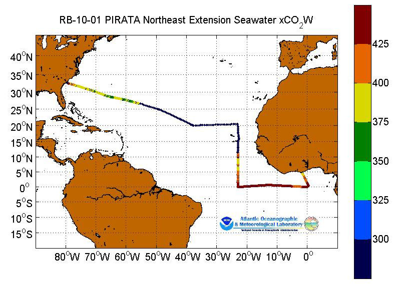
RB-10-02
PIRATA Northeast Extension 2010
04/26/2010-05/22/2010
»
CSV Data File
»
Readme File
RB-10-07
GOMEX Deep Coral Leg 2 2010
10/15/2010-11/03/2010
»
CSV Data File
»
Readme File
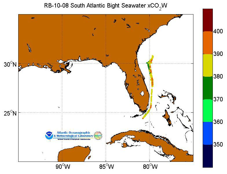
RB-10-08
South Atlantic Bight 2010
11/28/2010-12/20/2010
»
CSV Data File
»
Readme File
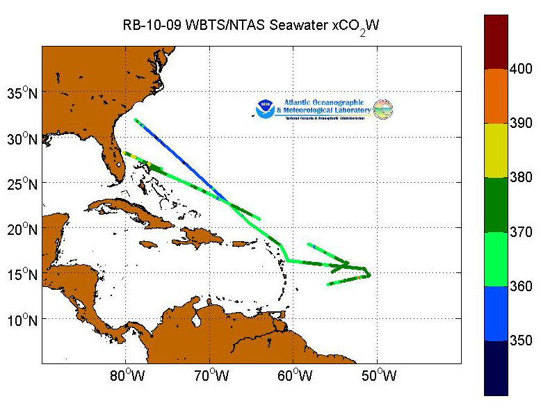
RB-10-09
WBTS/NTAS 2010
11/09/2010-11/22/2010
»
CSV Data File
»
Readme File
Master Readme File
Privacy Policy
|
Disclaimer