|
The G-IV tail Doppler radar will support the operational hurricane modeling objectives of the NOAA National Weather Service (NWS) Environmental Modeling Center and provide state of the art hurricane forecast guidance to the National Centers for Environmental Prediction (NCEP) Tropical Prediction Center. The Environmental Modeling Center is developing the next generation hurricane prediction system, the Hurricane Weather Research and Forecasting (HWRF). The HWRF will assimilate the GIV Doppler radar measurements taken in the hurricane core circulation to improve the model storm initialization. This effort is fundamental to improving hurricane intensity and structure forecasts. The HWRF will transition into operations at NCEP in 2007. The HWRF will also provide the tropical research community with an advanced coupled air-sea-land hurricane prediction system to increase scientific understanding of tropical cyclone processes and provide opportunities for further advancements in the prediction of tropical cyclone track, intensity, and rainfall. |
|
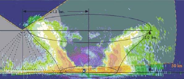
Initially, HWRF will be working with data on a 10-15 km horizontal grid, with future versions requiring grid resolutions of 4 km or less. Vertical resolution requirements are 5 km, with 1 km vertical grids expected in future enhancements. As can be seen in Figure 1, a typical strong hurricane (this is Hugo in 1989 as a Category 5 storm) can have eye diameters (including the eyewall) of about 40 km. If the G-IV can not penetrate the storm, it should at least have the capability to map the inner core wind field from just outside of the core region. |
|
Project Overview |