Effects of Synoptic Surveillance on model forecasts for
Hurricane Wilma.
| October 18, 2005 | 18 Z | |||
| October 19, 2005 | 00 Z | 06 Z | 12 Z | 18 Z |
| October 20, 2005 | 00 Z | 06 Z | 12 Z | 18 Z |
| October 21, 2005 | 00 Z | 06 Z | 12 Z | 18 Z |
| October 22, 2005 | 00 Z | 06 Z | 12 Z | 18 Z |
| October 23, 2005 | 00 Z | 06 Z | 12 Z | 18 Z |
| October 24, 2005 | 00 Z | 06 Z | 12 Z | 18 Z |
| October 25, 2005 | 00 Z |
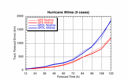
Figure 1a. Track forecast errors for the no dropwindsonde and the all dropwindsonde runs for the GFS and GFDL models for Hurricane Wilma synoptic surveillance missions.
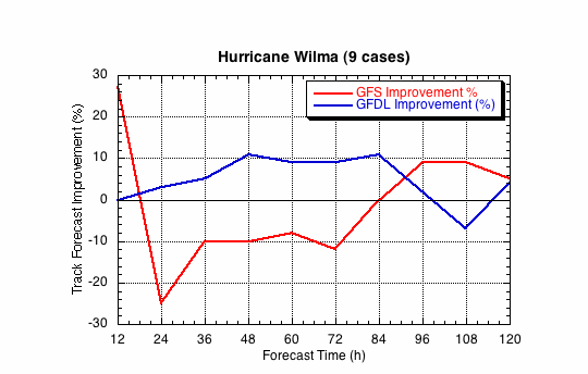
Figure 1b. Track forecast improvements for the GFS and GFDL models for the Hurricane Wilma synoptic surveillance missions.
(a)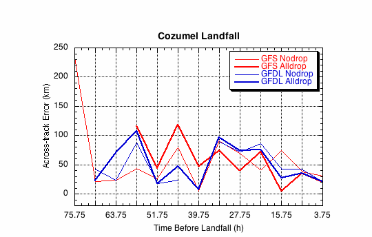
(b)
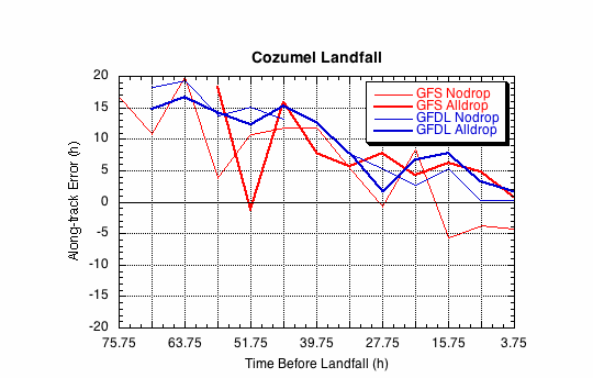
Figure 2. Forecast errors for the landfall of Wilma at Cozumel, in the (a) cross- and (b) along-track directions for the no dropwindsonde and the all dropwindsonde runs for the GFS and GFDL models.
(a)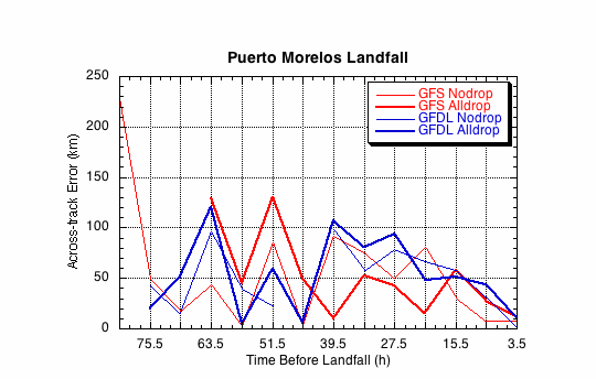
(b)
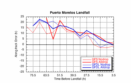
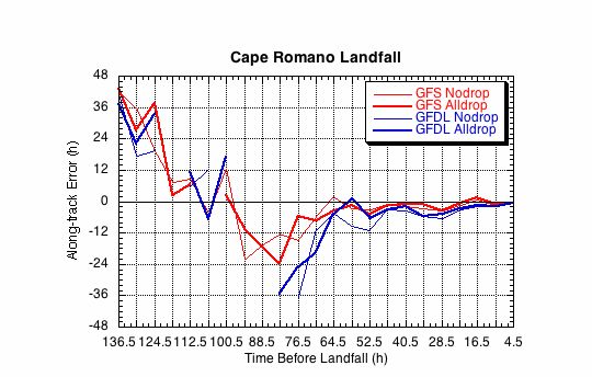
Figure 3. Forecast errors for the landfall of Wilma at Puerto Morelos, in the (a) cross- and (b)along-track directions for the no dropwindsonde and the all dropwindsonde runs for the GFS and GFDL models.
(a)
(b)