Effects of Synoptic Surveillance on model forecasts for
Hurricane Michelle.
Quicktime movie of DLM wind analyses
Quicktime movie of DLM wind data initial
increments
| October 31, 2001 | November 1, 2001 |
| November 2, 2001 | November 3, 2001 |
| October 31, 2001 | 18 Z | |||
| November 1, 2001 | 00 Z | 06 Z | 12 Z | 18 Z |
| November 2, 2001 | 00 Z | 06 Z | 12 Z | 18 Z |
| November 3, 2001 | 00 Z | 06 Z | 12 Z | 18 Z |
| November 4, 2001 | 00 Z | 06 Z | 12 Z |
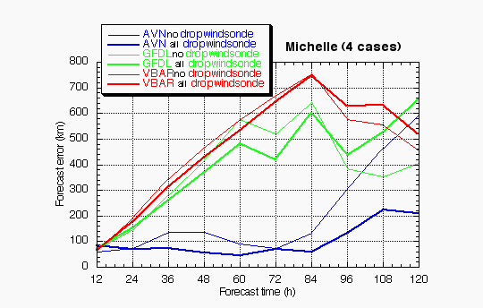
Figure 1a. Track forecast errors for the no dropwindsonde (NO or NN) and the all dropwindsonde (AL) runs for the AVN, GFDL, and VBAR models for four Hurricane Michelle synoptic surveillance missions.
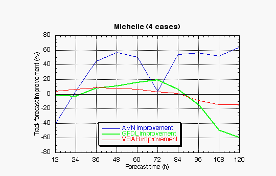
Figure 1b. Track forecast improvements for the AVN, GFDL, and VBAR models for the four Hurricane Michelle synoptic surveillance missions.
(a)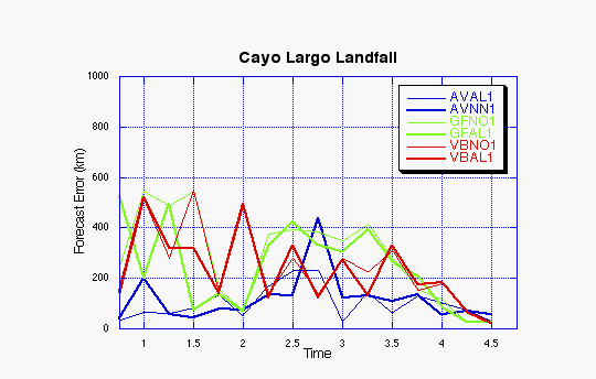
(b)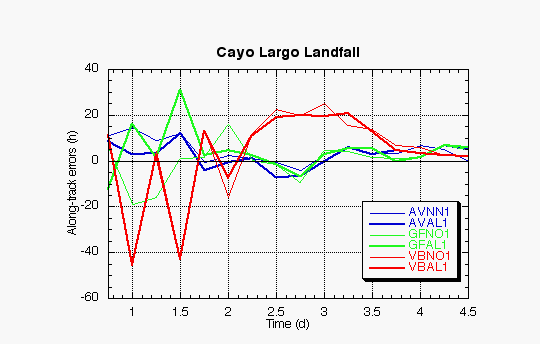
Figure 2. Forecast errors for the landfall of Hurricane Michelle at Cayo Largo, Cuba, in the (a) cross- and (b) along-track directions for the no dropwindsonde (NO or NN) and the all dropwindsonde (AL) runs for the AVN, GFDL, and VBAR models.
(a)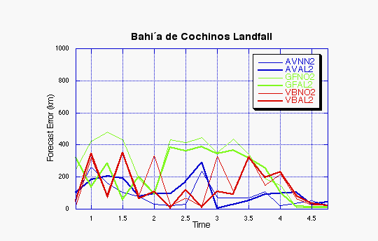
(b)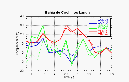
Figure 3. Forecast errors for the landfall of Hurricane Michelle at Bahia de Cochinos, Cuba, in the (a) cross- and (b) along-track directions for the no dropwindsonde (NO or NN) and the all dropwindsonde (AL) runs for the AVN, GFDL, and VBAR models.
(a)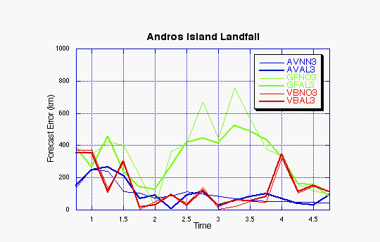
(b)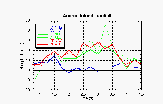
Figure 4. Forecast errors for the landfall of Hurricane Michelle at Andros Island, Bahamas, in the (a) cross- and (b) along-track directions for the no dropwindsonde (NO or NN) and the all dropwindsonde (AL) runs for the AVN, GFDL, and VBAR models.
(a)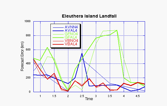
(b)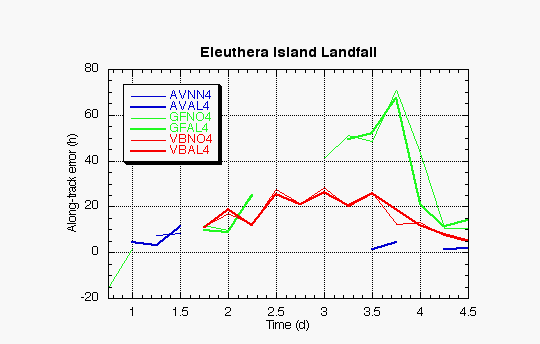
Figure 5. Forecast errors for the landfall of Hurricane Michelle at Eleuthera Island, Bahamas, in the (a) cross- and (b) along-track directions for the no dropwindsonde (NO or NN) and the all dropwindsonde (AL) runs for the AVN, GFDL, and VBAR models.
Return to 2001 assessment page
Return to HRD home page