Effects of Synoptic Surveillance on model forecasts for
02 October 2002 0600 UTC
Lili.
Quicktime movie of AVN DLM wind model
forecast
Quicktime movie of DLM wind data
increment
| TRACK (km) | ||||||||||||||||||||||||||||||||||||||||||||||||||||||||||||||||||||||||||||||||||||||||||||||||||||||||||||||||||||||||||||||||||||||||||||||||
| MODEL | 12 h | 24 h | 36 h | 48 h | 60 h | 72 h | 84 h | 96 h | 108 h | 120 h
|
| AVNN | 30. | 91. | 93. | 71. |
| AVNO | 30. | 115. | 169. | 213. |
| %IMP | 0% | -26% | -82% | -200%
|
| GFNO | 20. | 87. | 164. | 172.
| GFAL | 37. | 73. | 135. | 114.
| %IMP | -85% | 16% | 18% | 34%
|
| AVNN | -84. | -66. | -22. | -9. |
| AVNO | -78. | -61. | -17. | 2. |
| %IMP | 7% | 8% | 23% | 78%
| INTENSITY (kt)
| MODEL | 12 h | 24 h | 36 h | 48 h | 60 h | 72 h | 84 h | 96 h | 108 h | 120 h
|
| GFNO | -26. | -12. | 24. | 10.
| GFAL | -28. | -11. | 23. | 14.
| %IMP | -8% | 8% | 4% | -40%
|
| SHNO | -17. | 3. | 50. | 76. |
| SHIP | -20. | -3. | 42. | 65. |
| %IMP | -18% | 0% | 16% | 14%
|
| DSNO | -17. | 3. | 50. | 24. |
| DSHP | -20. | -3. | 42. | 21. |
| %IMP | -18% | 0% | 16% | 13%
| | ||||||||||||||||||
| 03/1300 UTC 29.5N 92.2W near Intracoastal City, LA 31 h into the forecast | |||||||||||||||||||||||||||||||||||||||||
| MODEL | LAT | LON | TIME | ERROR | LOCATION
|
| AVNN | 29.58 | 92.68 | 35.5 | 47.2 | Pecan Island, LA
| AVAL | 29.74 | 92.18 | 40.0 | 26.7 | Intracoastal City, LA
| %IMP | -100% | 43%
|
| GFNO | 29.81 | 93.50 | 38.5 | 130.2 | Peveto Beach, LA
| GFAL | 29.72 | 93.05 | 37.5 | 85.7 | Oak Grove, LA
| %IMP | 13% | 34%
| | ||||
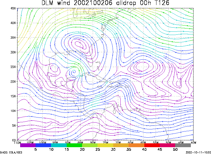
Figure 1. NCEP 850 - 200 hPa mean wind analysis for 02 October 2002 0600 UTC (Hurricane Lili).
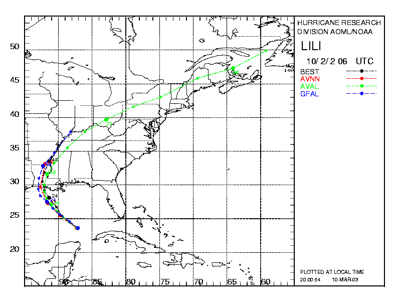
Figure 2. Track forecasts for the no dropwindsonde (NO or NN) and the all dropwindsonde (AL) runs for the AVN and GFDL models initialized on 02 October 2002 0600 UTC. The best track is shown in black.
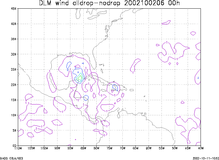
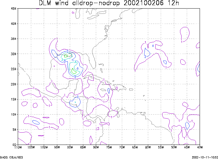
Figure 3. Initial condition differences in the 850 - 200 hPa mean wind between the no and all dropwindsonde cases for 02 October 2002 0600 UTC.