Effects of Synoptic Surveillance on model forecasts for
04 October 2000 0000 UTC
KEITH.
QuickTime movie of DLM wind model forecasts
QuickTime movie of DLM wind data increments
| TRACK (km) | ||||||||||||||||||||||||||||||||||||||||||||||||||||||||||||||||||||||||||||||||||||||||||||||||||||||||||||||||||||||||||||||||||||||||||||||||||||||||||||||
| MODEL | 12 h | 24 h | 36 h | 48 h | 60 h | 72 h | 84 h | 96 h | 108 h | 120 h
|
| AVNN | 109. | 172. | 249. | 296. | 440.
| AVAL | 39. | 126. | 72. | 88. | 167.
| %IMP | 64% | 27% | 71% | 70% | 62% |
|
| GFNO | 130. | 226. | 334. |
| GFAL | 148. | 289. | 328. |
| %IMP | -14% | -28% | 2%
|
| VBNO | 43. | 84. | 133. | 168. | 279.
| VBAL | 33. | 102. | 167. | 212. | 361.
| %IMP | 23% | -21% | -26% | -26% | -29%
| INTENSITY (kt)
| MODEL | 12 h | 24 h | 36 h | 48 h | 60 h | 72 h | 84 h | 96 h | 108 h | 120 h
|
| AVNN | -11. | -40. | -54. | -27. | 0.
| AVAL | -11. | -33. | -49. | -22. | -6.
| %IMP | 0% | 18% | 9% | 19% | und%
|
| GFNO | -4. | -36. | -45. |
| GFAL | -8. | -37. | -45. |
| %IMP | -100% | -3% | 0%
|
| SHNO | -10. | -32. | -40. | -2. | 31.
| SHAL | -9. | -30. | -38. | 0. | 34.
| %IMP | 10% | 6% | 5% | 100% | -10%
|
| DSNO | -9. | -30. | -38. | 0. | 33.
| DSAL | -8. | -29. | -37. | 2. | 35.
| %IMP | 11% | 3% | 3% | und% | -6%
| | ||||||||||
| 05/1800 UTC 22.6N 97.9W 20 nm north of Tampico, Mexico 42 h into the forecast | ||||||||||||||||||||||||||||||||||||||||||||||||||||||||
| MODEL | LAT | LON | TIME | ERROR | LOCATION
|
| AVNN | 25.46 | 97.30 | 49.5 | 323.5 | Near Valle Hermoso, Tamaulipas, MX
| AVAL | 23.18 | 97.78 | 45.5 | 65.6 | Near Barra del Tordo, Tamaulipas, MX
| %IMP | 53% | 80%
|
| GFNO | 18.70 | 95.48 | 85.5 | 501.0 | Angel R. Cabada, Veracruz, MX
| GFAL | dissipated
| %IMP |
|
| VBNO | 23.57 | 97.78 | 40.0 | 108.5 | Near La Pesca, Tamaulipas, MX
| VBAL | 24.04 | 97.76 | 41.0 | 160.6 | Near La Pesca, Tamaulipas, MX
| %IMP | 50% | -48%
| | ||||||||
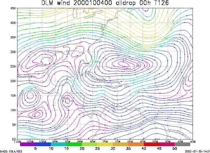
Figure 1. NCEP 850 - 200 hPa mean wind analysis for 04 October 2000 0000 UTC (Tropical Depression Keith).
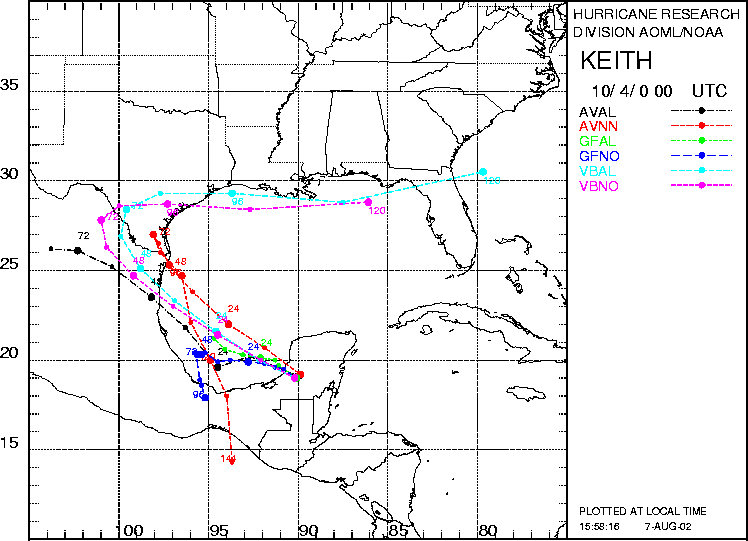
Figure 2. Track forecasts for the no dropwindsonde (NO or NN) and the all dropwindsonde (AL) runs for the AVN, GFDL, and VBAR models initialized on 04 October 2000 0000 UTC. The best track is shown in black.
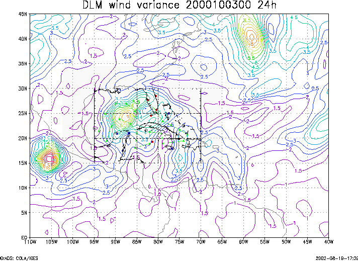
Figure 3. Ensemble perturbation variance at the nominal sampling time 04 October 2000 0000 UTC from the previous day NCEP ensemble forecast. The green circles represent the dropwindsonde locations.
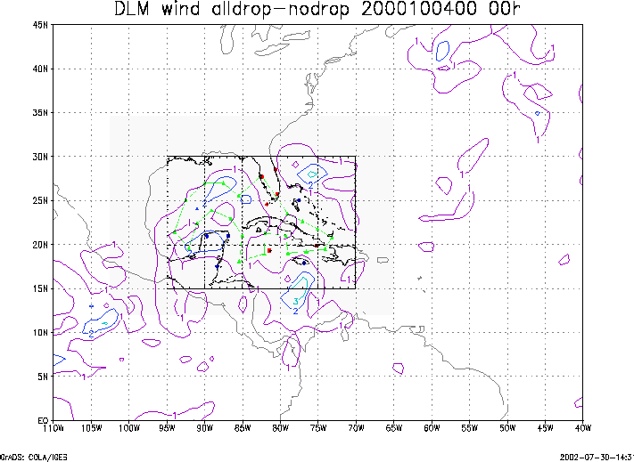
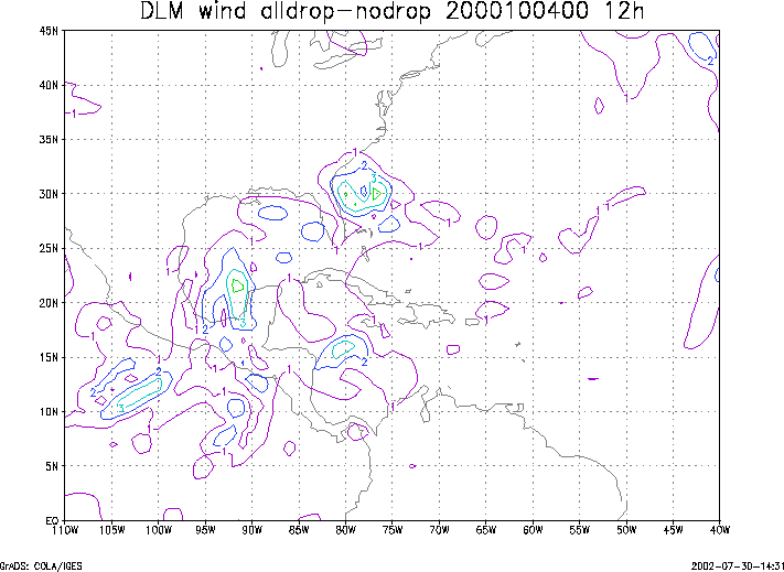
Figure 4. Initial condition differences in the 850 - 200 hPa mean wind between the no and all dropwindsonde cases for 04 October 2000 0000 UTC. The green circles represent the dropwindsonde locations.