Effects of Synoptic Surveillance on model forecasts for
13 September 2004 0000 UTC
Ivan.
Quicktime movie of AVN DLM wind model
forecast
Quicktime movie of DLM wind data
increment
| TRACK (km) | ||||||||||||||||||||||||||||||||||||||||||||||||||||||||||||||||||||||||||||||||||||||||||||||||||||||||||||||||||||||||||||||||||||||||||||||||||||||||||||||||||||||||||
| MODEL | 12 h | 24 h | 36 h | 48 h | 60 h | 72 h | 84 h | 96 h | 108 h | 120 h
|
| AVNN | 33 | 44 | 60 | 24 | 45 | 116 | 173 | 269 | 283 | 386
| AVNO | 24 | 73 | 102 | 78 | 45 | 98 | 135 | 215 | 186 | 223
| %IMP | 27% | -66% | -70% | -225% | 0% | 16% | 22% | 20% | 34% | 42%
|
| GFNO | 47 | 80 | 108 | 113 | 119 | 97 | 96 | 143 | 248 | 388
| GFDL | 43 | 94 | 117 | 110 | 97 | 69 | 35 | 67 | 115 | 232
| %IMP | 9% | -18% | -8% | 3% | 18% | 29% | 74% | 53% | 54% | 40%
|
| INTENSITY (kt)
| MODEL | 12 h | 24 h | 36 h | 48 h | 60 h | 72 h | 84 h | 96 h | 108 h | 120 h
|
| AVNN | -65 | -64 | -55 | -38 | -34 | -32 | 7 | 13 | 3 | -1
| AVNO | -69 | -62 | -45 | -39 | -34 | -34 | -9 | -1 | -2 | -4
| %IMP | -6% | 3% | 18% | -3% | 0% | -6% | -29% | 92% | 33% | -300%
|
| GFNO | -25 | -17 | -7 | -6 | -6 | -9 | 24 | 24 | 16 | 19
| GFDL | -7 | -7 | 0 | -12 | -7 | -8 | 16 | 12 | 17 | 16
| %IMP | 72% | 79% | 100% | -200% | -17% | 11% | 33% | 50% | -6% | 16%
|
| | ||||||||||
| 14/0100 UTC 21.7N 85.2W 15 n mi SW of Cabo San Antonio, Cuba 25.0 h into the forecast | ||||||||||||||||||||||||||||||||||||||||||||||||||||||||||||||||||||||||||||||||||||||||||
| MODEL | LAT | LON | TIME | ERROR | LOCATION
|
| AVNN | 21.85 | 85.00 | 23.0 | 26.5 | Near La Fe, Pinar del Rio, Cuba
| AVNO | 21.71 | 85.16 | 21.0 | 4.3 | La Fe, Pinar del Rio, Cuba
| %IMP | -100% | 84%
|
| GFNO | 21.84 | 86.31 | 29.0 | 115.6 | Offshore La Fe, Pinar del Rio, Cuba
| GFDL | 21.45 | 85.40 | 19.5 | 34.6 | Near La Fe, Pinar del Rio, Cuba
| %IMP | -63% | 70%
|
16/0650 UTC 30.2N 87.9W Near Pine Beach, AL 79.0 h into the forecast
| MODEL | LAT | LON | TIME | ERROR | LOCATION
|
| AVNN | 30.42 | 86.60 | 87.0 | 127.1 | Fort Walton Beach, FL
| AVNO | 30.42 | 86.68 | 80.0 | 119.5 | Fort Walton Beach, FL
| %IMP | 87% | 63%
|
| GFNO | 28.99 | 89.19 | 72.5 | 183.3 | South Pass, LA
| GFDL | 30.27 | 88.20 | 76.0 | 29.8 | Dauphin Island, AL
| %IMP | 54% | 84%
|
| | |||||||||||||
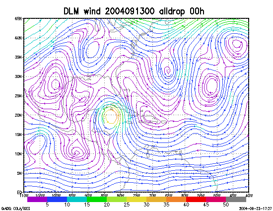
Figure 1. NCEP 850 - 200 hPa mean wind analysis for 13 September 2004 0000 UTC (Hurricane Ivan).
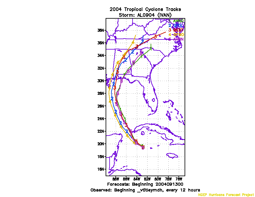
Figure 2. Track forecasts for the no dropwindsonde (NO or NN) and the all dropwindsonde (AL) runs for the AVN and GFDL models initialized on 13 September 2004 0000 UTC.
Figure 3. NCEP Global Ensemble Predction System track forecasts for all cyclones in the Atlantic basin initialized from 11 September 2004 0600 UTC to 12 September 2004 0000 UTC, showing the tracks of Hurricane Ivan.
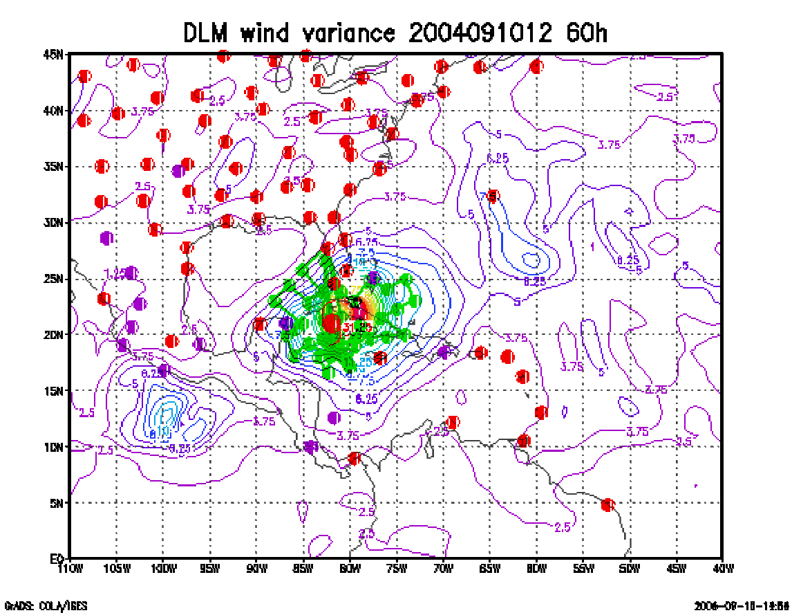
Figure 4. Ensemble perturbation variance at the nominal sampling time 13 September 2004 0000 UTC from the previous day NCEP ensemble forecast. The green circles represent the dropwindsonde locations.
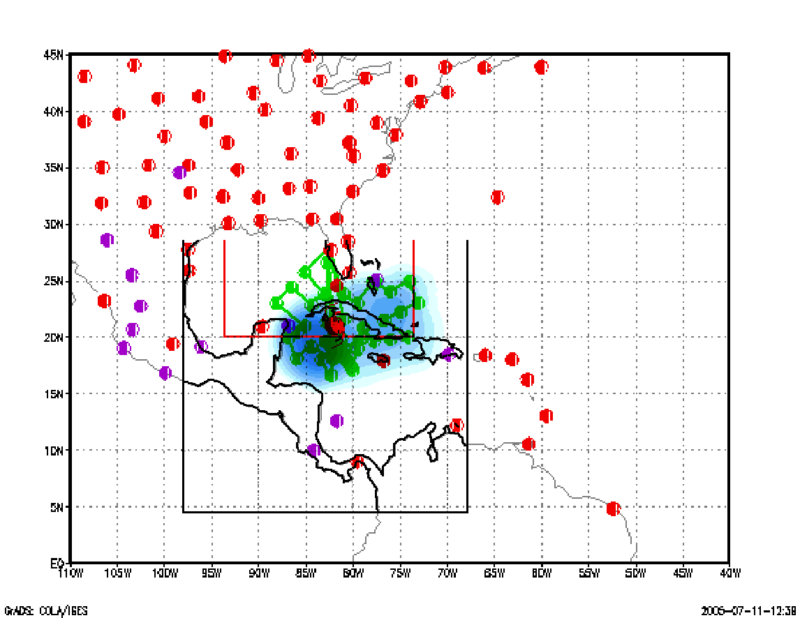
Figure 5. Variance explained within the verification region (large red circle) for observations taken at the sampling time 13 September 2004 0000 UTC from the Ensemble Transform Kalman Filter run from the previous day NCEP ensemble forecast. The green circles represent the dropwindsonde locations.
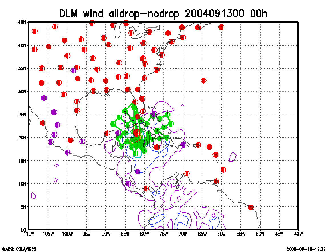
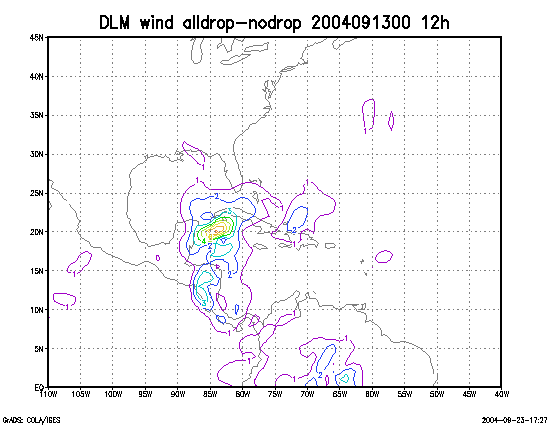
Figure 6. Initial condition differences in the 850 - 200 hPa mean wind between the no and all dropwindsonde cases for 13 September 2004 0000 UTC. The circles represent the dropwindsonde locations.