Effects of Synoptic Surveillance on model forecasts for
Tropical Storm Isidore.
Quicktime movie of DLM wind analyses
Quicktime movie of DLM wind data
initial
increments
| September 17, 2002 | 18 Z | |||
| September 18, 2002 | 00 Z | 06 Z | 12 Z | 18 Z |
| September 19, 2002 | 00 Z | 06 Z | 12 Z | 18 Z |
| September 20, 2002 | 00 Z | 06 Z | 12 Z | 18 Z |
| September 21, 2002 | 00 Z | 06 Z | 12 Z | 18 Z |
| September 22, 2002 | 00 Z | 06 Z | 12 Z | 18 Z |
| September 23, 2002 | 00 Z | 06 Z | 12 Z | 18 Z |
| September 24, 2002 | 00 Z | 06 Z | 12 Z | 18 Z |
| September 25, 2002 | 00 Z | 06 Z | 12 Z |
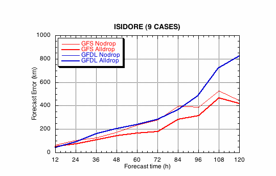
Figure 1a. Track forecast errors for the no dropwindsonde (NO or NN) and the all dropwindsonde (AL) runs for the GFS and GFDL models for the Hurricane Isidore synoptic surveillance mission.
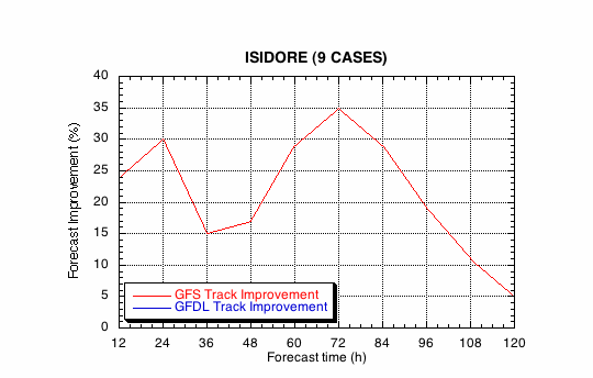
Figure 1b. Track forecast improvements for the GFS and GFDL models for the the Hurricane Isidore synoptic surveillance mission.
(a)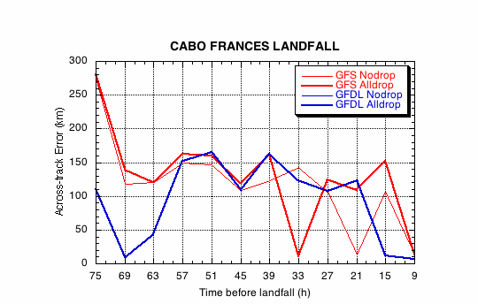
(b)
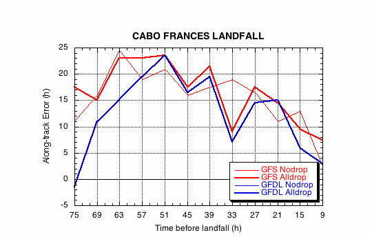
Figure 2. Forecast errors for the landfall of Hurricane Isidore at Cabo Frances, Cuba, in the (a) cross- and (b) along-track directions for the no dropwindsonde (NO or NN) and the all dropwindsonde (AL) runs for the GFS and GFDL models.
(a)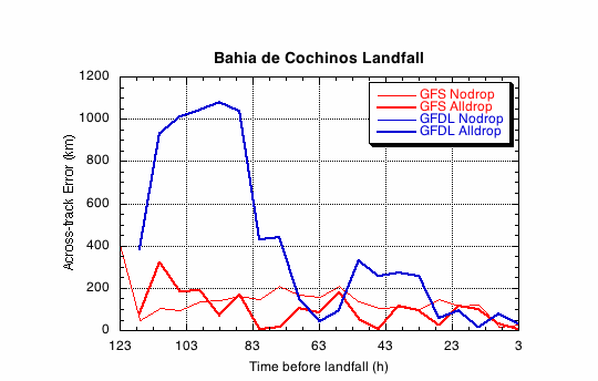
(b)
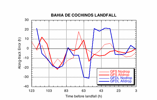
Figure 3. Forecast errors for the landfall of Hurricane Isidore at Puerto Telchac, Yucatan, Mexico, in the (a) cross- and (b) along-track directions for the no dropwindsonde (NO or NN) and the all dropwindsonde (AL) runs for the GFS and GFDL models.
(a)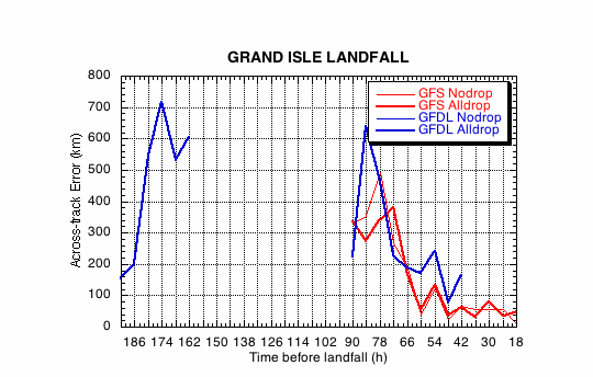
(b)
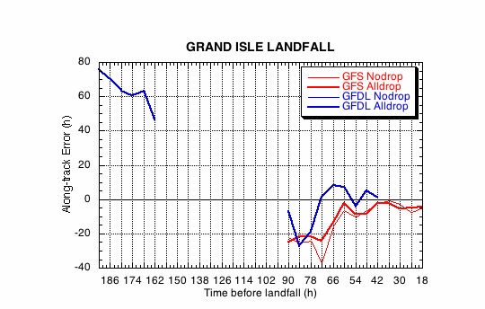
Figure 4. Forecast errors for the landfall of Hurricane Isidore just west of Grand Isle, LA, in the (a) cross- and (b) along-track directions for the no dropwindsonde (NO or NN) and the all dropwindsonde (AL) runs for the GFS and GFDL models.
Return to 2002 assessment page
Return to HRD home page