Effects of Synoptic Surveillance on model forecasts for
Tropical Storm Irene.
QuickTime movie of DLM wind analyses
QuickTime movie of DLM wind data initial
increments
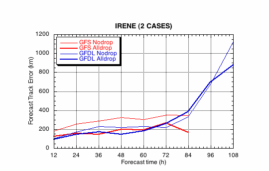
Figure 1a.
Track forecast errors for the no dropwindsonde (NO or NN) and
the all dropwindsonde (AL) runs for the GFS and GFDL models for
the Hurricane Irene synoptic surveillance mission.
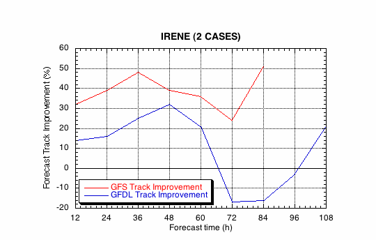
Figure 1b.
Track forecast improvements for the GFS and GFDL
models for the the Hurricane Irene synoptic surveillance mission.
(a)
(b)
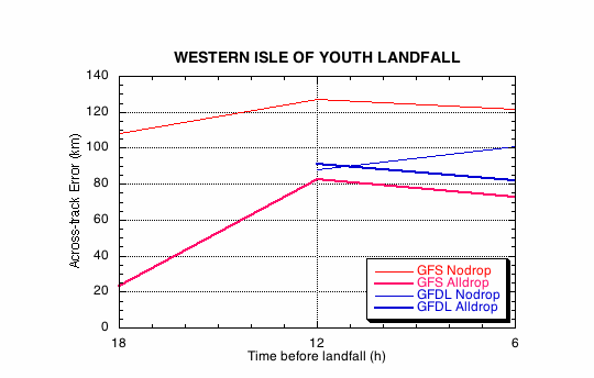
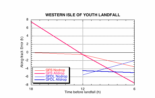
Figure 2.
Forecast errors for the landfall of Hurricane Irene at Western
Isle of Youth, Cuba, in the (a) cross- and (b) along-track directions for
the no dropwindsonde (NO or NN) and the all dropwindsonde (AL) runs for
the GFS and GFDL models.
(a)
(b)
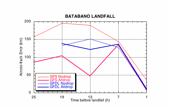
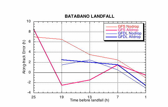
Figure 3.
Forecast errors for the landfall of Hurricane Irene at
Batabano, Cuba, in the (a) cross- and (b) along-track directions for
the no dropwindsonde (NO or NN) and the all dropwindsonde (AL) runs for
the GFS and GFDL models.
(a)
(b)
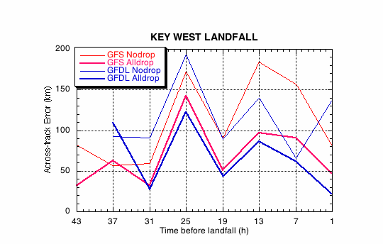
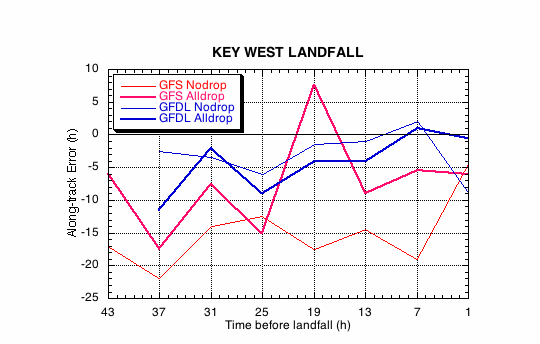
Figure 4.
Forecast errors for the landfall of Hurricane Irene at Key
West, FL, in the (a) cross- and (b) along-track directions for
the no dropwindsonde (NO or NN) and the all dropwindsonde (AL) runs for
the GFS and GFDL models.
(a)
(b)
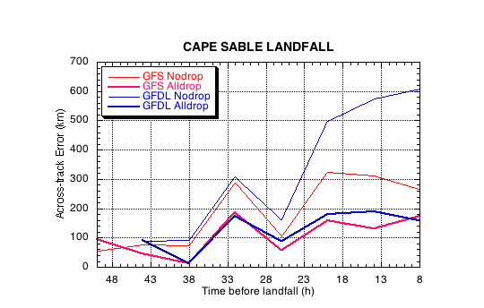
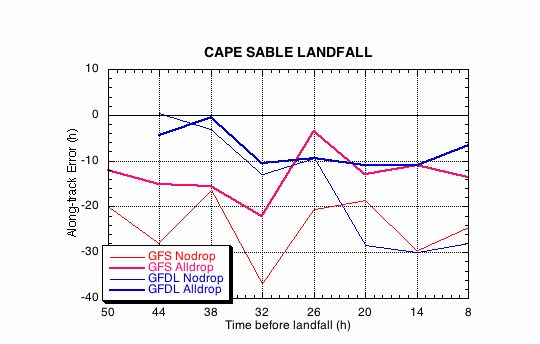
Figure 5.
Forecast errors for the landfall of Hurricane Irene at Cape
Sable, FL, in the (a) cross- and (b) along-track directions for
the no dropwindsonde (NO or NN) and the all dropwindsonde (AL) runs for
the GFS and GFDL models.
Return to 1999 assessment page
Return to HRD home page