
|
Introduction
|
|
Accurate modeling of tropical cyclone motion and intensity
requires both realistic numerical models and accurate
representation of meteorological fields through the depth of the
troposphere on a variety of scales.
Reynolds et al. (1994) and
Zhu et al. (1996) indicated that, in the midlatitudes,
most synoptic-scale errors in global numerical weather prediction
models are not due primarily to model deficiencies, and that
the largest forecast improvements are likely to be achieved by
decreasing the analysis error. They also found evidence of
significant model improvements in the tropics in the six years
leading to 1992, but suggest that both model and analysis
aimprovements are necessary for accurate forecasting there. To
improve the analysis of initial conditions for tropical cyclone
forecasting, between 1982 and 1996, the Hurricane Research
Division (HRD) of the National Oceanographic and Atmospheric
Administration (NOAA) conducted twenty "Synoptic-Flow"
experiments to gather observations in the data-sparse tropical
cyclone core and environment in the North Atlantic basin and
assess the impact of the observations on numerical guidance.
The experiments were typically conducted two to three days
before the projected landfall of a mature hurricane on the
coastline of the United States.
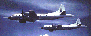 Using the NOAA WP-3D (P3) research aircraft and Omega-based
dropwindsondes (ODWs), vertical profiles of wind, temperature,
and humidity were gathered below about 400 hPa within 1000 km of
the tropical cyclone center. The dropwindsonde observations
produced significant improvements in the primary numerical
guidance for the Tropical Prediction Center (TPC) official track
forecasts (
Burpee et al. 1996). The size of the improvements
(16% - 30% for 12 - 60 h forecasts) were as large as those
obtained over the previous 20 - 25 years, and suggested that
operational dropwindsonde missions would be highly effective in
reducing forecast errors on a regular basis.
Using the NOAA WP-3D (P3) research aircraft and Omega-based
dropwindsondes (ODWs), vertical profiles of wind, temperature,
and humidity were gathered below about 400 hPa within 1000 km of
the tropical cyclone center. The dropwindsonde observations
produced significant improvements in the primary numerical
guidance for the Tropical Prediction Center (TPC) official track
forecasts (
Burpee et al. 1996). The size of the improvements
(16% - 30% for 12 - 60 h forecasts) were as large as those
obtained over the previous 20 - 25 years, and suggested that
operational dropwindsonde missions would be highly effective in
reducing forecast errors on a regular basis.
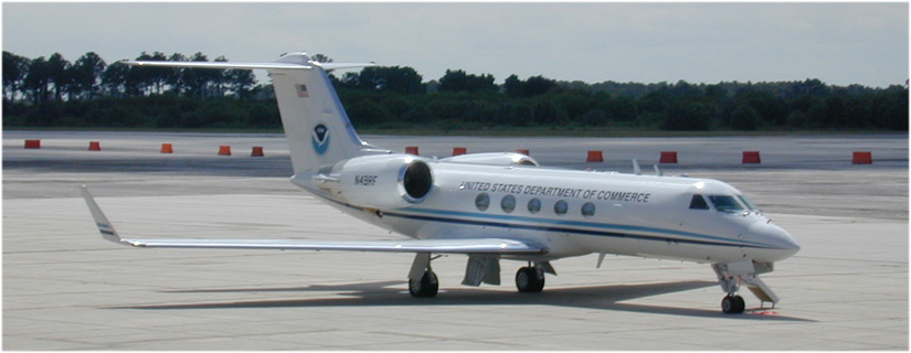 In 1996, NOAA procured a Gulfstream-IV jet aircraft (G-IV) to conduct
operational "Synoptic Surveillance" missions in the environments of
hurricanes threatening the coastline of the continental United States,
Puerto Rico, and the Virgin Islands. The G-IV is a low-wing, twin
turbofan, pressurized aircraft which can fly at an altitude of
13 716 m (45 000 ft) with a cruise speed of 226.5 ms-1 (440 kn),
with an operational range of 7412 km (4000 nm) (White et al.
1998). A new dropwindsonde, based on the Global Positioning
System (GPS), has been developed by the National Center for
Atmospheric Research (NCAR) to replace the ODW (
Franklin et al. 1997, Hock and Franklin 1998).
Approximately ten to fifteen missions are expected in a typical
year.
In 1996, NOAA procured a Gulfstream-IV jet aircraft (G-IV) to conduct
operational "Synoptic Surveillance" missions in the environments of
hurricanes threatening the coastline of the continental United States,
Puerto Rico, and the Virgin Islands. The G-IV is a low-wing, twin
turbofan, pressurized aircraft which can fly at an altitude of
13 716 m (45 000 ft) with a cruise speed of 226.5 ms-1 (440 kn),
with an operational range of 7412 km (4000 nm) (White et al.
1998). A new dropwindsonde, based on the Global Positioning
System (GPS), has been developed by the National Center for
Atmospheric Research (NCAR) to replace the ODW (
Franklin et al. 1997, Hock and Franklin 1998).
Approximately ten to fifteen missions are expected in a typical
year.
Return to Table of Contents
Return to HRD Main Page