Effects of Synoptic Surveillance on model forecasts for
20 September 1999 1800 UTC
HARVEY.
QuickTime movie of DLM wind model forecasts
QuickTime movie of DLM wind data increments
| TRACK (km) | ||||||||||||||||||||||||||||||||||||||||||||||||||||||||||||||||||||||||||||||||||||||||||||
| MODEL | 12 h | 24 h | 36 h | 48 h | 60 h | 72 h | 84 h | 96 h | 108 h | 120 h
|
| AVNN | 56. | 102.
| AVAL | 56. | 128.
| %IMP | 0% | -25%
|
| GFNO | 113. | 180.
| GFAL | 92. | 230.
| %IMP | 19% | -28%
| INTENSITY (kt)
| MODEL | 12 h | 24 h | 36 h | 48 h | 60 h | 72 h | 84 h | 96 h | 108 h | 120 h
|
| AVNN | -26. | -23.
| AVAL | -24. | -22.
| %IMP | 8% | 4%
|
| GFNO | -6. | 16.
| GFAL | -4. | 23.
| %IMP | 33% | -44%
|
| SHNO | 5. | 7.
| SHAL | 5. | 7.
| %IMP | 0% | 0%
|
| DSNO | 5. | -3.
| DSAL | 5. | -3.
| %IMP | 0% | 0%
| | ||||||||||
| 21/1700 UTC 25.9N 81.7W Near Everglades City, FL 23 h into the forecast | |||||||||||||||||||||||||||||||||||||||||
| MODEL | LAT | LON | TIME | ERROR | LOCATION
|
| AVNN | 26.78 | 82.17 | 22.0 | 108.4 | Puerto Real, PR
| AVAL | 26.87 | 82.15 | 20.0 | 116.7 | Playa de Ponce, PR
| %IMP | -200% | -8%
|
| GFNO | 27.32 | 82.55 | 19.5 | 178.9 | Esperanza, Vieques, PR
| GFAL | 27.49 | 82.68 | 18.5 | 201.7 | Las Mareas, PR
| %IMP | -29% | -13%
| | ||||
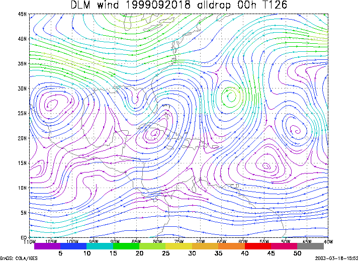
Figure 1. NCEP 850 - 200 hPa mean wind analysis for 20 September 1999 1800 UTC (Tropical Storm Harvey).
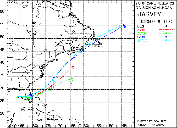
Figure 2. Track forecasts for the no dropwindsonde (NO or NN) and the all dropwindsonde (AL) runs for the AVN and GFDL models initialized on 20 September 1999 1800 UTC. The best track is shown in black.
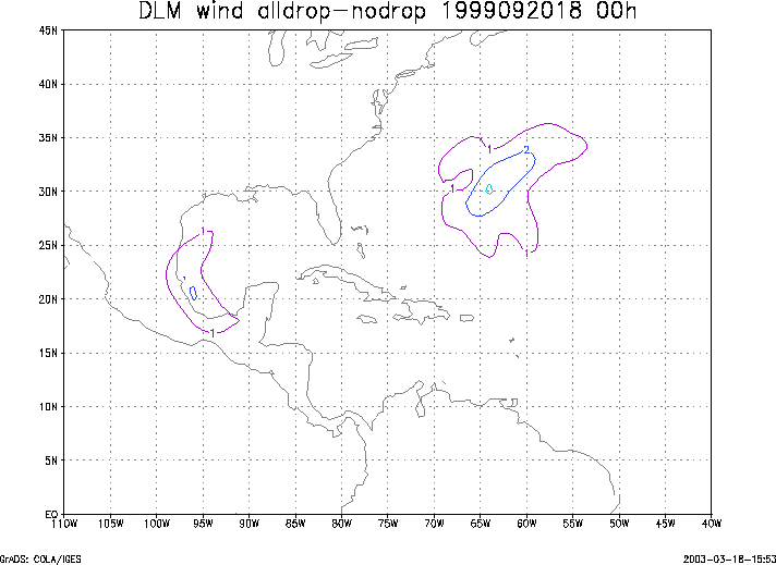
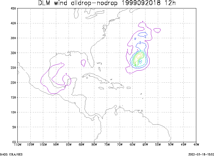
Figure 3. Initial condition differences in the 850 - 200 hPa mean wind between the no and all dropwindsonde cases for 20 September 1999 1800 UTC.