Effects of Synoptic Surveillance on model forecasts for
Tropical Storm Hanna.
Quicktime movie of DLM wind analyses
Quicktime movie of DLM wind data
initial
increments
| September 12, 2002 | 18 Z | |||
| September 13, 2002 | 00 Z | 06 Z | 12 Z |
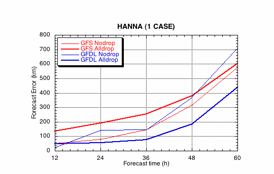
Figure 1a. Track forecast errors for the no dropwindsonde (NO or NN) and the all dropwindsonde (AL) runs for the GFS and GFDL models for the Tropical Storm Hanna synoptic surveillance mission.
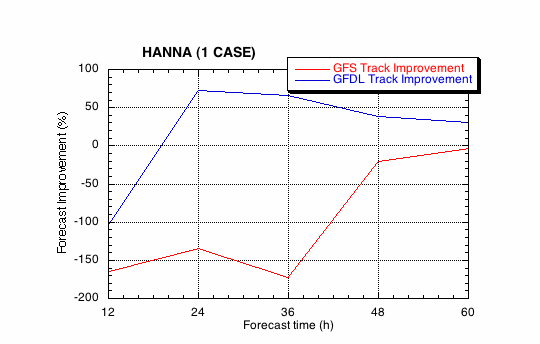
Figure 1b. Track forecast improvements for the GFS and GFDL models for the the Tropical Storm Hanna synoptic surveillance mission.
(a)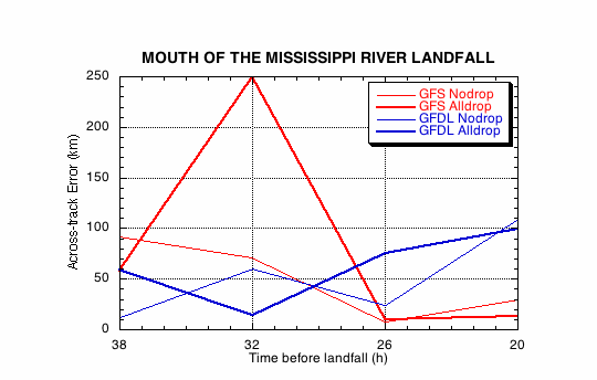
(b)
Figure 2. Forecast errors for the landfall of Tropical Storm Hanna at the mouth of the Mississippi Rover, LA, in the (a) cross- and (b) along-track directions for the no dropwindsonde (NO or NN) and the all dropwindsonde (AL) runs for the GFS and GFDL models.
(a)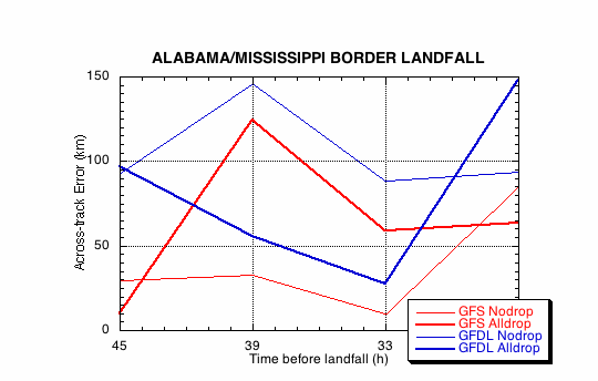
(b)
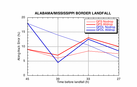
Figure 3. Forecast errors for the landfall of Tropical Storm Hanna at the Alabama/Mississippi border in the (a) cross- and (b) along-track directions for the no dropwindsonde (NO or NN) and the all dropwindsonde (AL) runs for the GFS and GFDL models.
Return to 2002 assessment page
Return to HRD home page