Effects of Synoptic Surveillance on model forecasts for
13 September 2002 1200 UTC
HANNA.
Quicktime movie of AVN DLM wind model
forecast
Quicktime movie of DLM wind data
increment
| TRACK (km) | ||||||||||||||||||||||||||||||||||||||||||||||||||||||||||||||||||||||||||||||||||||||||||||||||||||||||||||||||||||||||||||||||||
| MODEL | 12 h | 24 h | 36 h | 48 h | 60 h | 72 h | 84 h | 96 h | 108 h | 120 h
|
| AVNN | 83. | 111. | 289. | 512
| AVNO | 122. | 234. | 330. | 513
| %IMP | 47% | -111% | 15% | 0%
|
| GFNO | 106. | 104. | 286. | 671.
| GFAL | 150. | 142. | 320. | 625.
| %IMP | -42% | -37% | -12% | 7%
| INTENSITY (kt)
| MODEL | 12 h | 24 h | 36 h | 48 h | 60 h | 72 h | 84 h | 96 h | 108 h | 120 h
|
| AVNN | -24. | -24. | -8. | -8
| AVNO | -21. | -30. | -8. | -8
| %IMP | 13% | -24% | 0% | 0%
|
| GFNO | 4. | 3. | 40. | 20.
| GFDL | -8. | -7. | 34. | 20.
| %IMP | -100% | -133% | 15% | 0%
|
| SHNO | -3. | 2. | 38. | 44.
| SHIP | -2. | 5. | 41. | 43.
| %IMP | 50% | -150% | -8% | -2%
|
| DSNO | -3. | 2. | 13. | 9. |
| DSHP | -2. | 5. | 14. | 9.
| %IMP | 50% | -150% | -8% | 0%
| | |||||||||||
| 14/0800 UTC 29.1N 89.1W Mouth of the Mississippi River 20 h into the forecast | ||||||||||||||||||||||||||||||||||||||||||||||||||||||||||||||||||||||||
| MODEL | LAT | LON | TIME | ERROR | LOCATION
|
| AVNN | 29.10 | 89.40 | 14.5 | 29.1 | Pilottown, LA
| AVAL | 29.22 | 89.10 | 12.5 | 13.3 | Pilottown, LA
| %IMP | -36% | 54%
|
| GFNO
| GFAL | 29.25 | 90.11 | 13.0 | 99.4 | Cheniere Caminada, LA
| %IMP
|
|
14/1500 UTC 30.4N 88.4W Alabama/Mississippi border 27 h into the forecast
| MODEL | LAT | LON | TIME | ERROR | LOCATION
|
| AVNN | 30.05 | 89.19 | 19.5 | 85.2 | Near Bay St. Louis, MS
| AVAL | 30.37 | 89.06 | 17.0 | 63.3 | Gulfport, MS
| %IMP | -33% | 26%
|
| GFNO
| GFAL | 30.13 | 89.91 | 18.5 | 148.0 | New Orleans, LA
| %IMP
| | |||||||||
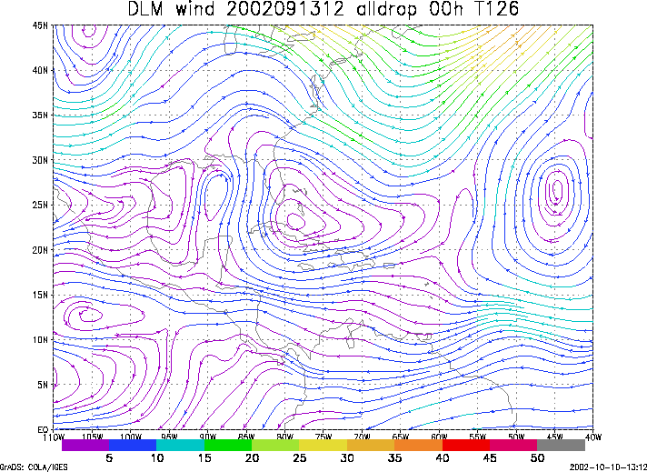
Figure 1. NCEP 850 - 200 hPa mean wind analysis for 13 September 2002 1200 UTC (Tropical Storm Hanna).
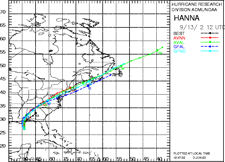
Figure 2. Track forecasts for the no dropwindsonde (NO or NN) and the all dropwindsonde (AL) runs for the AVN and GFDL models initialized on 13 September 2002 1200 UTC. The best track is shown in black.
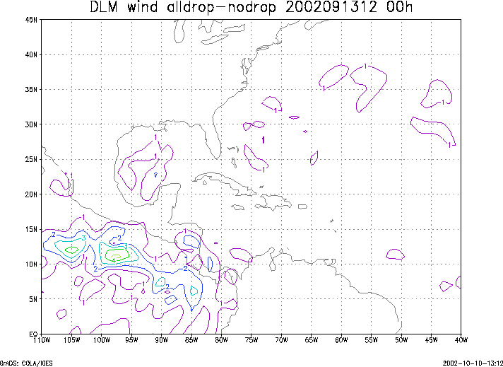
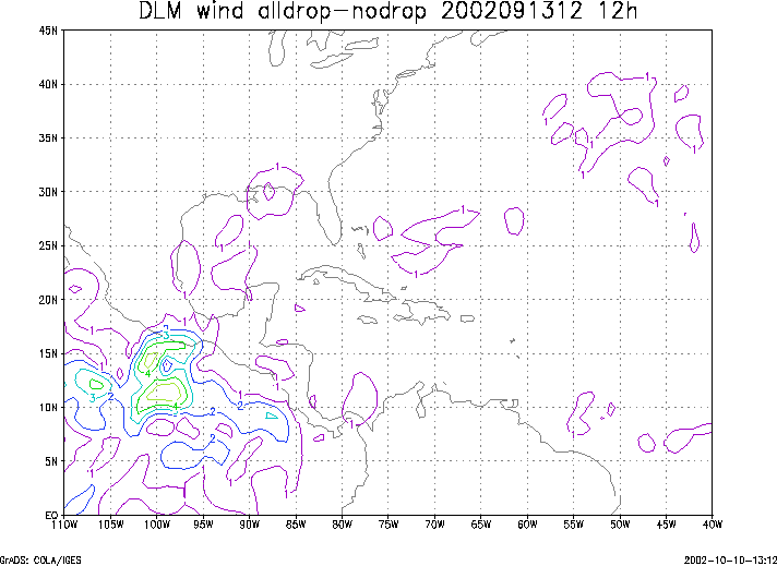
Figure 3. Initial condition differences in the 850 - 200 hPa mean wind between the no and all dropwindsonde cases for 13 September 2002 1200 UTC.