Effects of Synoptic Surveillance on model forecasts for
16 September 2000 0600 UTC
GORDON.
QuickTime movie of DLM wind model forecasts
QuickTime movie of DLM wind data increments
| TRACK (km) | ||||||||||||||||||||||||||||||||||||||||||||||||||||||||||||||||||||||||||||||||||||||||||||||||||||||||||||||||||||||||||||||||||||||||||||||||||||||||||||||||||||||||||||||||||||||||||||||||||||||||||||||||||||||||||||||||||
| MODEL | 12 h | 24 h | 36 h | 48 h | 60 h | 72 h | 84 h | 96 h | 108 h | 120 h
|
| AVNN | 52. | 134. | 217. | 294. | 400. | 571. | 639. | 535. | 9999. | 9999.
| AVAL | 74. | 171. | 226. | 333. | 478. | 705. | 851. | 815. | 9999. | 9999.
| %IMP | -42% | -28% | -4% | -13% | -20% | -30% | -33% | -52%
|
| GFNO | dissipated
| GFAL
| %IMP
|
| VBNO | 83. | 122. | 102. | 39. | 160. | 331. | 568. | 786. | 851. | 894.
| VBAL | 94. | 132. | 126. | 44. | 124. | 264. | 480. | 702. | 784. | 859.
| %IMP | -13% | -8% | -24% | -13% | 23% | 20% | 15% | 11% | 8% | 4%
| INTENSITY (kt)
| MODEL | 12 h | 24 h | 36 h | 48 h | 60 h | 72 h | 84 h | 96 h | 108 h | 120 h
|
| AVNN | -15. | -30. | -21. | 6. | 8. | -7. | -11. | 1. | 9999. | 9999.
| AVAL | -23. | -32. | -22. | -1. | 7. | -1. | -12. | -9. | 9999. | 9999.
| %IMP | -53% | -7% | -5% | 83% | 13% | 86% | -9% | -800%
|
| GFNO | dissipated
| GFAL
| %IMP
|
| SHNO | 1. | -5. | 1. | 25. | 38. | 41. | 32. | 28. | 19. | 17.
| SHAL | 1. | -5. | 1. | 25. | 38. | 40. | 31. | 27. | 18. | 16.
| %IMP | 0% | 0% | 0% | 0% | 0% | 2% | 3% | 4% | 5% | 6%
|
| DSNO | 1. | -5. | 1. | 25. | 38. | 41. | 32. | 28. | 19. | 17.
| DSAL | 1. | -5. | 1. | 25. | 38. | 40. | 31. | 27. | 18. | 16.
| %IMP | 0% | 0% | 0% | 0% | 0% | 2% | 3% | 4% | 5% | 6%
| | ||||||||||||||||||||||||||||
18/0300 UTC 29.3N 83.2W near Cedar Key, FL 45 h into the forecast
| MODEL | LAT | LON | TIME | ERROR | LOCATION
|
| AVNN | 30.25 | 85.60 | 56.0 | 254.4 | Lynn Haven, FL
| AVAL | 30.20 | 85.90 | 60.0 | 279.0 | Panama City Beach, FL
| %IMP | -36% | -10%
|
| GFNO | dissipated
| GFAL
| %IMP
|
| VBNO | 29.23 | 83.02 | 45.5 | 19.1 | Cedar Key, FL
| VBAL | 29.16 | 82.95 | 46.5 | 28.8 | Cedar Key, FL
| %IMP | -200% | -51%
| | |||||||||||||
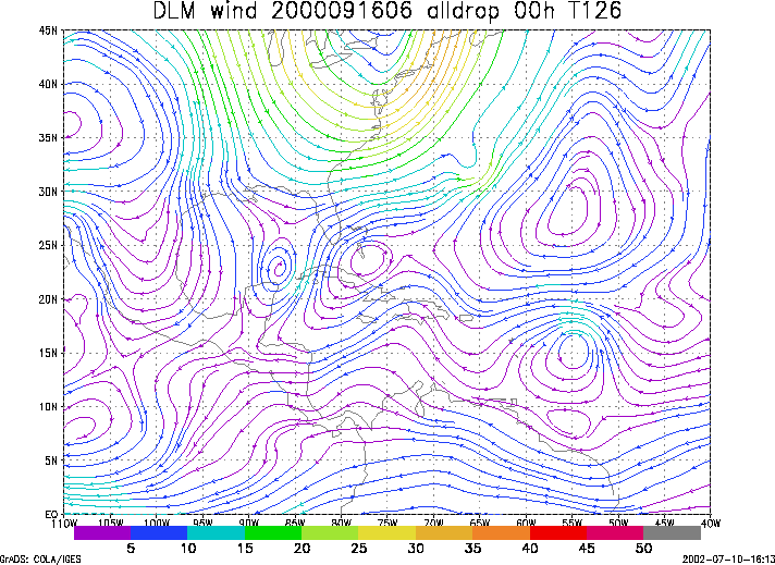
Figure 1. NCEP 850 - 200 hPa mean wind analysis for 16 September 2000 0600 UTC (Tropical Storm Gordon).
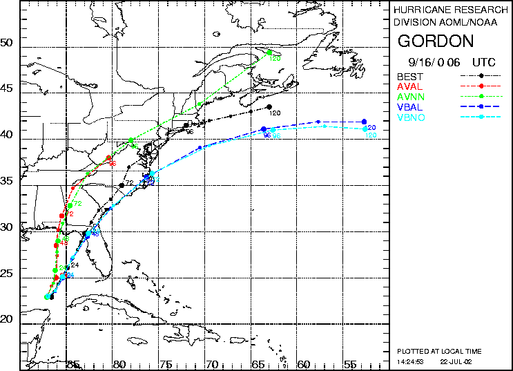
Figure 2. Track forecasts for the no dropwindsonde (NO or NN) and the all dropwindsonde (AL) runs for the AVN, GFDL, and VBAR models initialized on 16 September 2000 0600 UTC. The best track is shown in black.
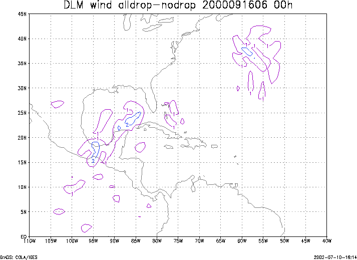
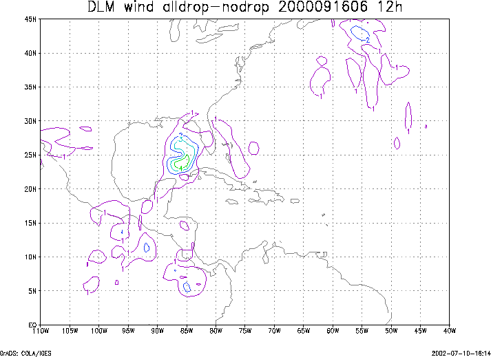
Figure 3. Initial condition differences in the 850 - 200 hPa mean wind between the no and all dropwindsonde cases for 16 September 2000 0600 UTC.