Effects of Synoptic Surveillance on model forecasts for
13 September 2000 1800 UTC
GORDON.


QuickTime movie of DLM wind model forecasts
QuickTime movie of DLM wind data increments


Landfall forecasts

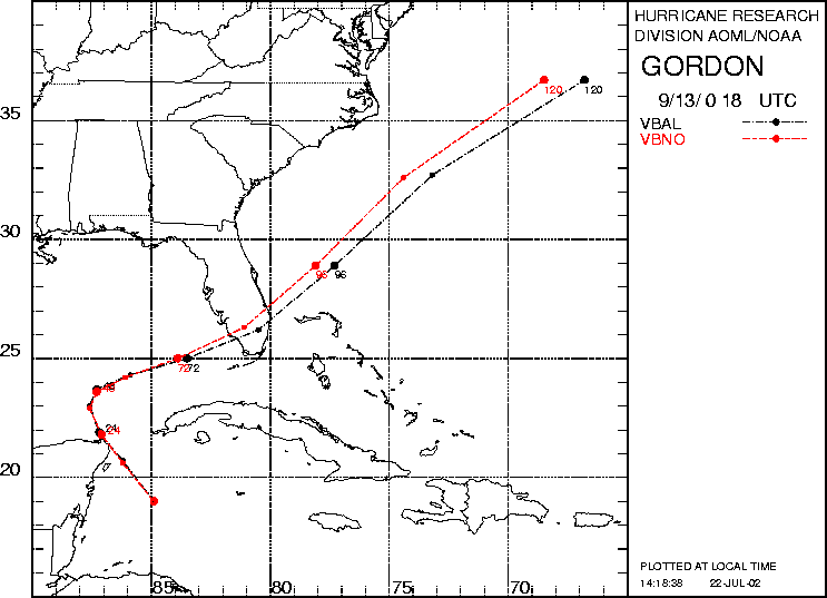
18/0300 UTC 29.3N 83.2W near Cedar Key, FL 105 h into the forecast
MODELLATLONTIMEERRORLOCATION
VBNO25.9481.7081.5401.4Marco, FL
VBAL25.7981.2781.0433.8Chevelier Bay,FL %IMP-1% -8%

Figure 1. NCEP 850 - 200 hPa mean wind analysis for 13 September 2000 1800 UTC (The tropical disturbance to become Hurricane Gordon).

Figure 2. Track forecasts for the no dropwindsonde (NO or NN) and the all dropwindsonde (AL) runs for the AVN, GFDL, and VBAR models initialized on 13 September 2000 1800 UTC. The best track is shown in black.

Figure 3. Initial condition differences in the 850 - 200 hPa mean wind between the no and all dropwindsonde cases for 13 September 2000 1800 UTC.

Figure 4. 12-h forecast differences in the 850 - 200 hPa mean wind between the no and all dropwindsonde cases for 13 September 2000 1800 UTC.