Effects of Synoptic Surveillance on model forecasts for
15 August 2003 1200 UTC
Erika.
Quicktime movie of GFS DLM wind model
forecast
Quicktime movie of DLM wind data
increment
| TRACK (km) | |||||||||||||||||||||||||||||||||||||||||||||||||||||||||||||||||||||||||||||||||||||||||||||||||||||||
| MODEL | 12 h | 24 h | 36 h | 48 h | 60 h | 72 h | 84 h | 96 h | 108 h | 120 h
|
| GFSN | 24 | 63
| GFSO | 10 | 82
| %IMP | 58% | -30%
|
| GFNO | 102 | 49 | 121
| GFDL | 87 | 82 | 171
| %IMP | 15% | -67% | -41%
| INTENSITY (kt)
| MODEL | 12 h | 24 h | 36 h | 48 h | 60 h | 72 h | 84 h | 96 h | 108 h | 120 h
|
| GFSN | -25 | -45
| GFSO | -25 | -43
| %IMP | 0% | 4%
| GFNO | -7 | -16 | 12
| GFDL | -6 | -29 | 9
| %IMP | 14% | -81% | 25%
|
| SHNO | -10 | -13 | 35
| SHIP | -2 | -12 | 37
| %IMP | 80% | 8% | -6%
|
| DSNO | -10 | -24 | 6
| DSHP | -2 | -12 | 9
| %IMP | 80% | 50% | -50%
| | ||||||||||
| 16/1030 UTC 25.3N 97.4W Boca San Rafael, Mexico 22.5 h into the forecast | ||||||||||||||||||||||||||||||||||||||||
| MODEL | LAT | LON | TIME | ERROR | LOCATION
|
| GFSN | No landfall forecast
| GFSO | 25.62 | 97.20 | 25.5 | 40.8 | Isla las Vaquitas, Tamaulipas, Mexico
| %IMP |
|
| GFNO | 25.62 | 97.25 | 23.5 | 38.6 | Guajardo, Tamaulipas, Mexico
| GFDL | 25.65 | 97.60 | 27.0 | 43.8 | Isla la Tuna, Tamaulipas, Mexico
| %IMP | -350% | 13%
| | ||||||||
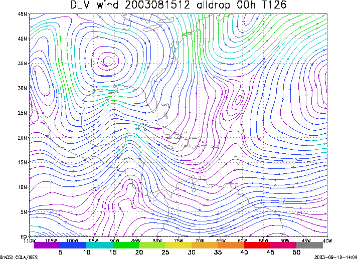
Figure 1. NCEP 850 - 200 hPa mean wind analysis for 15 August 2003 1200 UTC (Hurricane Erika).
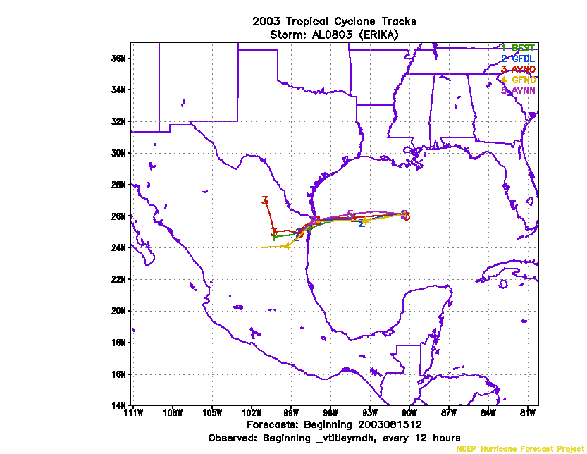
Figure 2. Track forecasts for the no dropwindsonde (NO or NN) and the all dropwindsonde (AL) runs for the GFS and GFDL models initialized on 15 August 2003 1200 UTC.
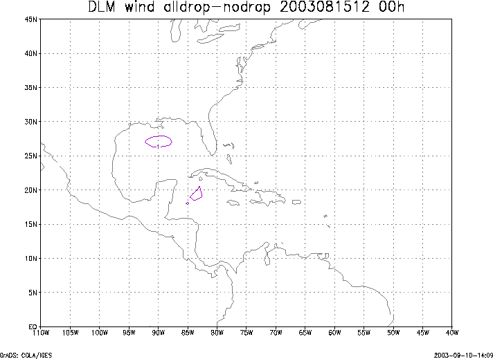
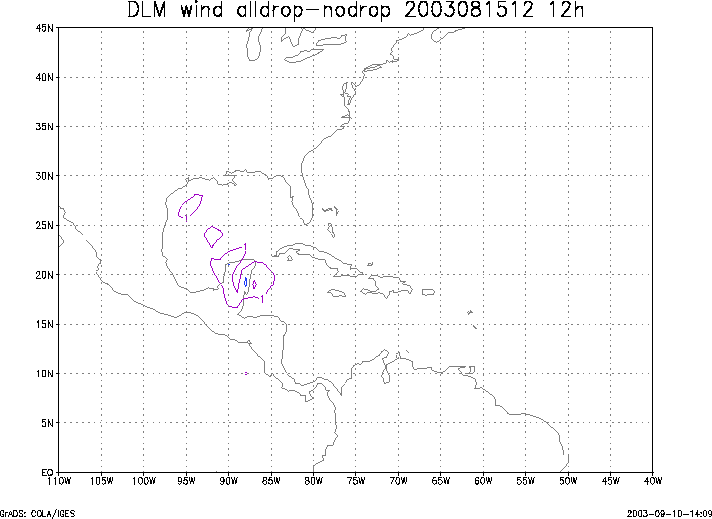
Figure 3. Initial condition differences in the 850 - 200 hPa mean wind between the no and all dropwindsonde cases for 15 August 2003 1200 UTC.