Effects of Synoptic Surveillance on model forecasts for
24 August 1999 1200 UTC
DENNIS.
QuickTime movie of DLM wind model forecasts
QuickTime movie of DLM wind data increments
| TRACK (km) | ||||||||||||||||||||||||||||||||||||||||||||||||||||||||||||||||||||||||||||||||||||||||||||||||||||||||||||||||||||||||||||||||||||||||||||||||||||||||||||||||||||||||||||||||||||||||||||||||||||||||||||||||||||||||||||||||||||||||||||
| MODEL | 12 h | 24 h | 36 h | 48 h | 60 h | 72 h | 84 h | 96 h | 108 h | 120 h
|
| AVNN | 65. | 165. | 249. | 306. | 294. | 295. | 337. | 349. | 412. | 469.
| AVAL | 47. | 42. | 69. | 101. | 74. | 93. | 83. | 163. | 201. | 215.
| %IMP | 28% | 75% | 72% | 67% | 75% | 68% | 75% | 53% | 51% | 54%
|
| GFNO | 108. | 225. | 317. | 335. | 362. | 316. | 368. | 437. | 552. | 688.
| GFAL | 38. | 128. | 163. | 173. | 232. | 266. | 308. | 309. | 346. | 421.
| %IMP | 65% | 43% | 49% | 48% | 36% | 16% | 16% | 29% | 37% | 39%
| INTENSITY (kt)
| MODEL | 12 h | 24 h | 36 h | 48 h | 60 h | 72 h | 84 h | 96 h | 108 h | 120 h
|
| AVNN | -16. | -23. | -38. | -40. | -41. | -37. | -42. | -53. | -59. | -57.
| AVAL | -13. | -19. | -36. | -37. | -38. | -35. | -41. | -55. | -55. | -50.
| %IMP | 19% | 17% | 5% | 8% | 7% | 5% | 2% | -4% | 7% | 12%
|
| GFNO | -11. | -5. | -9. | -9. | 4. | 19. | 23. | 20. | 16. | 21.
| GFAL | -1. | 9. | -6. | 9. | 9. | 22. | 28. | 24. | 27. | 16.
| %IMP | 91% | -80% | 33% | 0% | -125% | -16% | -22% | -20% | -69% | 24%
|
| SHNO | -3. | 1. | -5. | -2. | 4. | 9. | 6. | -8. | -13. | -12.
| SHAL | -3. | 1. | -6. | -4. | 2. | 6. | 3. | -11. | -14. | -13.
| %IMP | 0% | 0% | -20% | -100% | 50% | 33% | 50% | -38% | -8% | -8%
|
| DSNO | -3. | 1. | -5. | -2. | 4. | 9. | 6. | -8. | -13. | -12.
| DSAL | -3. | 1. | -6. | -4. | 2. | 6. | 3. | -11. | -14. | -13.
| %IMP | 0% | 0% | -20% | -100% | 50% | 33% | 50% | -38% | -8% | -8%
| | ||||||||||
| 28/0700UTC 26.6N 76.8W Abaco Islands, Bahamas 91 h into forecast | |||||||||||||||||||||||||||||||||||||||||||||||||||||||||||||||||||||||||||||||||
| MODEL | LAT | LON | TIME | ERROR | LOCATION
|
| AVNN | 22.14 | 71.10 | 4.0 | 760.4 | Lorimers, Grand Caicos, Turks and Caicos Islands
| AVAL | 25.36 | 76.31 | 71.0 | 146.2 | Alice Town, Eleuthera Island, Bahama Islands
| %IMP | 77% | 81%
|
| GFNO | 23.59 | 74.99 | 30.0 | 380.8 | Port Nelson, Rum Cay, Bahama Islands
| GFAL | 22.39 | 72.96 | 23.5 | 607.9 | Abraham's Bay, Mayaguana Island, Bahama Islands
| %IMP | -11% | -60%
|
|
|
04/2100UTC 34.8N 76.5W Cape Lookout National Seashore, NC 273 h into forecast
| MODEL | LAT | LON | TIME | ERROR | LOCATION
|
| AVNN | No landfall forecast
| AVAL | No landfall forecast
| %IMP
|
| GFNO | 35.18 | 75.73 | 118.0 | 81.8 | Fort Clark, NC
| GFAL | 32.98 | 79.47 | 117.5 | 340.5 | McClellanville, SC
| %IMP | 0% | -315%
| | |||||||||||||
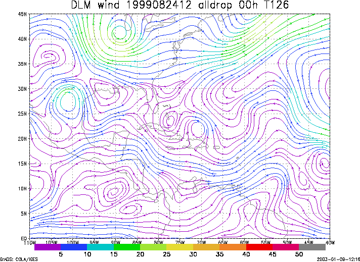
Figure 1. NCEP 850 - 200 hPa mean wind analysis for 24 August 1999 1200 UTC (Tropical Storm Dennis).
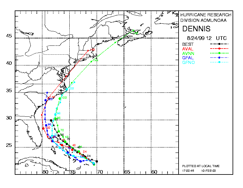
Figure 2. Track forecasts for the no dropwindsonde (NO or NN) and the all dropwindsonde (AL) runs for the AVN and GFDL models initialized on 24 August 1999 1200 UTC. The best track is shown in black.
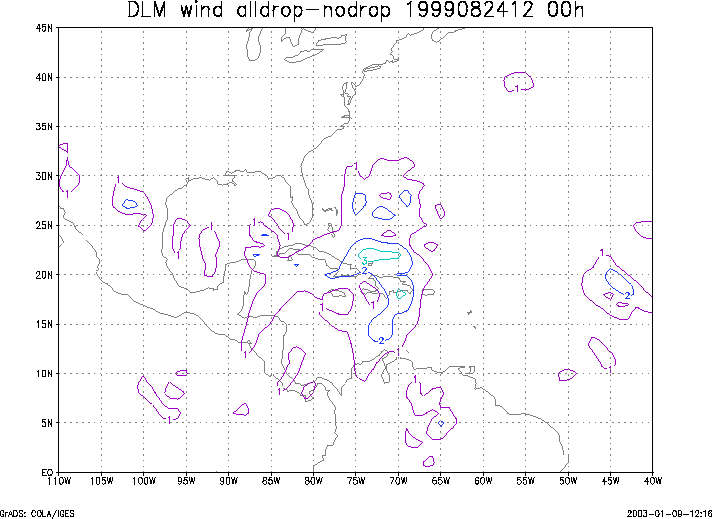
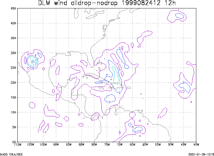
Figure 3. Initial condition differences in the 850 - 200 hPa mean wind between the no and all dropwindsonde cases for 24 August 1999 1200 UTC.