Effects of Synoptic Surveillance on model forecasts for
22 August 2000 1200 UTC
DEBBY.
QuickTime movie of DLM wind model forecasts
QuickTime movie of DLM wind data increments
| TRACK (km) | ||||||||||||||||||||||||||||||||||||||||||||||||||||||||||||||||||||||||||||||||||||||||||||||||||||||||||||||||||||||||||||||||||||||||||||||||
| MODEL | 12 h | 24 h | 36 h | 48 h | 60 h | 72 h | 84 h | 96 h | 108 h | 120 h
|
| AVNN | 39. | 105. | 43. | 193.
| AVAL | 126. | 237. | 166. | 100.
| %IMP | -223% | -126% | -286% | 48%
|
| GFNO | 39. | 73. | 246. | 477.
| GFAL | 31. | 63. | 236. | 472.
| %IMP | 21% | 14% | 4% | 1%
|
| VBNO | 167. | 296. | 481. | 691.
| VBAL | 164. | 286. | 471. | 670.
| %IMP | 2% | 3% | 2% | 3%
| INTENSITY (kt)
| MODEL | 12 h | 24 h | 36 h | 48 h | 60 h | 72 h | 84 h | 96 h | 108 h | 120 h
|
| AVNN | -32. | -30. | -15. | -4.
| AVAL | -23. | -29. | -10. | -7.
| %IMP | 28% | 3% | 33% | -75%
|
| GFNO | 16. | 37. | 46. | 66.
| GFAL | 22. | 32. | 62. | 78.
| %IMP | -38% | 14% | -35% | -18%
|
| SHNO | 2. | 8. | 30. | 43.
| SHAL | 2. | 7. | 28. | 41.
| %IMP | 0% | 13% | 7% | 5%
|
| DSNO | 2. | 8. | 30. | 43.
| DSAL | 2. | 7. | 28. | 41.
| %IMP | 0% | 13% | 7% | 5%
| | ||||||||||
| 22/1500 UTC 18.5N 64.4W near Virgin Gorda | 3 h into the forecast | ||||||||||||||||||||||||||||||||||||||||||||||||||||
| MODEL | LAT | LON | TIME | ERROR | LOCATION
|
| AVNN | 18.39 | 64.68 | 4.5 | 31.9 West End, Tortola, British Virgin Islands
| AVAL | 18.52 | 64.57 | 2.5 | 18.0 East End, Tortola, British Virgin Islands
| %IMP | 67% | 44%
|
| GFNO | 18.50 | 64.49 | 3.5 | 9.5 East End, Tortola, British Virgin Islands
| GFAL | 18.47 | 64.65 | 4.5 | 26.6 Rough Point, Tortola, British Virgin Islands
| %IMP | -200% | -180%
|
| VBNO | 18.44 | 64.57 | 7.5 | 19.1 East End, Tortola, British Virgin Islands
| VBAL | 18.54 | 64.54 | 7.5 | 15.4 East End, Tortola, British Virgin Islands
| %IMP | 0% | 19%
| | ||||||
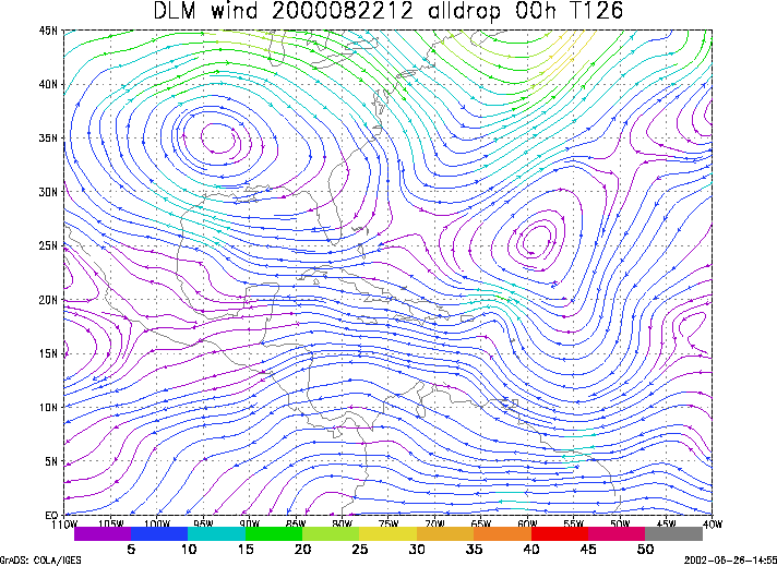
Figure 1. NCEP 850 - 200 hPa mean wind analysis for 22 August 2000 1200 UTC (Hurricane Debby).
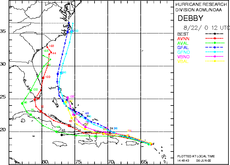
Figure 2. Track forecasts for the no dropwindsonde (NO or NN) and the all dropwindsonde (AL) runs for the AVN, GFDL, and VBAR models initialized on 22 August 2000 1200 UTC. The best track is shown in black.
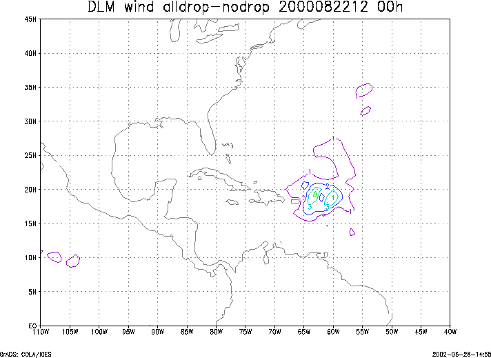
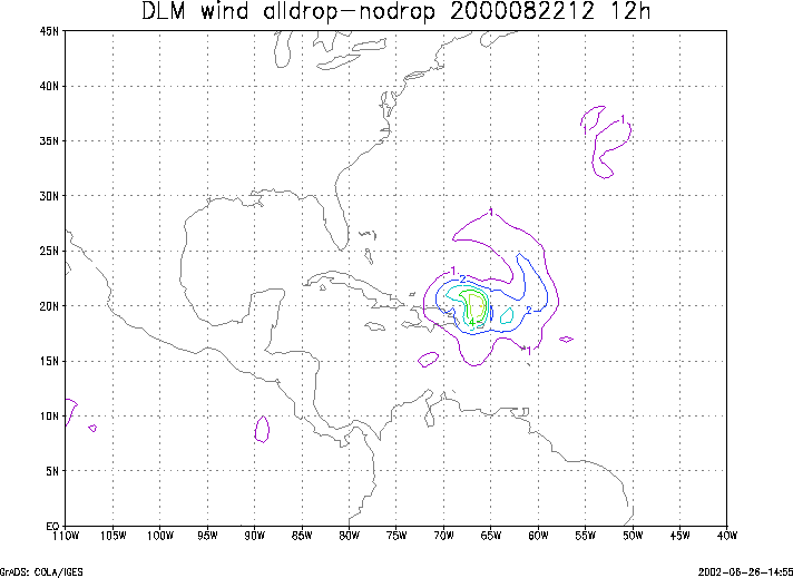
Figure 3. Initial condition differences in the 850 - 200 hPa mean wind between the no and all dropwindsonde cases for 22 August 2000 1200 UTC.