Effects of Synoptic Surveillance on model forecasts for
Hurricane Cindy.
| July 04, 2005 | 18 Z | |||
| July 05, 2005 | 00 Z | 06 Z | 12 Z |
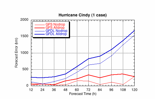
Fig 1a. Track forecast errors for the no dropwindsonde (NO or NN) and the all dropwindsonde (AL) runs for the GFS and GFDL models for the Tropical Storm Cindy synoptic surveillance missions.
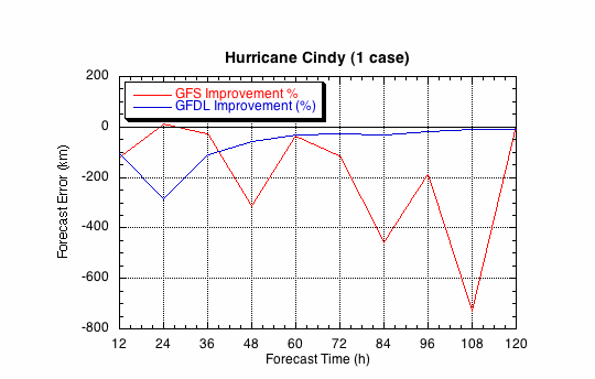
Fig 1b. Track forecast improvements for the GFS and GFDL models for the Tropical Storm Cindy synoptic surveillance missions.
(a)
(b)
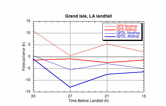
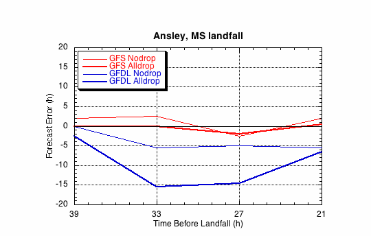
Fig 2. Forecast errors for the landfall of Tropical Storm Cindy at Grand Isle, LA, in the (a) cross- and (b)along-track directions for the no dropsonde (NO or NN) and the all dropwindsonde (AL) runs for the GFS and GFDL models.
(a)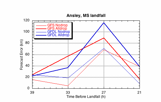
(b)