Effects of Synoptic Surveillance on model forecasts for
Hurricane Charley.
Quicktime movie of DLM wind analyses
Quicktime movie of DLM wind data
initial
increments
| August 11, 2004 | 18 Z | ||||
| August 12, 2004 | 00 Z | 06 Z | 12 Z | 18 Z | |
| August 13, 2004 | 00 Z |
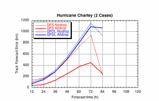
Figure 1a. Track forecast errors for the no dropwindsonde (NO or NN) and the all dropwindsonde (AL) runs for the GFS and GFDL models for the Hurricane Charley synoptic surveillance missions.
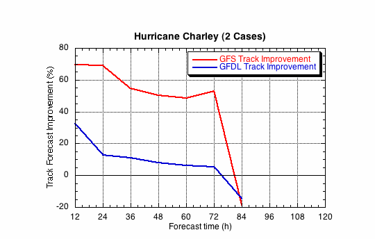
Figure 1b. Track forecast improvements for the GFS and GFDL models for the the Hurricane Charley synoptic surveillance mission.
(a)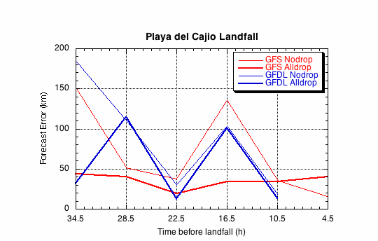
(b)
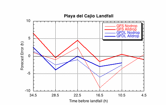
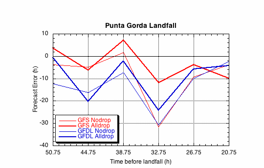
Figure 2. Forecast errors for the landfall of Hurricane Charley Playa del Cajio, Pinar del Rio, Cuba, in the (a) cross- and (b) along-track directions for the no dropwindsonde (NO or NN) and the all dropwindsonde (AL) runs for the GFS and GFDL models.
(a)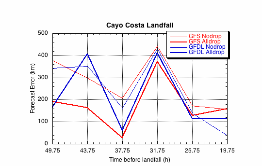
(b)
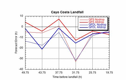
Figure 3. Forecast errors for the landfall of Hurricane Charley at Cayo Costa, FL, in the (a) cross- and (b) along-track directions for the no dropwindsonde (NO or NN) and the all dropwindsonde (AL) runs for the GFS and GFDL models.
(a)
(b)