Effects of Synoptic Surveillance on model forecasts for
11 August 2004 1800 UTC
Charley.
Quicktime movie of AVN DLM wind model
forecast
Quicktime movie of DLM wind data
increment
| TRACK (km) | ||||||||||||||||||||||||||||||||||||||||||||||||||||||||||||||||||||||||||||||||||||||||||||||||||||||||||||||||||||||||||||||||||||
| MODEL | 12 h | 24 h | 36 h | 48 h | 60 h | 72 h | 84 h | 96 h | 108 h | 120 h
|
| AVNN | 169 | 166 | 154 | 216 | 278 | 381 | 315
| AVNO | 123 | 160 | 212 | 356 | 548 | 670 | 555
| %IMP | 27% | 4% | -38% | -45% | -97% | -76% | -76%
|
| GFNO | 108 | 123 | 199 | 230 | 326 | 399 | 577
| GFDL | 46 | 56 | 90 | 107 | 120 | 172 | 325
| %IMP | 57% | 54% | 55% | 53% 61% | 57% | 44%
|
| INTENSITY (kt)
| MODEL | 12 h | 24 h | 36 h | 48 h | 60 h | 72 h | 84 h | 96 h | 108 h | 120 h
|
| AVNN | -47 | -60 | -78 | -93 | -41 | -35 | -12
| AVNO | -46 | -55 | -71 | -94 | -40 | -28 | -12
| %IMP | 2% | 8% | 9% | -1% | 2% | 20% | 0%
|
| GFNO | 0 | 4 | -3 | -13 | 33 | 24 | 9
| GFDL | 6 | 6 | 3 | -16 | 24 | -7 | 14
| %IMP | und% | -50% | 0% | -23% | 17% | 71% | -56%
| | ||||||||||
| 13/0430 UTC 22.7N 82.6W Near Playa del Cajio, Cuba 34.5 h into the forecast | ||||||||||||||||||||||||||||||||||||||||||||||||||||||||||||||||||||||||||||||||||||||||||||||||||||||||||||||||||||||||||||||||||||||||||||||||||||||||||||||||||||||||||||||||||||||||||||||||||||||||||||||||||||||||||||||||||||||||
| MODEL | LAT | LON | TIME | ERROR | LOCATION
|
| AVNN | 22.18 | 83.96 | 33.5 | 151.1 | Sabaia, Pinar del Rio, Cuba
| AVNO | 22.58 | 83.02 | 28.0 | 44.1 | Los Palacios, Pinar del Rio, Cuba
| %IMP | -550% | 71%
|
| GFNO | 21.91 | 84.18 | 33.0 | 184.6 | La Fe, Pinar del Rio, Cuba
| GFDL | 22.61 | 82.89 | 32.0 | 31.4 | San Cristobal, Pinal del Rio, Cuba
| %IMP | -67% | 83%
|
|
13/1945 UTC 26.6N 82.2W Near Cayo Costa, FL 49.75 h into the forecast
| MODEL | LAT | LON | TIME | ERROR | LOCATION
|
| AVNN | 29.80 | 83.50 | 54.5 | 377.6 | Fish Creek, FL
| AVNO | 28.23 | 82.87 | 45.5 | 192.8 | New Port Richey, FL
| %IMP | 11% | 2%
| GFNO | 29.53 | 83.33 | 63.0 | 343.9 | Horseshoe Beach, FL
| GFDL | 28.03 | 82.68 | 51.5 | 165.8 | Clearwater, FL
| %IMP | 87% | -56%
|
13/2045 UTC 26.9N 82.1W Near Punta Gorda, FL 50.75 h into the forecast
| MODEL | LAT | LON | TIME | ERROR | LOCATION
| AVNN | 29.80 | 83.50 | 54.5 | 350.1 | Fish Creek, FL
| AVNO | 28.87 | 82.72 | 47.0 | 227.2 | Crystal River, FL
| %IMP | 0% | 35%
|
| GFNO | 29.53 | 83.33 | 63.0 | 316.0 | Horseshoe Beach, FL
| GFDL | 28.03 | 82.68 | 51.5 | 137.9 | Clearwater, FL
| %IMP | 96% | 56%
|
14/1400 UTC 33.0N 79.4W Near Cape Romain, SC 68.0 h into the forecast
| MODEL | LAT | LON | TIME | ERROR | LOCATION
|
| AVNN | No landfall forecast
| AVNO | No landfall forecast
| %IMP | |
|
| GFNO | No landfall forecast
| GFDL | 32.35 | 80.80 | 63.5 | 149.5 | Hilton Head Island, SC
| %IMP | |
|
14/1600 UTC 33.8N 78.7W Near North Myrtle Beach, SC 70.0 h into the forecast
| MODEL | LAT | LON | TIME | ERROR | LOCATION
|
| AVNN | No landfall forecast
| AVNO | No landfall forecast
| %IMP | |
|
| GFNO | No landfall forecast
| GFDL | 32.35 | 80.80 | 63.5 | 253.3 | Hilton Head Island, SC
| %IMP | |
| | ||||||||||||||||||||||||||||||||||||||||||||||||||||||||||||||||
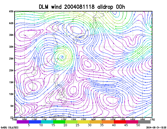
Figure 1. NCEP 850 - 200 hPa mean wind analysis for 11 August 2004 1800 UTC (Hurricane Charley).
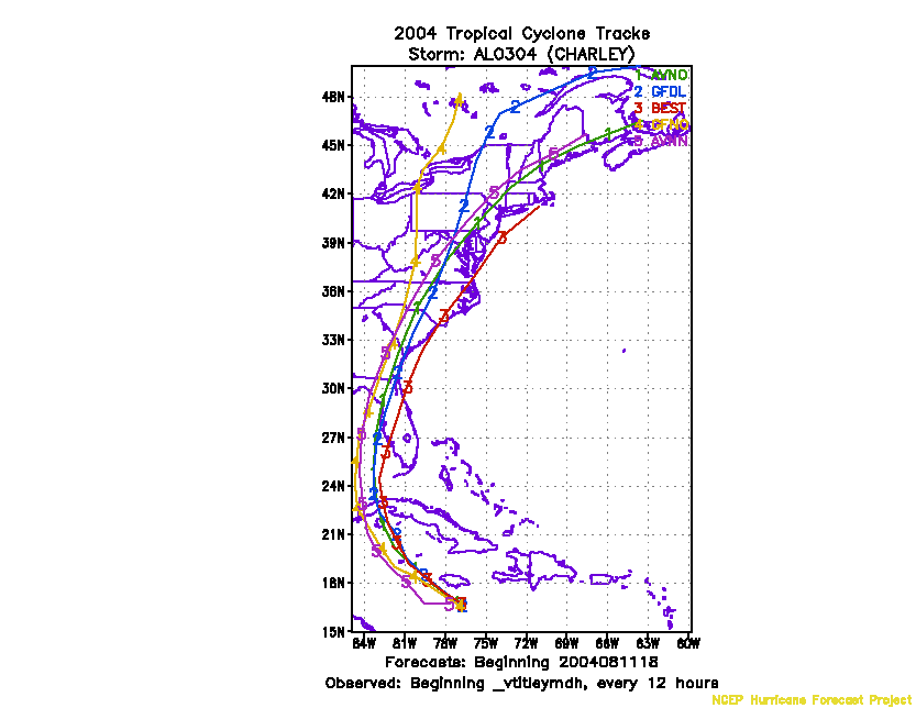
Figure 2. Track forecasts for the no dropwindsonde (NO or NN) and the all dropwindsonde (AL) runs for the AVN and GFDL models initialized on 11 August 2004 1800 UTC.
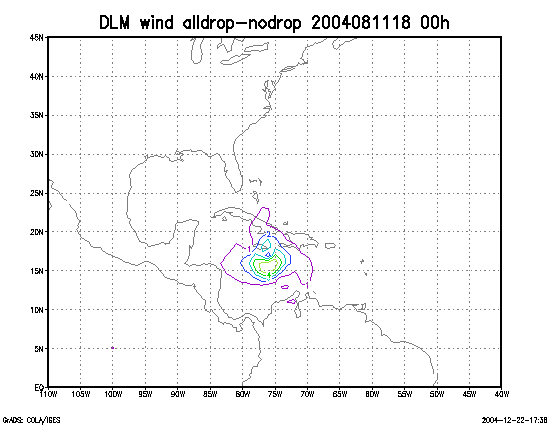
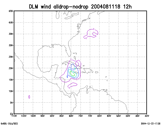
Figure 3. Initial condition differences in the 850 - 200 hPa mean wind between the no and all dropwindsonde cases for 11 August 2004 1800 UTC.