Effects of Synoptic Surveillance on model forecasts for
10 June 2005 0600 UTC
Arlene.
Quicktime movie of AVN DLM wind model
forecast
Quicktime movie of DLM wind data increment
| TRACK (km) | |||||||||||||||||||||||||||||||||||||||||||||||||||||||||||||||||||||||||||||||||||||||||||||||||||||||||||||||||||||||||||||||||||||||||||||||||||||||||||||||||||||||||
| MODEL | 12 h | 24 h | 36 h | 48 h | 60 h | 72 h | 84 h | 96 h | 108 h | 120 h
|
| AVNN 116 | 158 | 185 | 240 | 411 | 520 | 411 | | |
| AVNO | 101 | 78 | 56 | 206 | 560 | 899 | 1097 | | |
| %IMP | 13% | 51% | 70% | 14% | -36% | -73% | -167% | | |
|
| GFNO | 123 | 136 | 156 | 223 | 269 | 242 | 88 | 111 | |
| GFDL | 67 | 45 | 86 | 135 | 151 | 131 | 140 | 155 | |
| %IMP | 46% | 67% | 45% | 39% | 44% | 46% | -59% | -40% | |
|
| INTENSITY (kt)
| MODEL | 12 h | 24 h | 36 h | 48 h | 60 h | 72 h | 84 h | 96 h | 108 h | 120 h
|
| AVNN | -23 | -33 | -28 | -6 | -11 | -11 | -12 | | |
| AVNO | -23 | -30 | -28 | -13 | -9 | -9 | -12 | | |
| %IMP | 0% | 9% | 6% | -117% | 18% | 18% | 0% | | |
|
| GFNO | -18 | -16 | -11 | 0 | 3 | 3 | 21 | 45 | |
| GFDL | -3 | -16 | -13 | -1 | -1 | -3 | 24 | 27 | |
| %IMP | 83% | 0% | -18% | und% | 67% | 0% | 14% | 40% | |
|
| | ||||||||||
| 10/0800 UTC 21.8N 84.5W Near Cabo Corrientes, western Cuba 2.0 h into the forecast | ||||||||||||||||||||||||||||||||||||||||||||||||||||||||||||||||||||||||||||||||||||||||||
| MODEL | LAT | LON | TIME | ERROR | LOCATION
|
| AVNN | 21.92 | 84.72 | 2.0 | 26.3 | Near La Fe, Pinar del Rio, Cuba
| AVNO | No landfall forecast
| %IMP | |
|
| GFNO | 22.04 | 84.37 | 4.5 | 29.8 | La Fe, Pinar del Rio, Cuba
| GFDL | 22.43 | 84.34 | 4.5 | 71.9 | La Fe, Pinar del Rio, Cuba
| %IMP | 0% | -141%
|
|
11/1900 UTC 30.3N 87.5W Near and just west of Pensacola 37.0 h into the forecast
| MODEL | LAT | LON | TIME | ERROR | LOCATION
|
| AVNN | 29.77 | 88.86 | 42.0 | 143.4 | Chandeleur Islands, LA
| AVNO | 30.24 | 87.88 | 40.0 | 37.1 | Gulf Shores, AL
| %IMP | 60% | 74%
|
| GFNO | 30.08 | 89.20 | 40.0 | 165.1 | Gulfside, MS
| GFDL | 30.38 | 88.57 | 37.5 | 103.0 | Pascagoula, MS
| %IMP | 83% | 38%
| | |||||||||||||||||
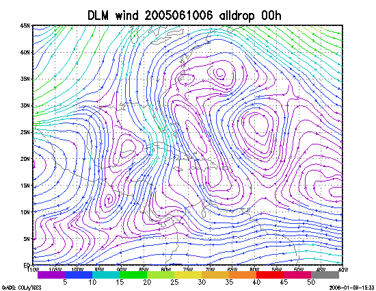
Figure 1. NCEP 850 - 200 hPa mean wind analysis for 10 June 2005 0600 UTC (Tropical Storm Arlene).
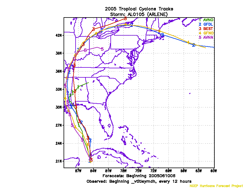
Figure 2. Track forecasts for the no dropwindsonde (NO or NN) and the all dropwindsonde (AL) runs for the AVN and GFDL models initialized on 10 June 2005 0600 UTC.
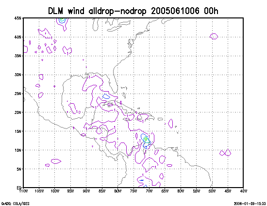
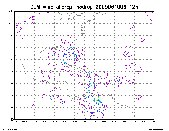
Figure 3. Initial condition differences in the 850 - 200 hPa mean wind between the no and all dropwindsonde cases for 10 June 2005 0600 UTC.