 |
 |
| Aircraft Commander | Justin Kibby |
| Co-pilot | Nate Kahn |
| Co-pilot | Adam Abitol |
| navigator | Brian Richards |
| flight engineer | Paul Darby |
| flight engineer | Chris Lalonde |
| Flight Director | Ian Sears |
| Radar Technician | Bobby Peek |
| Dropsonde Operator | Steve Paul |
| Dropsonde Operator | Todd Richards |
| LPS | Rob Rogers | HRD |
| Radar | Andy Hazelton | HRD |
| Dropsonde | Kathryn Sellwood | HRD |
| AXBT/CP/CTD | Benjamin Jaimes de la Cruz | UMiam/iRSMAS |
| Radar | HRD |
Mission Plan :
|
|
|
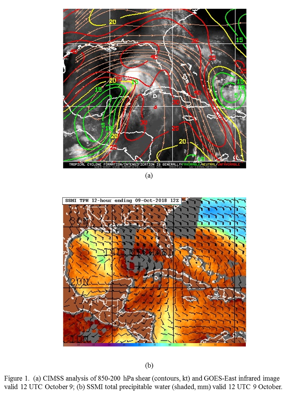
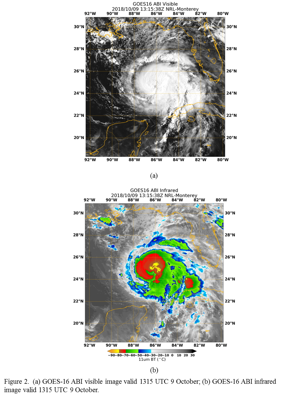
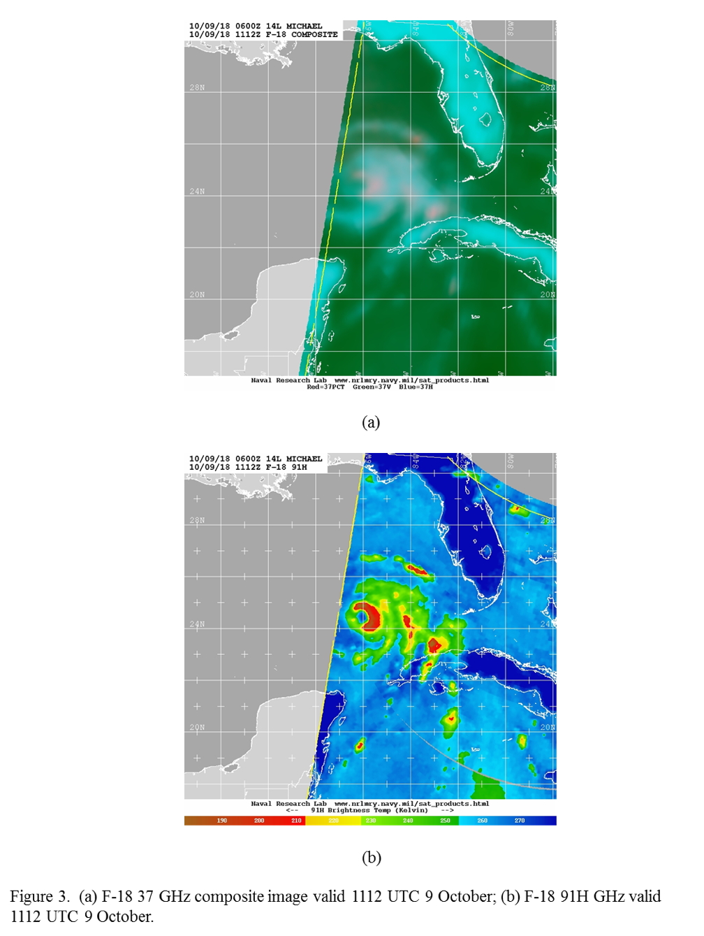
Conduct EMC-tasked TDR mission into Hurricane Michael, an 80-kt hurricane in the southeastern Gulf of Mexico. Michael is experiencing some westerly shear (likely moderate, though there is some uncertainty in the shear analysis, with CIMSS indicating a sharp shear gradient and peak values > 40 kt north of the center and SHIPS diagnosing ~15 kt), and moist low- and middle levels (Fig. 1). Michael is currently steady-state, though it has strengthened 50 kt in the ~36 h up to the time of takeoff. The large eye has not cleared out yet and the coldest cloud tops are in the northeast quadrant (Fig. 2). The heaviest rainfall revealed by 37 GHz microwave imagery is on the east side, though there are indications that precipitation surrounds most of the storm (Fig. 3). Significant ice scattering is on the east (downshear) side of the storm, and there is pronounced banding features at larger radii further east. Repeated convective bursts that are evident in the eyewall (Fig. 4). These are developing downshear and wrapping around the upshear side.
 |
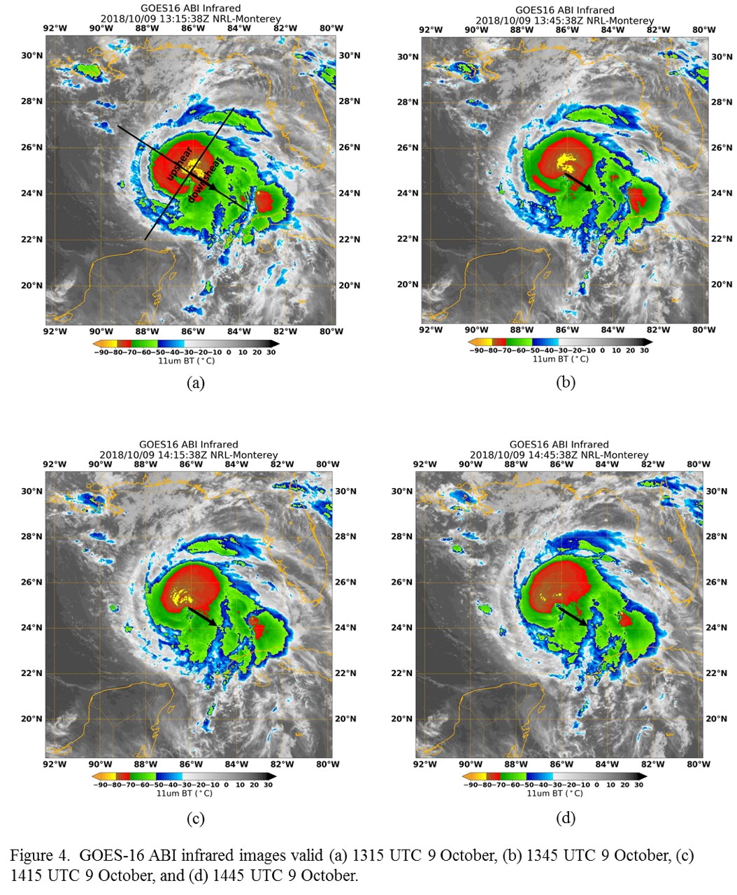 |
The plan calls for a rotated Figure-4, with an IP on the north side and an end on the southeast side, with 105 nm leg lengths. Dropsondes are planned at the end- and midpoints, as well as at the radius of maximum winds (RMW) and the center. AXBTs will be dropped in combination with the sondes at all end and midpoints. AXCPs will be dropped outside the RMW at all radials except the south and west sides. AXCTDs will be dropped on the first and third center pass. If an opportunity arises, fly a convective burst module after the pattern has completed. This would be on the downshear side, with the intent of sampling a convective feature as it is initiated downshear and wraps upshear, similar to that seen in Fig. 4. Flight altitude is 8000 ft pressure altitude.
Mission Summary :
| Take off | Landing
| Linder-Lakeland, FL
| 08:05 UTC
| Linder-Lakeland, FL
| 15:30 UTC
| | ||
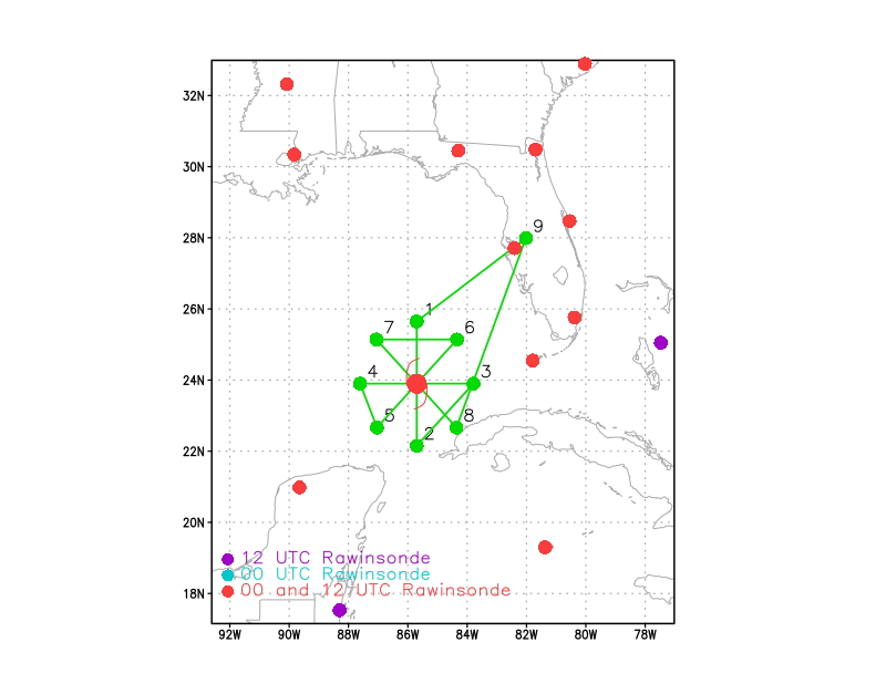 Figure 5. Proposed flight track 20181009H1 |
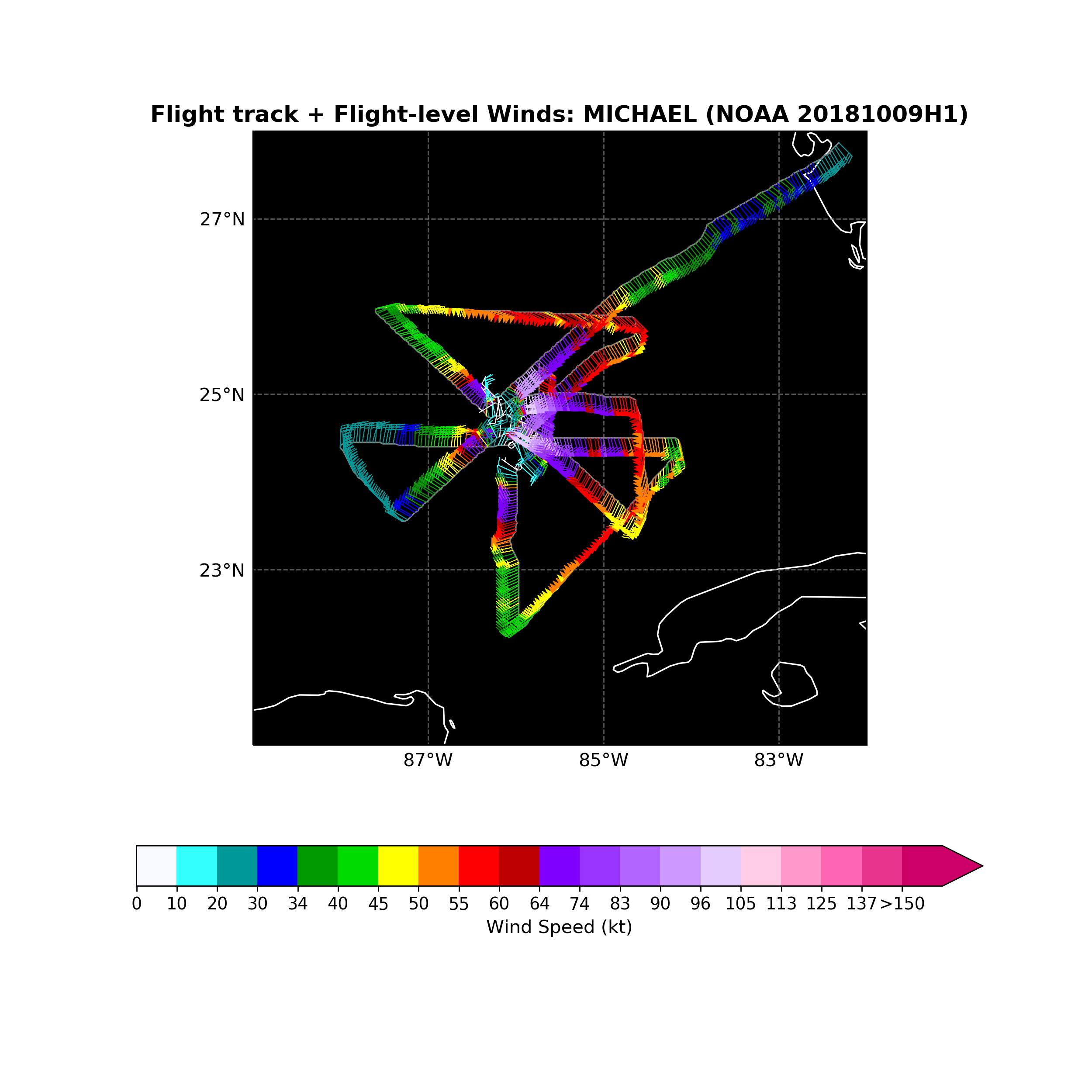
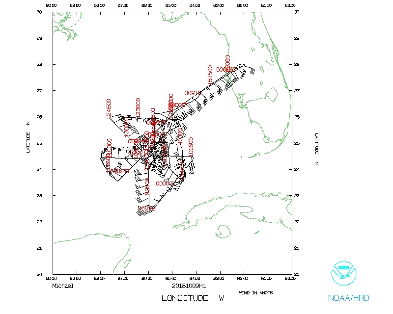
 Figure 6. Final flight track 20181009H1 |
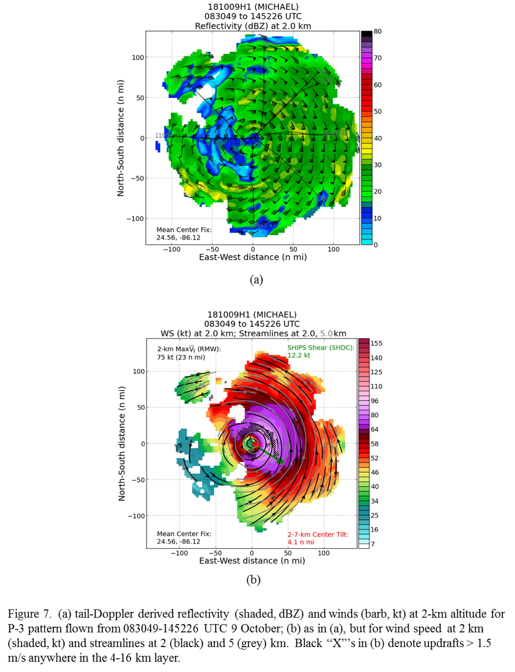
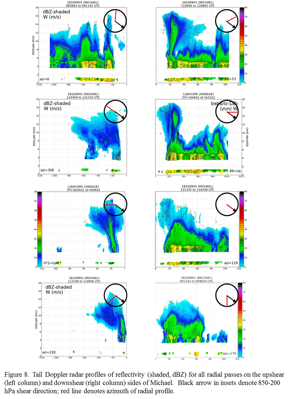
The pattern was flown as planned (Fig. 6). Michael's minimum sea level pressure dropped 4 hPa over the course of the mission, as it tracked just west of due north. The sea surface temperatures were cooler on the south and east sides (~26-27 C) and warmer on the north and west sides (~28-29 C). In addition to the rotated figure-4 there was a fifth pass inbound from the east side and outbound to the northeast, to replicate a convective burst module. Real-time radar analyses (Fig. 7) show the heaviest rain on the east and northeast sides, and weaker precipitation on the west side. The strongest and broadest wind field at 2 km is on the east and northeast sides, though vigorous updrafts are present around the storm. The storm is intensifying, even though it is asymmetric. The asymmetry may be decreasing, however, as repeated cycles of convective bursts develop downshear right, wrap around through the downshear left quadrant, and persist in a weakened state into the west (upshear) side. Profiles of reflectivity from all of the legs illustrate this general evolution (Fig. 8). This is presumably moistening the midlevels as it wraps around.
 |
 |
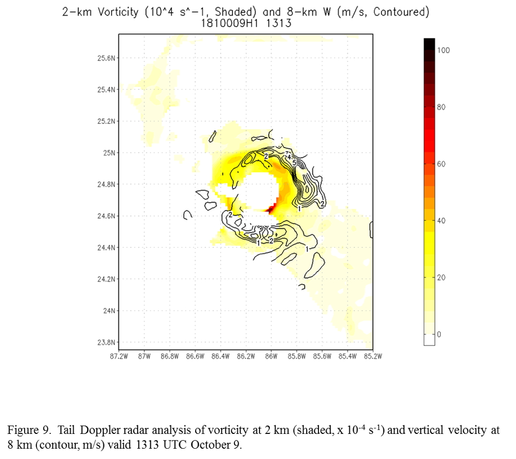
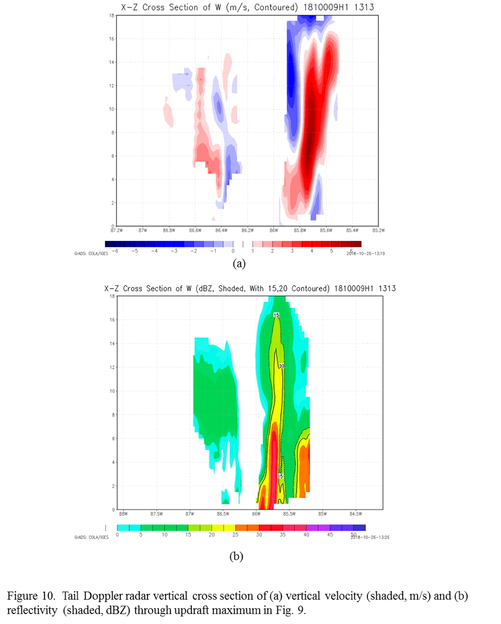
An analysis from one pass (Fig. 9) shows a core of high vorticity in the southeast eyewall and an area of updrafts > 8 m/s downwind and radially outward from the vorticity core. A vertical cross section through the updraft core (Fig. 10) shows a substantial deep-layer updraft in the eastern eyewall, with compensating subsidence along the inner edge of the updraft consistent with observations of previous storms. Radar echoes >20 dBZ reach 14 km, and echoes > 15 dBZ extend above 16 km.
 |
 |
Mission Evaluation :
The mission was a resounding success. Data was collected for EMC, and excellent radar, dropsonde, and ocean probe measurements were obtained in the inner core of Michael. The shear may be reducing, and high ocean heat content and SST seems to be promoting deeper convection. The tilt is reduced too, to < 5 nm. Strong updrafts are apparent on the upshear side inside the RMW. It looks like this storm may be on the verge of an RI event.
Problems :
There were no problems with this mission.
Rob Rogers
Oct. 26, 2018
Flight track with winds |
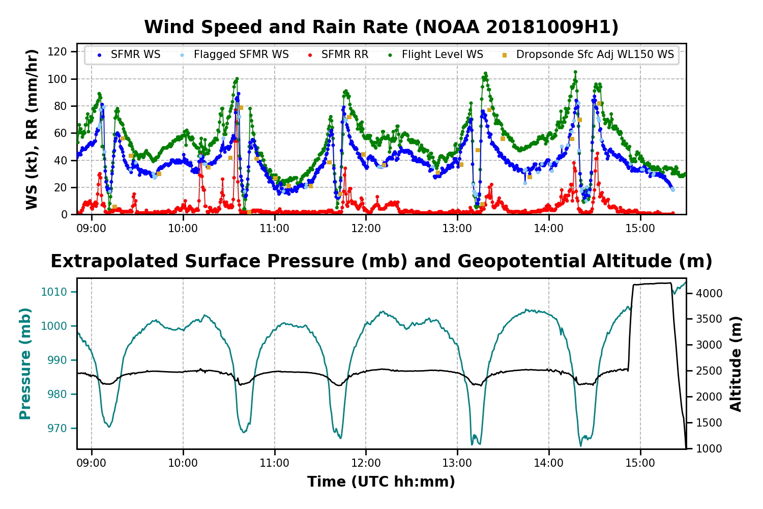
Timeseries wind, SFMR wind, rain rate, altitude and pressure plots |
 Flight track |
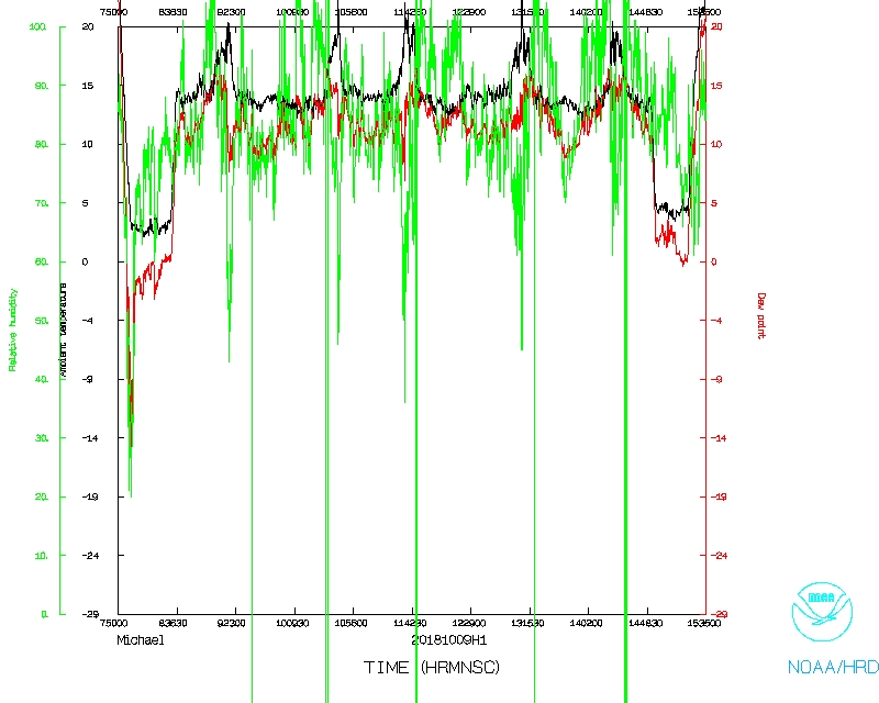 Temperature and Moisture |
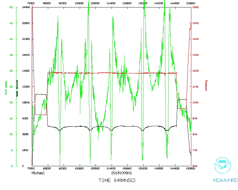 Wind and Atlitude |
Flight Director's log |
Flight Director's manifest |
NetCDF data |
serial data |
One second data
Lead Scientist's log |
Radar log |
Dropsonde log |
AVAPS log |
Air-Sea scientist's log