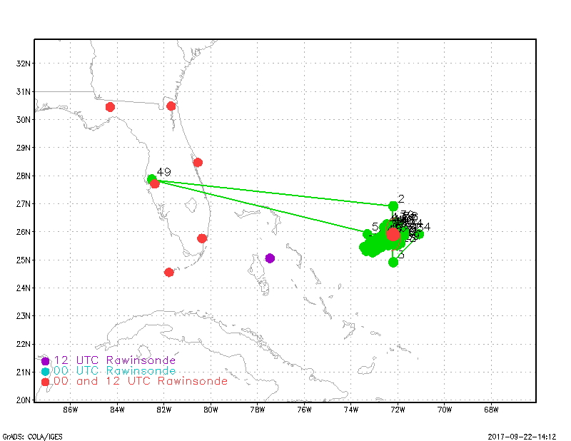
Proposed flight track for 20170923H1 |
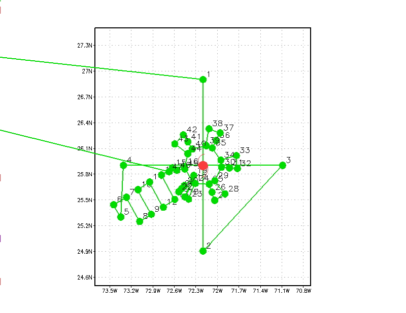
Detail of proposed flight track for 20170923H1 |
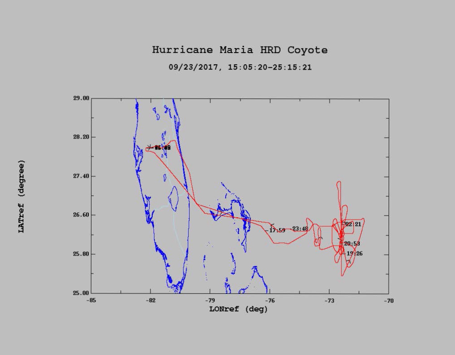
Final flight track for 20170923H1 |
| Aircraft Commander | Price |
| Co-pilot | Kahn |
| Co-pilot | Didier |
| Flight Engineer | Ken Heystek |
| Flight Engineer | Mike Sanchez |
| Navigator | Freeman |
| Flight Director | Jess Williams |
| System Engineer | Paul |
| Data Technician | Marc Mascaro |
| Dropsonde Operator | McAllister |
| Lead Project Scientist | Joe Cione | HRD |
| Radar Scientist | Jun Zhang | HRD |
| DWL Scientist | Kelly Ryan | HRD |
| COYOTE | Brad Kent | Raytheon |
| Guest | Rep. Ralph Abraham | U.S.House |
| Guest | Eric Blake | NHC |
| Radar Scientist | John Gamache | HRD |
Mission Plan :
NOAA 42RF (N42) will perform an HRD-tasked Doppler Winds LIDAR and COYOTE mission into Hurricane Maria. Takeoff from Lakeland is at 1700Z . Following the Figure-4 vortex survey, aircraft will turn downwind and then release first Coyote UAS at Pt 5. Aircraft will then navigate in a lawnmower pattern toward the eye. The second Coyote UAS will be released within the eye. As during previous flight, aircraft circumnavigate with repeated penetrations into and out of the eyewall, maintaining close communications with the Coyote UAS as the Coyote spirals outward into the eyewall. N42 flight altitude will be 8000-10000ft. The pattern may be updated for center position at time of mission. To the extent possible, keep straight legs heading to center during the initial Figure-4, as TDR data will be transmitted to EMC in real time.
|
Proposed flight track for 20170923H1 |
Detail of proposed flight track for 20170923H1 |
Final flight track for 20170923H1 |
Mission Summary :
| Take off | Landing
| Linder-Lakeland, FL
| 16:47 UTC
| Linder-Lakeland, FL
| 01:15 UTC
| Penetrations
| 2
| | ||||
Expendables: 3 COYOTEs, 15 AXBTs (1 bad), 21 dropsondes (15 IR, 2 RD41, 2 test)
Mission Evaluation:
Problems :
| NetCDF SFMR data | |
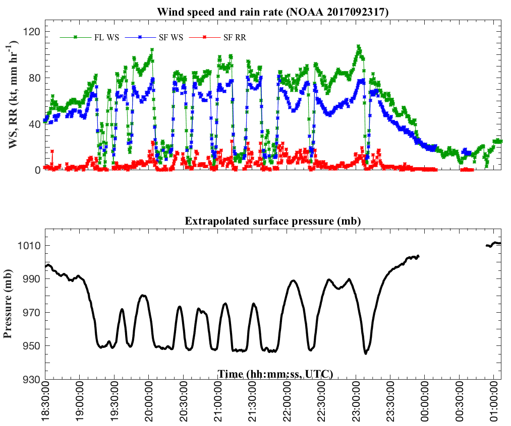
Timeseries wind, rain rate, and pressure plots |
|
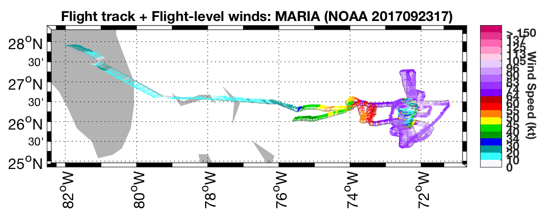
Flight level wind plots full flight |
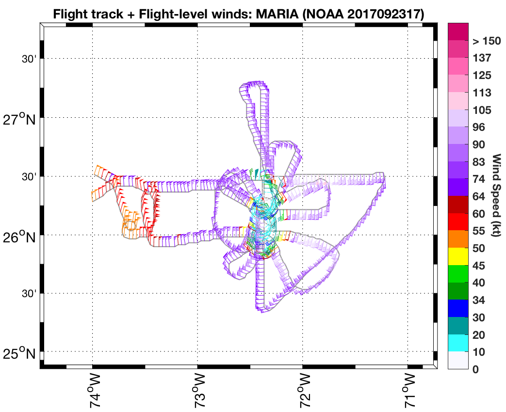
Flight level wind plots in storm |
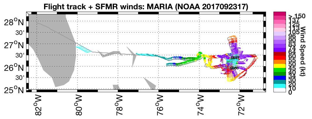
SFMR wind plots full flight |
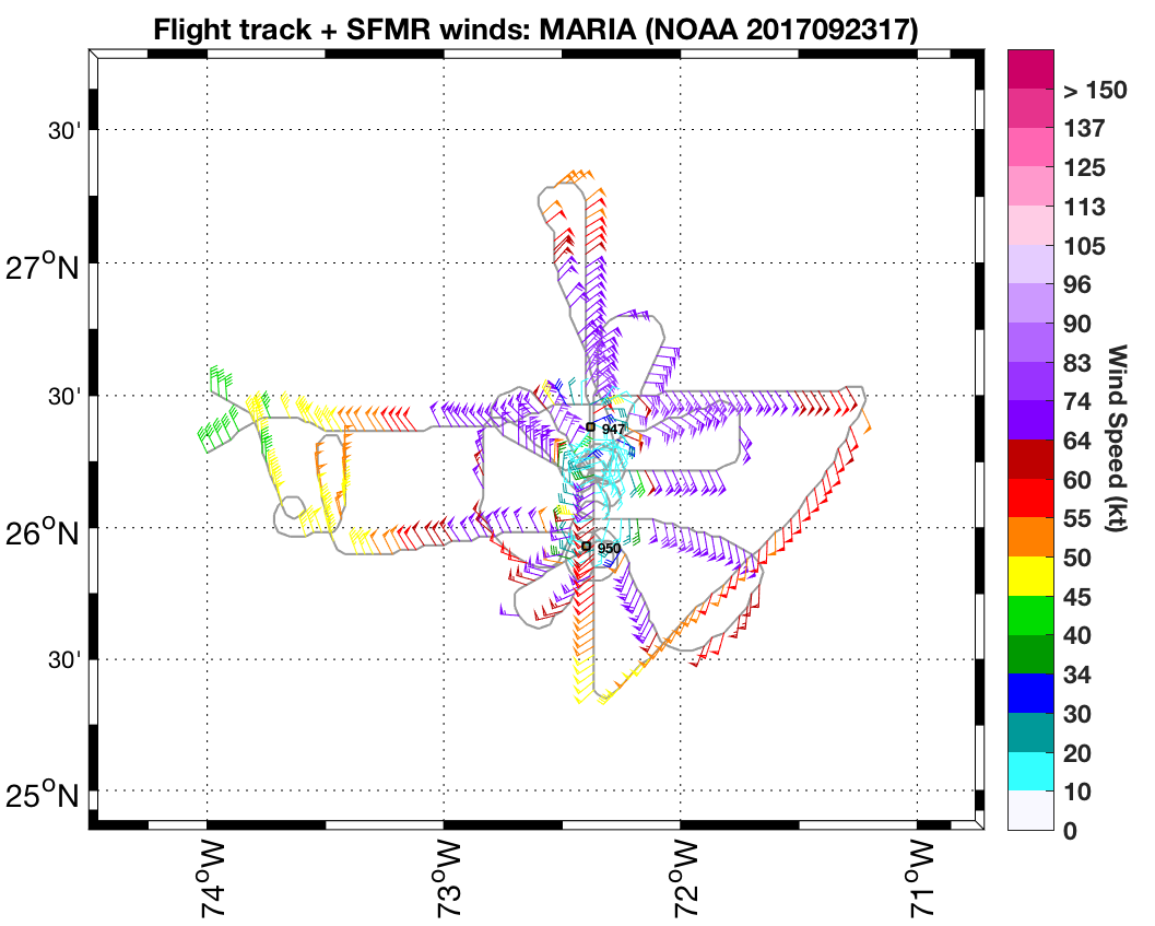
SFMR wind plots in storm |
COYOTE #1 data 15:34-18:46 Z COYOTE #2 data 19:26-19:56 Z COYOTE #3 data 20:21-20:51 Z
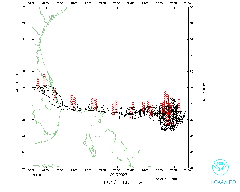 Flight track |
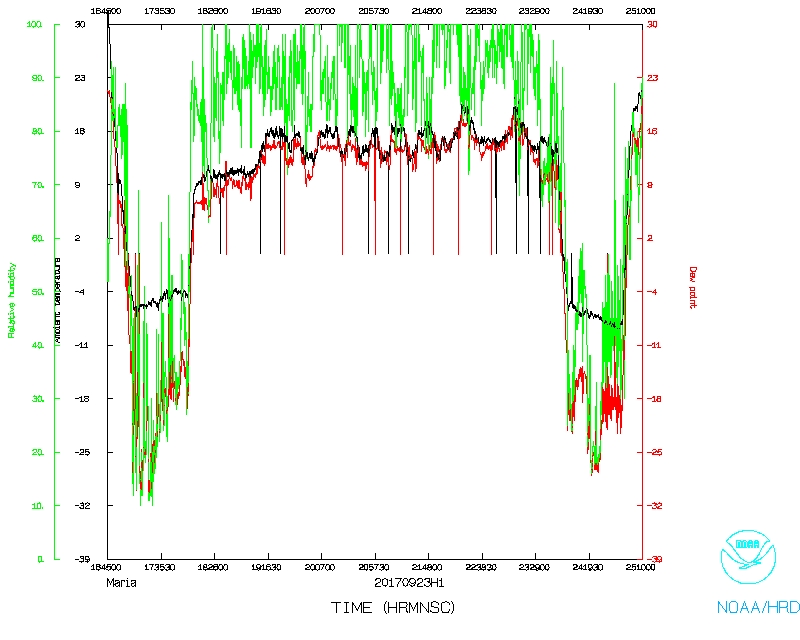 Temperature and Moisture |
 Wind and Atlitude |
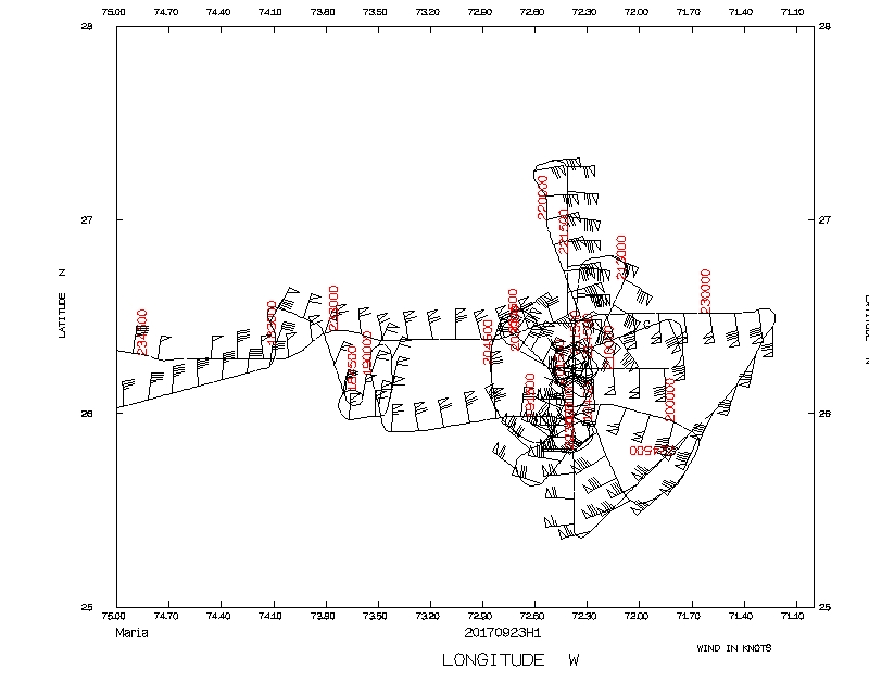 Flight track detail |
LPS log |
Radar log |
DWL log |
Drop log
SFMR data |
Flight Director's manifest
NetCDF data |
serial data |
1 second data