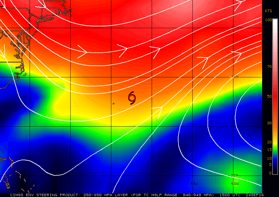
 15Z Steering currents |
 15Z Wind shear analysis |
| Aircraft Commander | Scott Price |
| Co-pilot | Danny Rees |
| Co-pilot | Nate Kahn |
| Navigator | Pete Siegel |
| Flight Engineer | Ken Heystek |
| Flight Director | Brian Belson |
| Flight Director | Ian Sears |
| Data Technician | Dana Naeher |
| Dropsonde Operator | Bobby Peek |
| Dropsonde Operator | Jeff Hartberger |
| LPS/DWL | Lisa Bucci> | HRD |
| Radar | Brad Klotz | HRD |
| Drops | Hui Christophersen | HRD |
| Ocean Winds | Zorana Jelenak | NESDIS |
| Ocean Winds | Joe Sapp | NESDIS |
| Radar | John Gamache | HRD |
Mission Plan :
|
15Z Steering currents |
15Z Wind shear analysis |
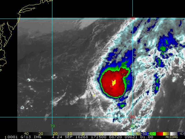
The mission is to conduct a RAPX experiment into Tropical Storm Karl. The storm has a central pressure of 994mb and is at 55kts. It is located just east of Bermuda and is accelerating into the North Atlantic at about 16kts (Figure 1). Karl is undergoing extratropical transition, so the maximum surface winds are shifting to the eastern side of the storm. It is embedded in a frontal zone and under high NE shear (Figure 2). Track guidance show Karl continuing into the North Atlantic (Figure 3) possibly strengthen to a minimal hurricane before becoming fully extratropical (Figure 4).
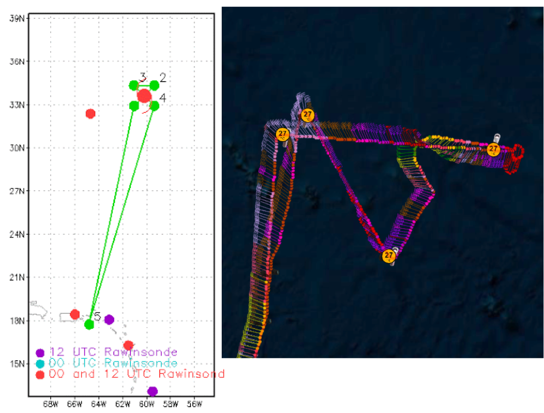
The plan calls for a single Figure-4 pattern with the shortened legs (60 nm) to reduce on station time given the long transit (Figure 5a). Flight altitude is at 7000 feet radar with only IR sondes/AXBT combo drops at the endpoints. During one of the cross sections of the storm, there may be a possible Global Hawk overflight for an intercomparison study. A possible Ocean Winds module may also be conducted in the region of highest winds during this flight with additional drops. The high incidence SFMR module may also be conducted if there is sufficient time. Upon completion of the mission, the plane will return to St. Croix.
|
Prepared by the Hurricane Research Division File: current1.ftk September 21, 2016 Aircraft: N43RF Proposed takeoff: 24/1800Z
DROP LOCATION TABLE
| #
| LAT
| LON
| RAD/AZM
| Time
|
| deg min
| deg min
| n mi/deg
| hr:min
| 1S | 32 54 | 61 02 | 60/225 | 2:52
| 2S | 34 19 | 59 21 | 60/045 | 3:24
| 3S | 34 19 | 61 03 | 60/315 | 3:47
| 4S | 32 54 | 59 22 | 60/135 | 4:19
| | ||||||||||||||
| Take off | Landing
| St. Croix, USVI
| 17:41 UTC
| St. Croix, USVI
| 02:25 UTC
| | ||
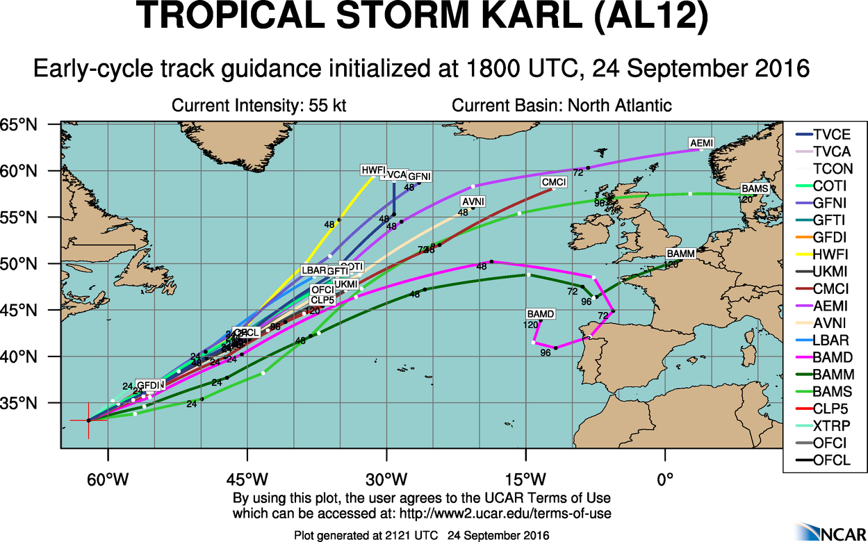 12Z Track forecasts |
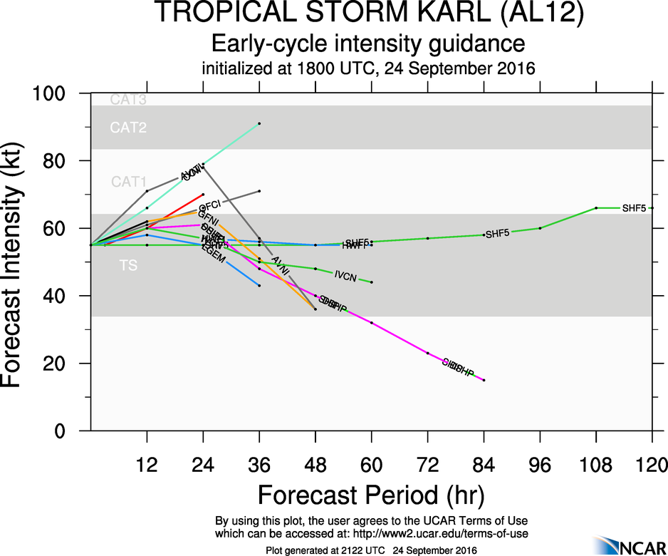 12Z Intensity forecasts |
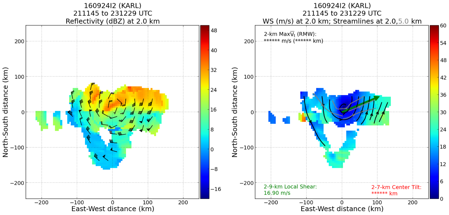
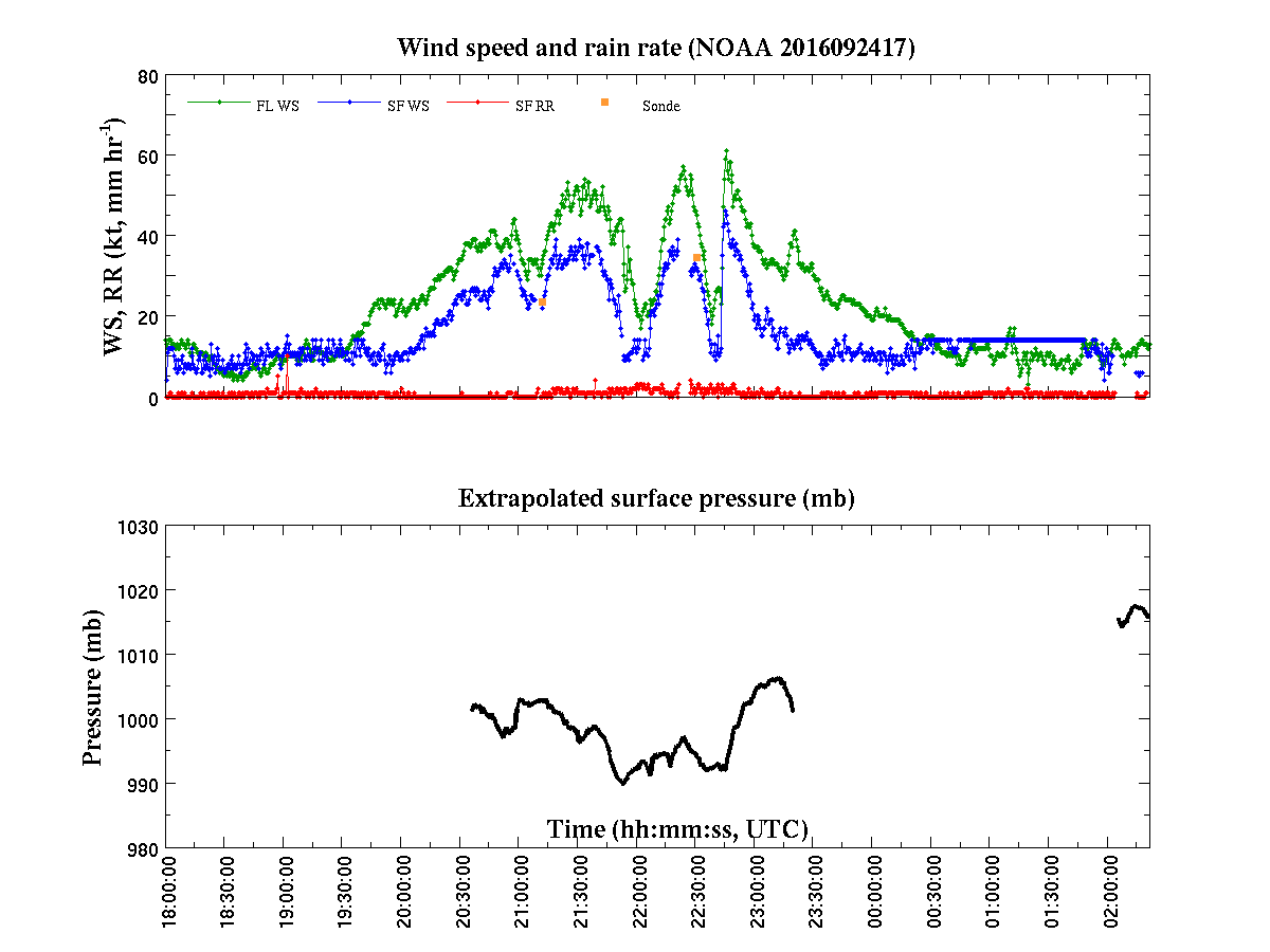
The butterfly pattern was abandoned in favor of attempting two over flights with the Global Hawk (Figure 5b). The initial was supposed to be a cross section began on the NW quadrant and finished to the SE, however the center was not fixed due to the need to stay on the same heading/path as the Global Hawk. A 'downwind' leg was taken out to the east of the storm where one 15 degree banked circle was performed. A final cross section was completed ending on the SW side of the storm. Given the storm’s acceleration it was determined that no more modules could be performed and the P3 recovered in St. Croix. A satellite animation showed the cold cloud tops associated with the center of Karl growing throughout the mission (Figure 6). The radar analysis shows the strongest winds were on the SE side of Karl and near the end of the 60 nm leg (Figure 7). Peak flight level winds were 59 knots. SFMR reached 46 knots while the strongest surface winds from a dropsonde were found on drop 2 with 42 knots.
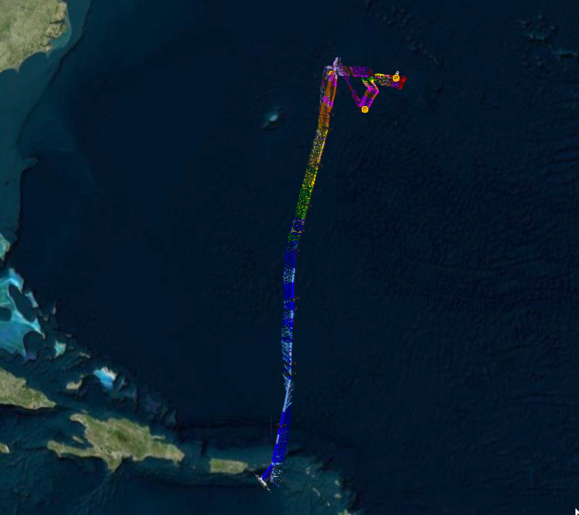
 Proposed and Actual flight track |
 IR satellitel loop |
A total of 4 IR sondes/AXBTs were dropped and 1 radar analyses were completed.
Mission Evaluation:
 Radar analyses |
This RAPX mission was shifted into an ET experiment given the structural changes Karl was presenting. One radar analysis was completed and the P3 worked to complement the data being collected by the Global Hawk and G-IV. However competing research interested made the mission difficult. A suggestion for the following missions where the P3 and Global Hawk perform coincident cross sections is to allow the flight director of the P3 to fix the center first. The FD can estimate the center better using the TDR than NHC often can using only satellite information.
Problems :
The distance and speed at which Karl was moving out to the North Atlantic reduced the on station time of the P3. Competing research interests between the TDR and an instrument intercomparison with the Global Hawk made it difficult to identify who had priority. Using the NHC fixed center for the first cross section without allowing the P3 to hunt for the center made the first pass miss the center by 40 miles. This caused the P3 to be travelling downwind and moving much faster than expected, staying well ahead of the Global Hawk. Unable to slow down and still maintain a nominal pitch for IWRAP to collect useable data, the first cross section was not performed as hoped. A second was attempt with much better results.
 Final flight track |
||
Plot of raw High Density Obs |
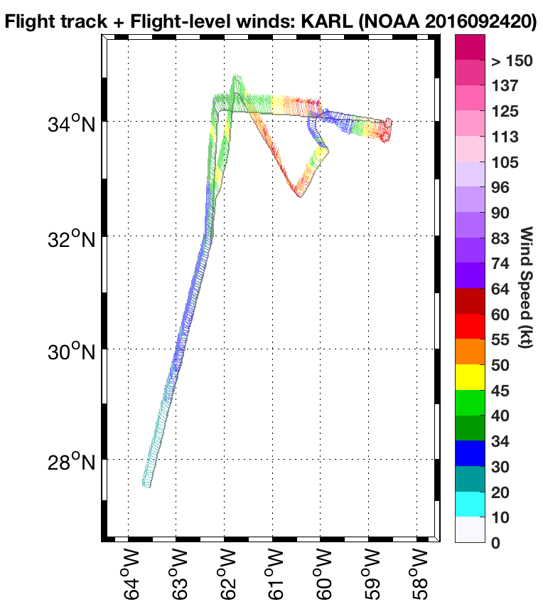
Plot of raw Flight Level winds |
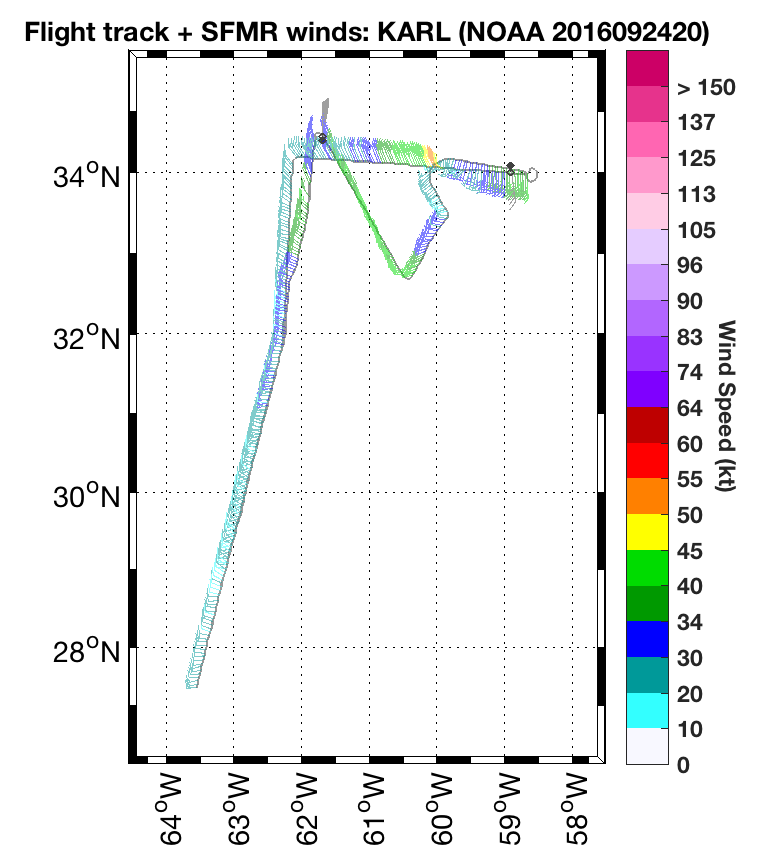
Plot of raw SFMR winds |
Flight Director's manifest | NetCDF data | Flight Director's log | serial data