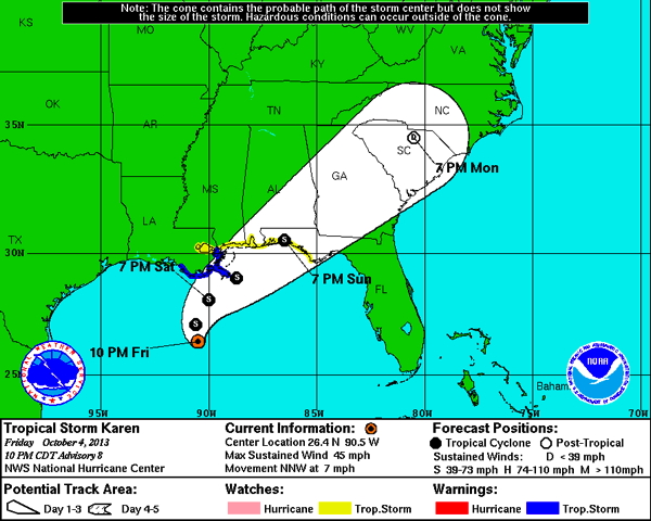
Proposed track
| Aircraft Commander | Justin Kibbey |
| Co-pilot | Cathy Martin |
| Co-pilot | Pat Didier |
| Navigator | Tim Gallagher |
| Flight Engineer | Ken Heystek |
| Flight Engineer | Paul Darby |
| Flight Director | Ian Sears |
| Data Technician | Dana Naeher |
| AVAPS | Jeff Newman |
| Electronics Technician | Bobby Peek |
| Systems Engineer | Jeff Smith |
| LPS | Joe Cione |
| Radar | Lisa Bucci |
| IWRAP | Joe Sapp (UMass) |
| W-band radar | Dan Wolfe (ESRL) |
Mission Plan :
NOAA 43RF will carry out a TDR missions into Tropical Storm Karen. The P-3 will leave MacDill AFB, FL 0600 UTC and will recover at MacDill AFB FL by 1300 UTC the same day.
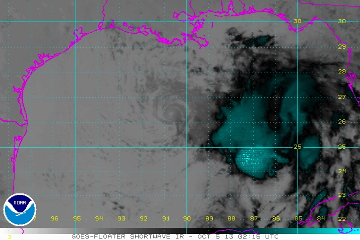
As of 10 p.m. CDT (0300 UTC) October 4, Tropical Storm Karen is located within 30 nautical miles of 26.1°N 90.5°W, about 205 mi (330 km) south-southwest of the mouth of the Mississippi River and about 230 mi (375 km) south of Morgan City, Louisiana. Maximum sustained winds are 35 knots (45 mph, 85 km/h), with stronger gusts. Minimum central pressure is 1002 mbar (hPa; 29.59 InHg), and the system is moving NNW 7 mph (11 km/h). Tropical storm force winds extend outward up to 140 mi (220 km) from the center of Karen, mainly to the north and east of the center.
Mission Summary :
| Take off | Landing
| MacDill AFB, FL | 05:30 UTC
| Corpus Christi, TX | 13:26 UTC
| | ||
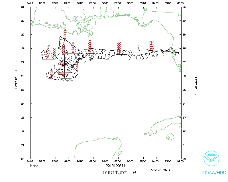
This flight was a 8h duration, NOAA EMC tasked operational mission. Real time TDR analyses, 20 GPS drops and 9 AXBTs were all transmitted in near-real time. The mission was conducted at 8K feet and was fully successful.
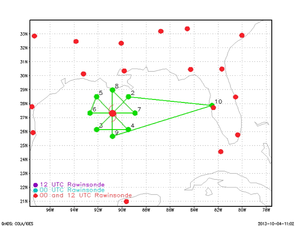
Expendables and drop points:
Joe Cione
Oct. 5, 2013
Mission Data :
Flight Director's manifest | LPS form | Radar form | Dropsonde form | AXBT form
 Flight track |
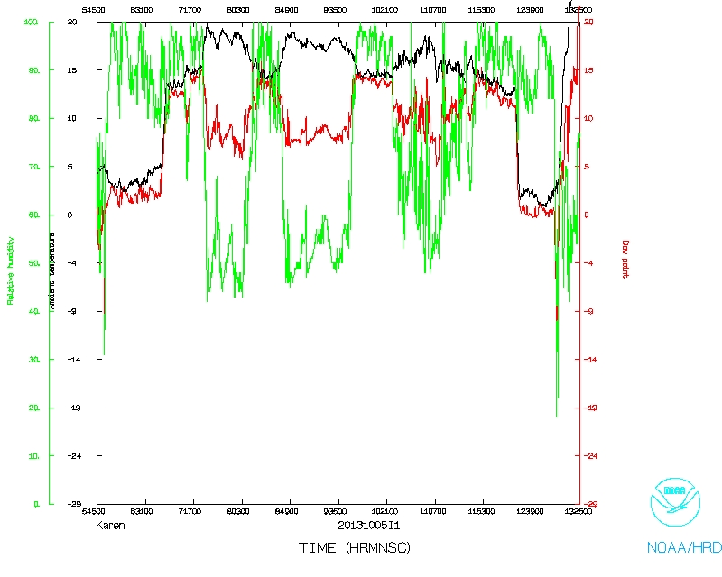 Temperature and Moisture |
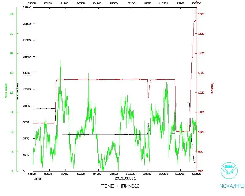 Wind and Atlitude |
|
Flight track detail |
Page last updated October 22, 2013
Return to Mission page.