| Aircraft Commander | Mark Nelson |
| Co-pilot | Mark Sweeney |
| Co-pilot | Chris Kerns |
| Navigator | Pete Siegel |
| Flight Engineer | Joe Klippel |
| Flight Engineer | Chris LaLonde |
| Flight Director | Rich Henning |
| Data Technician | Joe Bosko |
| Data Technician | Terry Lynch |
| System Engineer | Jim Roles |
| LPS | Rob Rogers |
| Drops/AXBT | Kathryn Sellwood |
| Radar | Andy Hazelton (FSU) |
| Observer | Tanner Sims (AOC) |
| Observer | Bryanna Herring (NRL) |
Mission Plan :
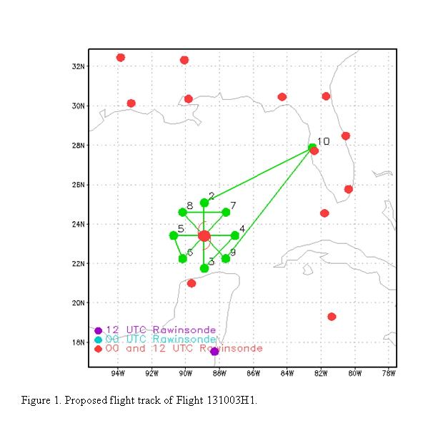
Conduct an EMC-tasked IFEX/TDR mission into Tropical Storm Karen, which is located just north of the Yucatan peninsula in the southern Gulf of Mexico. Fly a rotating figure-4 (Fig. 1), with an initial point on the north side and a final point on the southeast side. Leg lengths of 100 nm. Drop combination dropsondes and AXBT's at all turn points and the first center pass. Drop sondes only at all midpoints and the remaining center passes. Fly at 8000 ft altitude.
 |
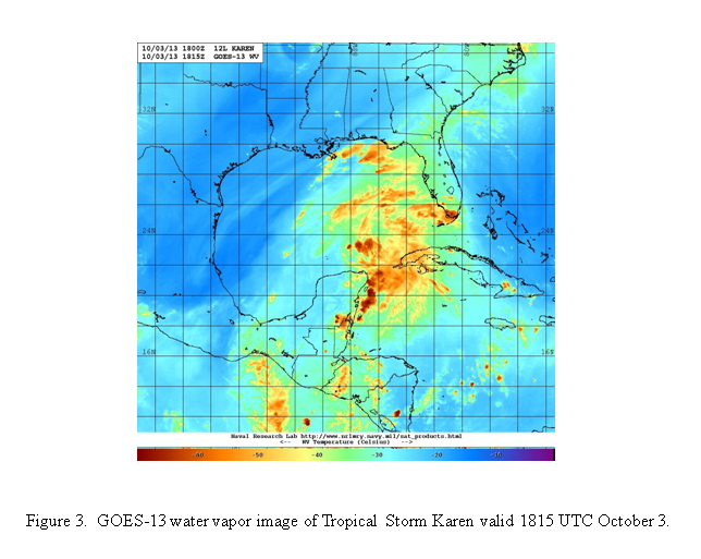 |
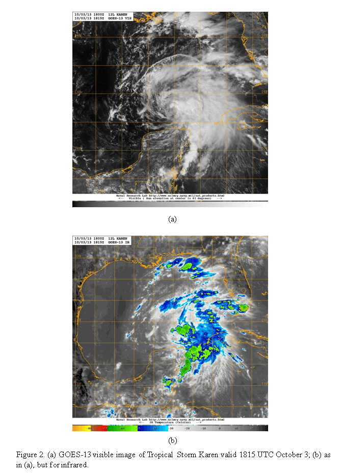
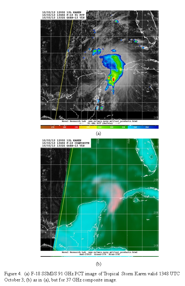
Storm is slowly intensifying, but encountering moderate southwesterly shear. Satellite imagery shows convection confined to the eastern side of the storm, though the cloud tops are not that cold, indicating the convection is not particularly deep (Fig. 2). Water vapor imagery (Fig. 3) shows very dry mid- to upper-level dry air in the western Gulf of Mexico, though the local environment of Karen is still relatively moist. Microwave imagery (Fig. 4) confirms that the deepest convection, and heaviest rain, is located in the eastern and southeastern part of the circulation.
Mission Summary :
| Take off | Landing
| MacDill AFB, FL | 18:05 UTC
| MacDill AFB, FL | 01:13 UTC
| | ||
 |
 |
Flew mission as planned (Fig. 5). Takeoff was at 1805 UTC from MacDill. Sondes were dropped at all points as planned, and we completed and transmitted four radar analyses and generated superobs. However, these data were not assimilated in the 18 or 00 UTC HWRF runs due to an error in the ATCF number entered for the job file for the radar analyses.
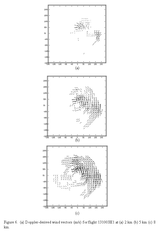
The storm is highly sheared, with precipitation well-displaced from the low-level center. However, coverage of scatterers is still relatively widespread (Fig. 6), and the storm is less tilted than what would be expected given the analyzed shear and precipitation distribution. The vortex is well-defined in the lower troposphere, but it is rather shallow, with a chaotic, and limited, wind field at 8 km. The peak SFMR winds of ~55 kt were seen on the north side, while the peak flight-level winds of ~50 kt were seen on the east side. During the latter half of the flight, convection started redeveloping northeast and north of the center. Echo tops up to 16-18 km were seen on the north side. Most scatterers were on the northeast side, with widespread stratiform precipitation, including a clear bright band with some embedded convective turrets, evident in the radar observations. No intensification occurred during the flight, likely due to the southwesterly shear and dry air on the west side.
Mission Evaluation:
The mission did meet all objectives in terms of the observations. All drops worked well, and four radar analyses with accompanying superobs were created. However, due to the error in coding the correct ATCF number for the storm, these data were not assimilated in the 18 or 00 UTC HWRF runs. Twenty-one sondes and nine AXBT's were dropped.
Problems :
There were no problems with this flight, other than the aforementioned ATCF error. All sondes and BT's worked, radar worked well.
Rob Rogers
Oct. 17, 2013
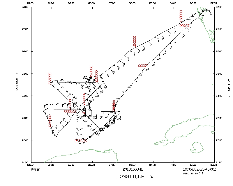 Flight track |
 Temperature and Moisture |
 Wind and Atlitude |
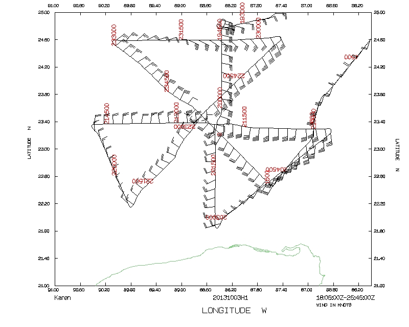 Flight track detail |