Mission Summary
20160803I2 Aircraft 43RF
Tropical Storm Earl
Aircraft Crew (43RF)
| Aircraft Commander | Chris Kerns
|
| Co-pilot | Adam Abitbol
|
| Co-pilot | Robert Mitchell
|
| Flight Engineer | Ken Heystek
|
| Navigator | Pete Siegel
|
| Flight Director | Ian Sears
|
| Flight Director | Jess Williams
|
| Data Technician | Dana Naeher
|
| Dropsonde Operator | Bobby Peek
|
| Dropsonde Operator | Steven Paul
|
Scientific Crew (43RF)
| LPS | Lisa Bucci | HRD
|
| Dropsonde | Kathryn Sellwood | HRD
|
| Radar | Gus Alaka | HRD
|
| Observer | Erin Daugherty | HRD
|
| Observer | Sandy Delgado | NHC
|
| Guest | DesRosiers |
|
| Guest | Strock |
|
Scientific Crew (Ground)
| Radar | Paul Reasor | HRD
|

Figure 1. TS Earl in relation to DL flow
|
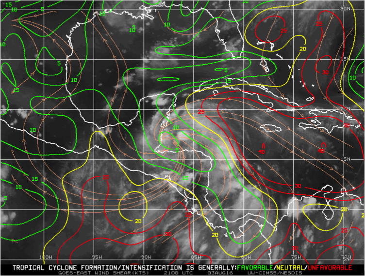
Figure 2. TS Earl in reltation to shear
|
Mission Plan :
The mission is to conduct a TDR experiment into Tropical Storm Earl, with a
secondary goal of collecting DWL observations. The system is located off the
coast of Belize and moving west at about 8 knots (Figure 1). It is located
between a gradient of westerly shear with 5 knots to its west ranging to ~20
knots on the eastern side (Figure 2). Satellite presentation shows increased
convection in all quadrants indicating a possible strengthening of the storm.
Track guidance agree that Earl will continue to travel west until making
landfall in Belize. The majority of models suggest that Earl will maintain
its strong tropical storm strength, however a few forecast bring it up to a
Category 1 hurricane (Figure 3).
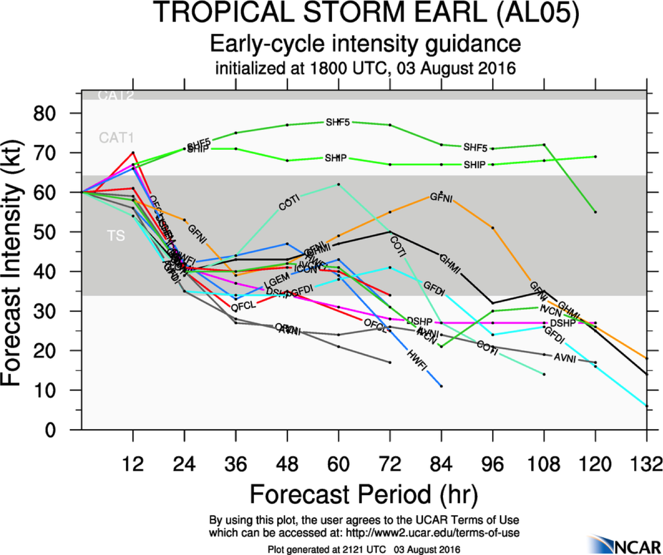
Figure 3. TS Earl forecast intensity
|
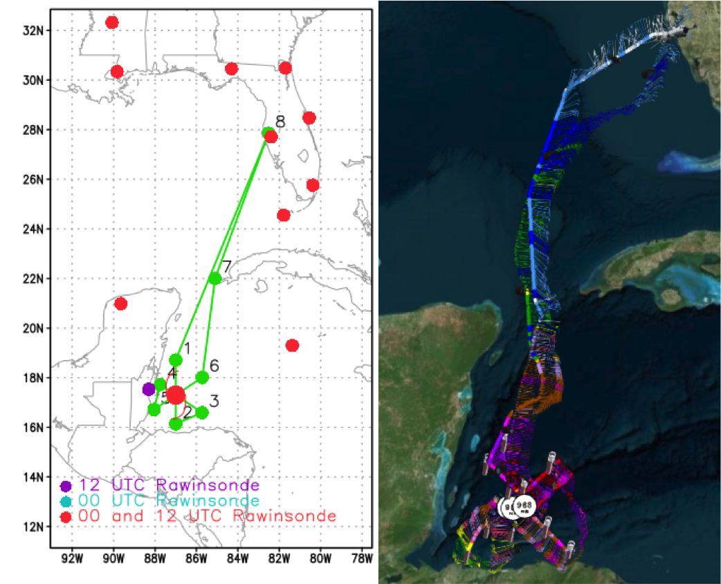
Figure 4a. Proposed track
Figure 4b. Actual track
|
Given the long transit time and proximity to land, the plan calls for a TDR
pattern with an initial point (IP) in the north quadrant. A butterfly pattern
will be flown and completed in the northeast quadrant (Figure 4a). Upon
completion of the mission, the plane will return to MacDill AFB.
MISSION PLAN: EARL
Prepared by the Hurricane Research Division
August 2, 2016
Aircraft: N43RF
Proposed takeoff: 03/1800Z
|
DROP LOCATION TABLE
|
| #
| LAT
| LON
| RAD/AZM
| Time
|
|
| deg min
| deg min
| n mi/deg
| hr:min
| | 1S | 18 43 | 87 00 | 85/000 | 3:13
| | 2S | 16 08 | 87 00 | 70/180 | 3:52
| | 3S | 16 35 | 85 43 | 85/120 | 4:13
| | 4S | 17 43 | 87 45 | 50/300 | 4:47
| | 5S | 16 43 | 88 03 | 70/240 | 5:04
| | 6S | 18 01 | 85 43 | 85/060 | 5:43
| | 7 | 22 00 | 85 06 | | 6:44
| |
Mission Summary :
| Take off
| Landing
| MacDill AFB, FL
| 17:49 UTC
| MacDill AFB, FL
| 01:07 UTC
| |
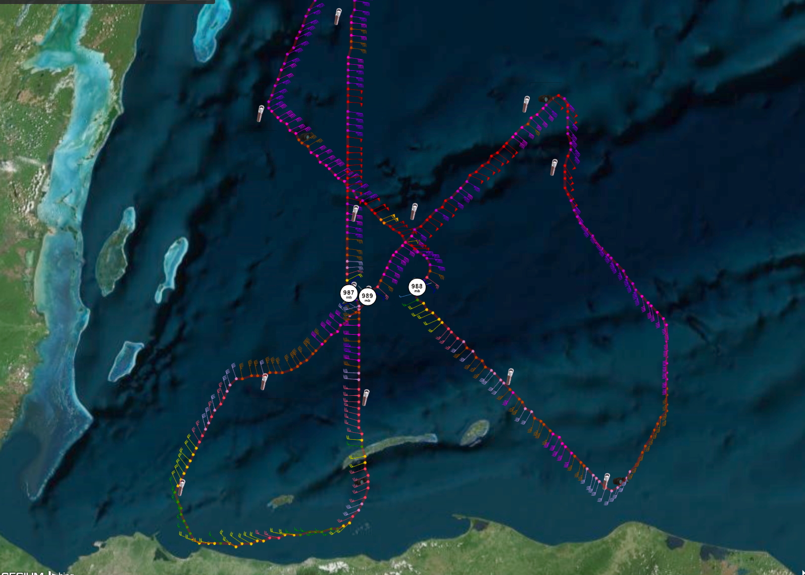
A butterfly pattern was flown, however the IP was shifted to the NW quadrant
(Figure 4b). Upon completing the first cross section, the downwind leg arched
between the eyewall and a newly forming rainband up to the NE quadrant (shown
in a lower fuselage radar image in Figure 5). This was a relatively cloud
free, precipitation free area making it ideal for the DWL and close enough to
the areas of precipitation to collect TDR observations. The EP was to the
north of the storm. This flight was responsible for upgrading Earl to a
category 1 hurricane. The strongest surface and flight level winds were
located in the NNW. Radar composites show increased convection, especially
in the eastern portion of the storm, with a more vertically aligned vortex
(Figure 5).
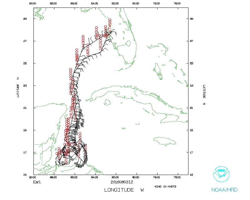
The mission was completed at 0107Z with a recovery at MacDill airport. A total of 14 GPS sondes were dropped.
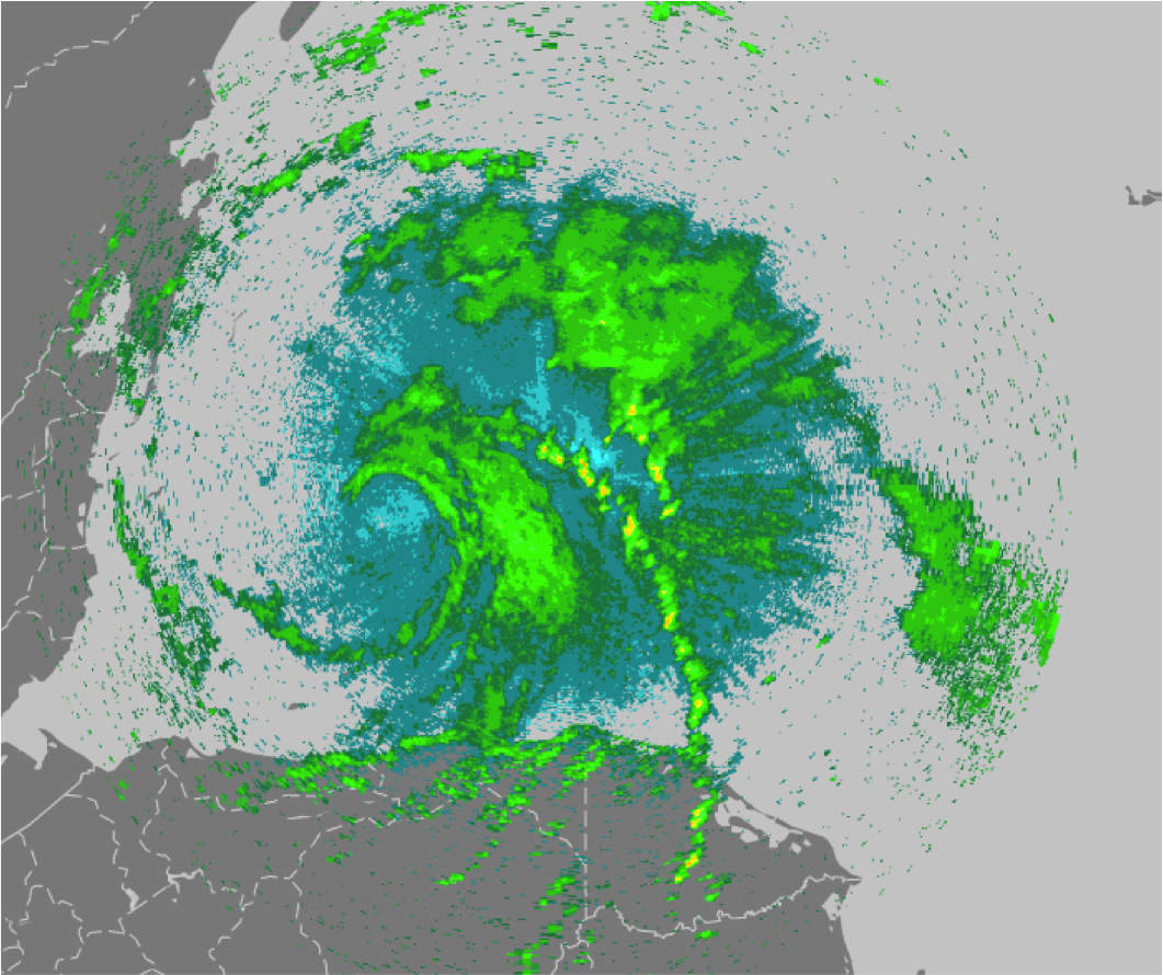
Figure 5. TS Earl on LF radar
|
Mission Evaluation:
The GPS/INS initialized properly on the DWL during this mission. DWL
observations were captured en route to Earl and within Earl. Within the
storm, the DWL collected wind profiles both above and below the plane (2
conical scans downward, 1 upward). A calibration flight over the everglades
was not performed due to storms in the targeted area.
It was hypothesized that the DWL caused the plane oscillations in the pervious
afternoon flight and tests were conducted. The plane was flown at a similar
speed and altitude and the DWL was positioned similarly to the day before.
While the oscillations as they occurred did not repeat themselves, smaller
brief oscillation did occur. It was recommended that the DWL not be place in
a forward facing position during takeoff and ascent.
Three radar analyses were completed and transmitted. One sonde stopped
transmitting at 946 mb and one drop had an early launch.
Problems :
No problems were encountered on this flight.
Lisa Bucci
October 18, 2016
Mission Data :
LPS log |
Radar log |
DWL log |
Dropsonde log
Flight Director's log |
Flight Director's manifest |
NetCDF data |
serial data |
1 second data |
Error Summary
Page last updated Nov. 10, 2016
Return to Mission page.