Mission Summary
20140704N1 Aircraft 49RF
Extratropical Transition Mission Hurricane Arthur
Aircraft Crew (49RF)
| Aircraft Commander | Ron Moyers
|
| Co-pilot | Jason Mansour
|
| Co-pilot | Doug MacIntyre
|
| Flight Director | Rich Henning
|
| Flight Director | Shannon Hefferan
|
| Data Technician | Joe Greene
|
| Data Technician | Gabe DeFeo
|
| Dropsonde Operator | Mike Mascaro
|
| Dropsonde Operator | Jeff Newnam
|
Scientific Crew (49RF)
| None
|
Mission Plan :
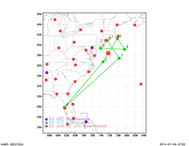
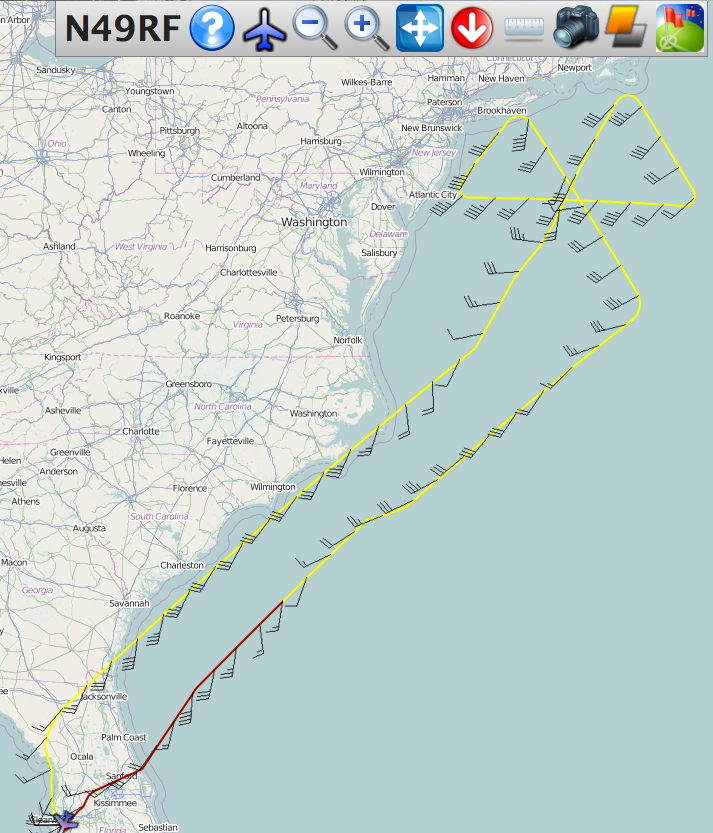
NOAA 49RF will conduct HRD-tasked Extratropical Transition mission into
Hurricane Arthur as it was completing the transition just south of Cape Cod.
The proposed flight pattern was for a butterfly pattern with three passes over
the center of the storm.
EXTRATROPICAL TRANSITION MISSION PLAN: ARTHUR
Prepared by the Hurricane Research Division
July 03, 2014 1:53 PM
Aircraft: N49RF
Proposed takeoff: 04/1730Z
|
TRACK DISTANCE TABLE
|
| #
| LAT
| LON
| RAD/AZM
| LEG
| TOTAL
| TIME
|
|
| deg min
| deg min
| n mi/deg
| n mi
| n mi
| hh:mm
| | 2S | 36 42 | 73 30 | 150/210 | 701. | 701. | 1:37
| | 3S | 41 13 | 70 09 | 150/030 | 314. | 1015. | 2:21
| | 4S | 39 09 | 68 29 | 150/090 | 146. | 1161. | 2:42
| | 5S | 39 19 | 74 04 | 120/270 | 260. | 1422. | 3:18
| | 6S | 40 51 | 72 31 | 100/330 | 116. | 1538. | 3:35
| | 7S | 37 24 | 69 44 | 150/150 | 244. | 1781. | 4:09
| |
Mission Summary :
| Take off
| Landing
| MacDill AFB, FL | 17:00 UTC
| MacDill AFB, FL | 23:10 UTC
| |
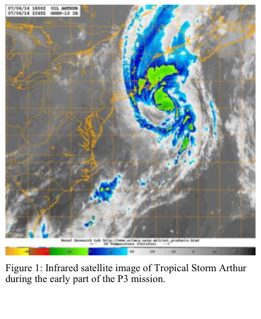
Hurricane Arthur was undergoing extratropical transition as the mission began
(Fig. 1). Convection was noticeably weaker than during the previous day, the
eye had disappeared from satellite imagery, and dry air had moved into the
southern semicircle of the storm. The cloud pattern was even more elongated
in the north-south direction than during the previous day, and the convective
maximum was shifting toward the left side of the storm.
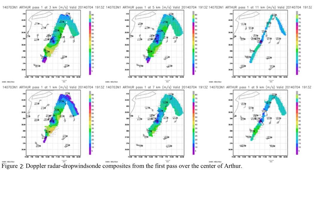
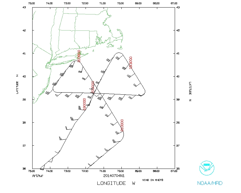
During the first pass of the aircraft over the center of Arthur (Fig. 2),
the Doppler radar was still sensing wind speeds of nearly 90 kt at 1-km
altitude, suggesting that the system remained at hurricane strength. Also
noteworthy is the elongation of the center toward the northwest at all levels.
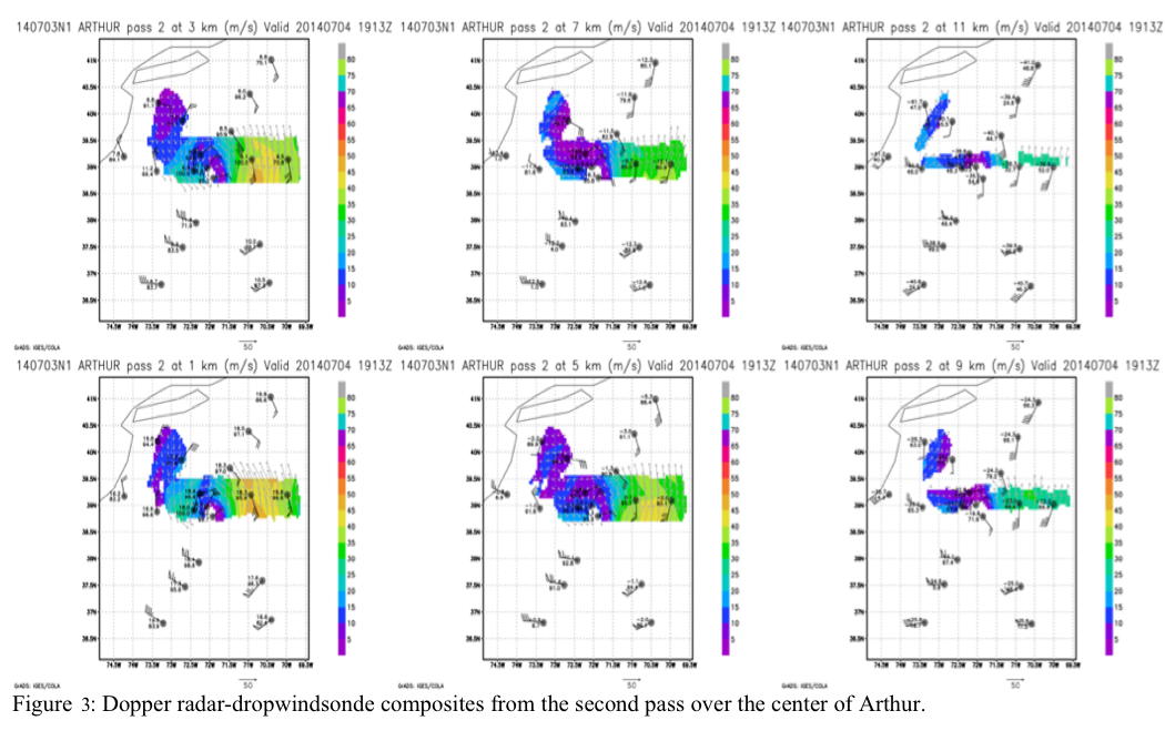
During the second pass (Fig. 3), the wind speeds remained at the same intensity
, but the clongation of the center was proceeding rapidly with only a few
strong wind vectors on the west side. Dropwindsonde data also shows the
center elongation.
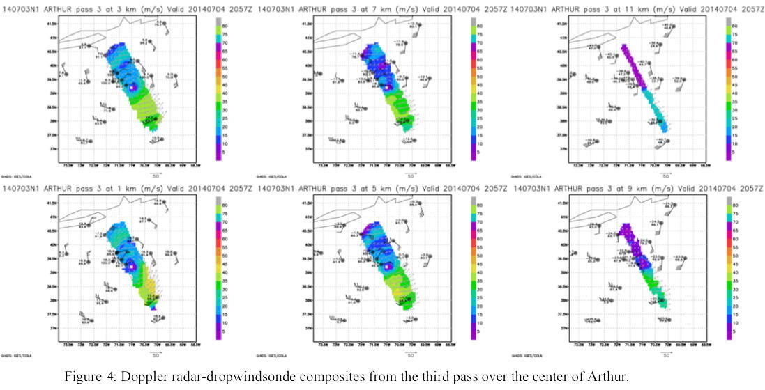
By the third pass (Fig. 4), the northwest side was
recovering a bit, suggesting a halt to the transition, though some elongation
of the center remained. The wind field was noticeably larger than during
previous missions, an important part of the transformation during extratropical
transition. 20 sondes were deployed.
Problems :
None
Mission Data :
Flight Director's log |
NetCDF data |
1 second data |
serial data
Page last updated March 3, 2015
Return to Mission page.