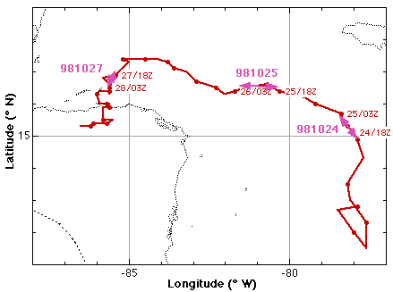
Mitch started as a depression on 22 October in the far SW Carribean, developing from a wave disturbance passing along the N coast of South America. An AFRES invest on 23 October found that Mitch had become the 13th named storm of the 1998 season. Between 23 and 24 October Mitch slowly strengthened and moved N. During 24 October Mitch became a hurricane and deepened ~58 mb in 24 h between 1500 UTC, 24 October and 1500 UTC, 25 October. Because the storm moved N and the models were wavering between a W turn and continued N motion the G-IV flew a synoptic surveillance mission covering the region N of the storm. During the day of 25 October Mitch started tracking W and continued to deepen. Again the models were divided between continued W motion and a recurvature toward the N, and the G-IV flew a second surveillance mission N of the storm. By 26 October Mitch was one of the five strongest hurricanes in the Atlantic basin with a central pressure of 905 mb at 2000 UTC. On 26 October the AFRES reconnaissance flight indicated flight-level winds >150 kt and dropsondes measured winds >160 kt, making Mitch a strong category 5 storm. HRD planned a modified Eyewall Vertical Motion Structure Experiment with one aircraft for 27 October in order to get GPS dropsonde and Doppler radar data in the eyewall of a category 4 or 5 hurricane. By the time N43RF arrived in the storm Mitch was a weakening category 5 - strong category 4 hurricane with very strong boundary layer winds (160-170 kts). The central pressure was rising ~1 mb h-1 during the mission, and by the time N43RF arrived had risen ~25 mb from the low of 905 mb 24 h before.
GPS dropsonde (HSA) data format
| Storm/Date | Aircraft (Duration) | Altitude | Experiment | Comments (expendables) |
| Mitch | ||||
| 24 October | G-IV (9 h) GPS dropsondes |
41 kft |
Synoptic Surveillance | 31 GPS sondes |
| 25 October | G-IV (9 h) GPS dropsondes |
41 kft |
Synoptic Surveillance | 31 GPS sondes |
| 27 October | N43RF (8 h) mission
summary WC-130 |
|
modified Eyewall Vertical Motion Structure Experiment N43RF: repeated 50 nm radius legs at 10 kft dropping GPS sondes in the eyewall and eye. Final penetration at 18 kft to investigate eye thermodynamics. AFRES recon. |
(38 GPS sondes,8 AXBTs). |