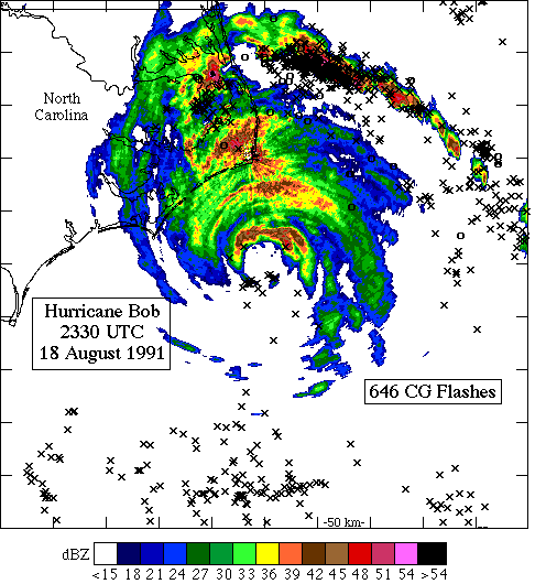
Horizontal reflectivity map with cloud-to-ground (CG) lightning overlaid in storm-relative coordinates for the total number of CG flashes from 1800 UTC 18 August to 0600 UTC 19 August1991 in Hurricane Bob. Positive flashes are plotted with (o), negative flashes with (x), north is at the top of the figure, and the center is the storm position corresponding to the reflectivity map for Bob from the NWS, WSR-57 radar at Cape Hatteras, North Carolina. The domain is 500 km by 500 km with tic spaces every 50 km.